
A couple summers ago, I wrote a post about my love for Lauterbrunnen, Switzerland. To this day, it is my 3rd least viewed post. So I am shamelessly putting the link here in an effort to garner a few more views. Probably the reason for its failure was that the theme was a bit of a stretch and I couldn’t really think of a good title. But for those of you not willing to click the link, what it boils down to is this provocative view.
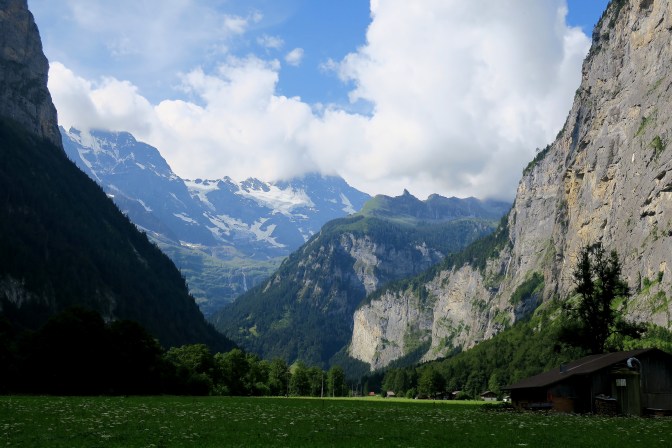
I love coming every summer to see this amazing valley and every year that I come, I deliberately make an effort to stand in this very spot in the middle of the valley looking toward the southern end of the valley. And every year, while I stand in awe of the beauty of nature, the same question pops into my mind.
What is back there?
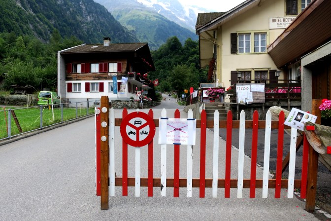
I have hiked the mountains on both sides of the valley, but I had no idea what was at the end of the valley. I know there is a town there, called Stechelberg. It is the location of the gondola which takes you up to Gimmelwald and beyond. And I know that for car traffic, it is the end of the road.
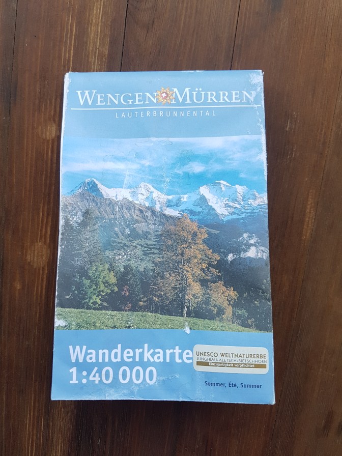
Unfortunately the handy free tourist hiking maps don’t highlight that part of the region. So to really know what is back there, a full hiking map is required. They aren’t cheap. I found this one for 14 CH (Swiss Francs) in 2016. But what you get is a very good map.
This summer, due to my procrastination and not being able to get a tent pitch at Camping Jungfrau, I had to search for other places to stay and found a great Airbnb in Stechelberg. Now that I was actually staying at the end of the valley, perhaps it would be a great time to consult the map.

One look at the map and it was obvious to me where I had to go. But it didn’t look like it was going to be easy.
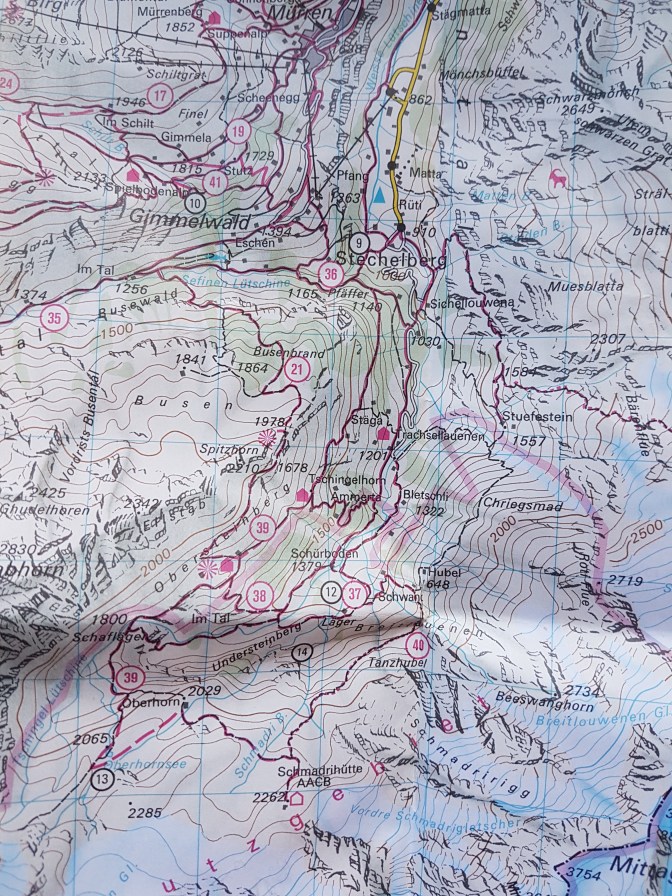
South of Stechelberg, high in the mountains, just below the glacier line, a mountain hut, Schmadrihütte and just to the west, a mountain lake, Oberhornsee. Not only did it look difficult, but the planned route would be longer than any hike I’ve ever done. But the cool thing is no car, no train, no cable car, no transportation schedules of any kind. The hike begins and ends at my Airbnb. It was all down to my feet and luck of the weather.
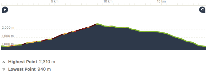
Route Overview
- Starting Point: Stechelberg
- Ending Point: Stechelberg
- Distance: 19.2 km
- Time: 4 hours 42 minutes
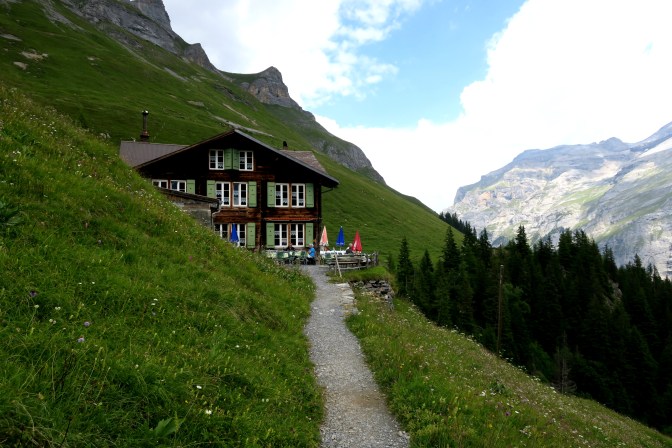
- Eating Point: Berghotel Obersteinberg, Berggasthaus Tschingelhorn

Tips
- Do the hike in a clockwise direction. Climb up on the East side and do the down direction on the West side. The East side has better views climbing up to keep giving you incentive to deal with the 1400m ascent.
- On the West side are the two mountain restaurants to save your butt if you run out of supplies on this long hike. Better to have these towards the end of the hike.
- Remember to bring cash. Mountain restaurants don’t take plastic.
The Hike
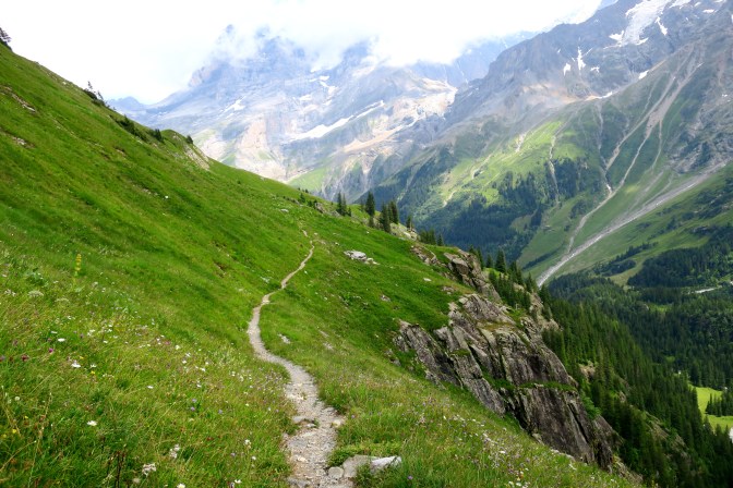
The hike starts out rather uneventful. Just a tedious climb up the valley. But the views start to open up. The target is to get closer to that split peak in the distance called the Chantzel.
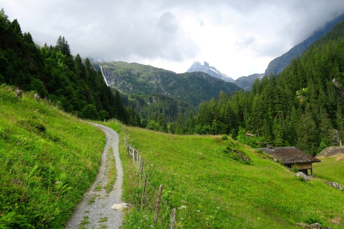
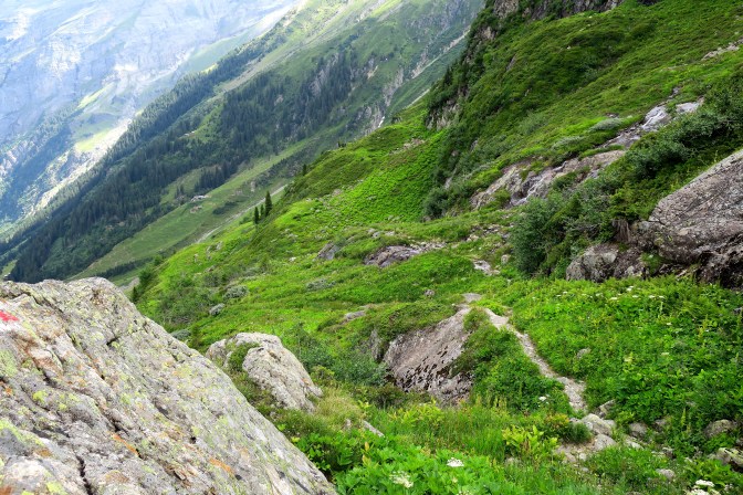
Once above the main tree line, the trail changes to a zig-zag heart pounding uphill climb. Yes, you need to go that direction.
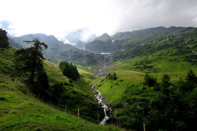
Eventually the trail starts to go lateral again. You can just make out the trail crossing over the stream. Need to get over that ridge. This is the hardest part of the uphill climb. Seems like endless zig zags.
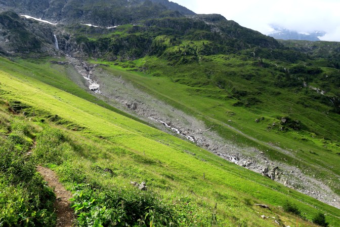
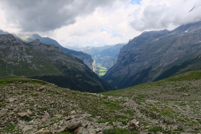
Climbing up to the ridge, don’t forget to look back and see how far you have come.
Once over the ridge, it is a completely different landscape and you can really see how far you’ve come. The green valley in the distance is near Stechelberg.
From here it is a pretty easy climb up to the hut. You can just make out the tip of the roof.

Schmadrihütte is 2262m above sea level and one of many across Switzerland where it is possible for hikers to spend the night and/or make a hot meal. I was just curious to peak inside. One bonus for my visit was a family of Ibex which were grazing in a pasture nearby.


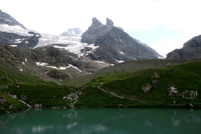
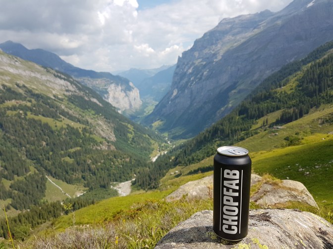
From here the hike gets much easier. It is onward to the Oberhornsee. Getting there gave me perhaps my favorite photo of the entire hike.

The Oberhornsee is actually quite small, but it is picturesque mountain beauty and serenity. Perfect for sitting and having a break. This is as close as I got to the characteristic Chantzel formation. There is a trail which takes you a bit closer but I didn’t follow it.
From here the trail goes predominantly downhill back to Stechelberg. Along the way, you pass the two mountain restaurants. Good to check out the other side of the valley and remember that you had to climb up that.

After the mountain restaurants, it is an aggravating hike downhill over a root riddled path which is hard on both the knees and ankles. Part of the reason I recommend doing the ascent on the other side of the valley.
Final Thoughts
So there it was. 19.2 km. The longest hike that I have ever done. I succeeded to reach the hut where I had failed in my attempt to the Schreckhornhütte last year. After climbing to my personal highest mountain peak the day before (Schwarzhorn), this was just as proud a moment for me. And also it meant that I experienced the mysterious scenery that always appeared in the backdrop of my favorite viewpoint in the Lauterbrunnen valley. I am not 100% sure this tops the Schynige Platte – Faulhorn – First hike for pure scenery, but definitely this hike was epic. Since it is not on the touristic maps, you can also be sure that if you meet any other hikers, they will either be locals or serious hikers.

Awesome article!!! Thank you! It’s as if i relived what I just did 2 weeks ago. Lauterbrunnen is also a place that I love! I discovered it last year. I just came back from hiking in the area for 7 days, and my personal best achievement is so similar to your description! It was a tough but memorable day of 20km, from the Rotstock hut (where we had slept) down into the valley to then all the way up to the Oberhornsee (and then back down to Stechelberg), with a wonderful lunch stop at Obersteinberg. The last stretch to the Oberhornsee was officially closed, but we didn’t let that stop us! The views were so majestic!! My heart touched heaven!!! By 8pm our legs were so tired! Amazing memories for life!
LikeLiked by 1 person
Amazing! Serious hiker!
LikeLiked by 1 person
We did a similar walk back in 1986. We started from Murren and walked via Gimmelwald up to the Oberhornsee and back down to Stechelberg. It was the next to last day of our stay – as all the paths above 2000m had been closed due to snow. The Oberhornsee was the most beautiful colour of turquoise and surrounded by snow covered peaks was probably the most beautiful and peaceful place I have seen. Somewhere Have some 35mm slides….
LikeLiked by 1 person