
Any American in their 40’s grew up watching Bugs Bunny cartoons. I was quite a fanatic and watched them repeatedly. There were often references to European culture in those cartoons and I do give them some credit for helping create my love for Europe. For example, an entire generation of American kids were exposed to some of the great European operas and classical music pieces just from Bugs Bunny cartoons. I can’t imagine there is a cartoon today that benefits kids in that way. One of the most memorable episodes for me was “Pikers Peak” which is an episode where Bugs Bunny and Yosemite Sam compete in a race to climb the Schmatterhorn. I can’t pinpoint exactly when I understood that it was a play on the name Matterhorn, but I feel pretty confident that it was the first mountain in the world that I knew by name. This is just a short excerpt but the scene where Yosemite Sam is trying to find the blade in his Swiss Army knife is priceless.
Seeing the Matterhorn has always been on my bucket list but once I discovered the amazing Lauterbrunnen valley, I felt no pressure to try to get to it. For one, it is not a place one can get to as easily as Lauterbrunnen. It lies on the border between Switzerland and Italy and the nearest town, Zermatt, cannot be reached by car.
But this summer, I decided once and for all to make the effort to get to the Matterhorn. First there was the matter of getting there.
Arriving by Car
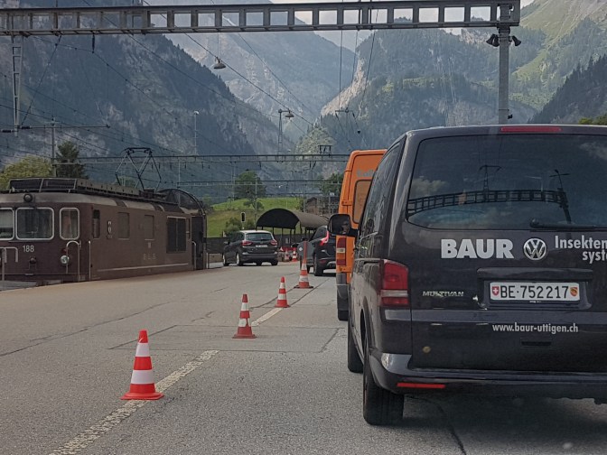
When you are coming by car, the closest town to Zermatt accessible by car is Täsch. To get there, it is necessary to go thru the Lötschberg tunnel, which you can only do by train. Arriving at the train is basically going thru a toll booth and credit cards are accepted. You get in line behind other cars and when the light is green, you drive onto the train in a single file. Piece of cake. The train ride itself takes about 10-15 minutes. When the train pulls up, you drive off. Similar to a boat ferry.
Of course Zermatt is the nicer more lively place to stay. Many more shops, hotels, and restaurants. But that also makes it more touristy. I chose to stay in Täsch where it is more quiet.

Planning the hike
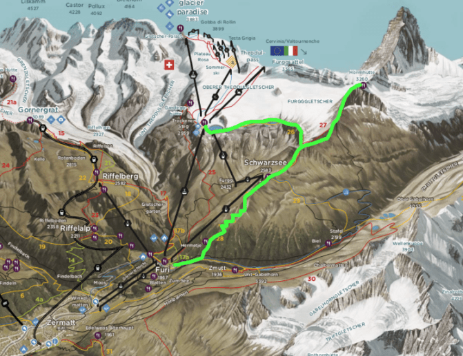
Looking at the tourist hiking map, it was clear what the ultimate hike was going to be. I wanted to get up close, and the closest you can get without special equipment is the Hörnlihütte. I wasn’t going to be racing to the summit like Yosemite Sam and Bugs, but it would do. I decided to start the hike at the Furi cable car station, climb up to the Schwarzsee first and then to the hut. After backtracking a bit from the hut, I would follow the Matterhorn glacier trail to the Trockener Steg cable car station which would take me back down to Zermatt.
Hike Overview
- Starting Point: Furi cable car station (~12 euros from Zermatt)
- Ending Point: Trockener cable car station (~42 euros to Zermatt)
- Distance: 15.2 km
- Time: 4 h 52 m
- Eating Point: Hörnlihütte (bring cash!)


Tips
- Hörnlihütte is at 3260m elevation and even on a sunny summer day will be chilly. If you want to enjoy your beer and food outside, you will probably need at least a fleece sweatshirt or some kind of long sleeve hiking jacket. I wore a light tank top and was ok during the hike, but I ate inside the hut to stay warm. Later on, the weather changed and rain clouds started forming. It got cold. Definitely take something fleece along.
- Something that I finally came to the conclusion about on this hike. Since I enjoy strength training, I eat a lot of protein bars. So I stocked up on many protein bars to take on these hikes. But most of these protein bars are low on sugar and carbohydrates. They are meant to pack the muscle with protein thruout the day in between meals while not making one fat. However, this makes them not ideal for cardio-endurance activities like hiking. You need quick energizing sugars. So hiking with protein bars is like fighting off hunger but always feeling low blood sugar. And all that protein in your system not being optimized, well strength trainers know what it can do to one’s digestive system. Most of you will say ‘duh, I could have told you that.’ Ok, ok I get it now.
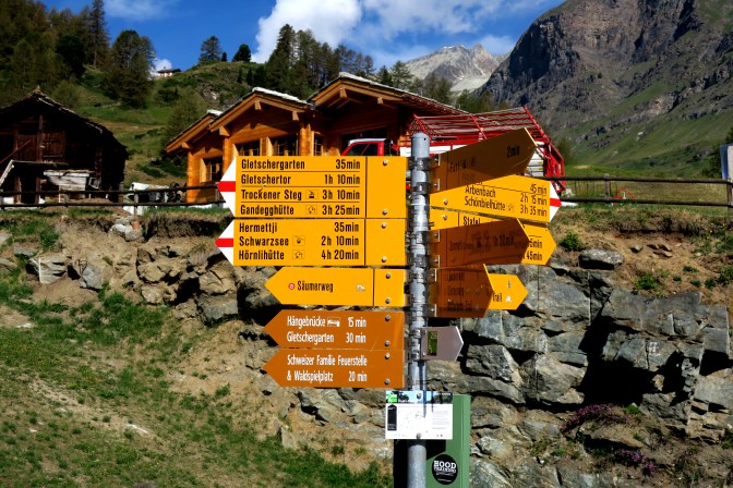
Getting to the starting point from Täsch
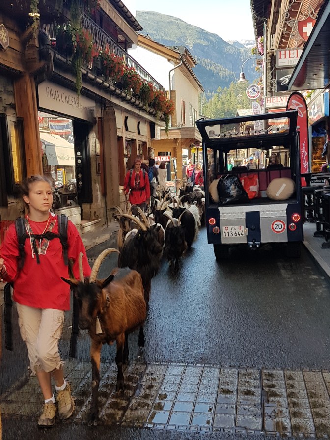
The train station is the very heart of tiny Täsch. The entire life here seems to center around the station. Nobody is really here to visit Täsch. Round trip train ticket to Zermatt is about 16 euros full price. Trains leave about every 20 minutes. When you arrive at Zermatt, just start walking down the main shopping street and eventually you will see signs directing you to the cable car station to Furi. It is about a 10-minute walk. There are many shops along the way to upgrade your gear or supply anything you may have forgotten (at expensive prices).
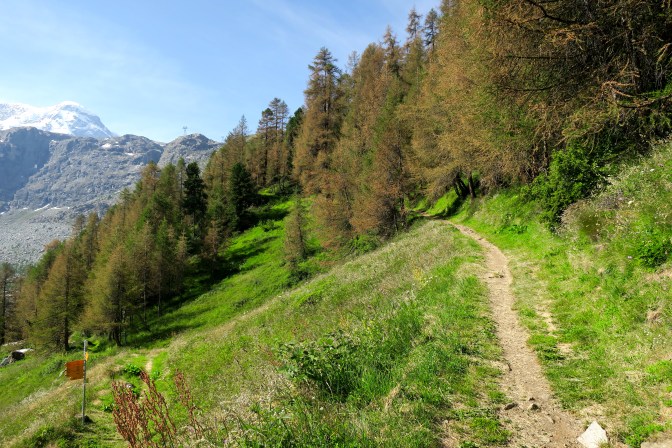
The Hike
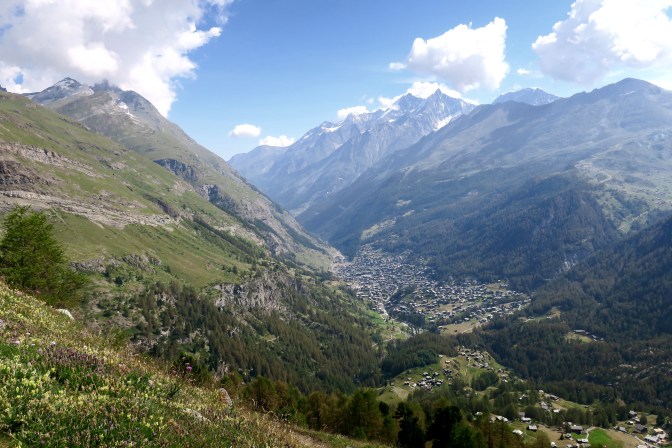
Usually on these hikes, one of the least exciting parts of the hike is the initial uphill climb. However, since the initial elevation is already at 1900m, the views were breathtaking right from the beginning.
Knowing that I needed to go up to 3300m and wanting to make the uphill more enjoyable, I decided to try a different approach to uphill hiking. Usually I find myself doing a burst until my heart rate feels maxed out, taking a short break, and then another burst. Repeating this over and over. But when you are getting your heart rate maxed out, this takes its toll and can make the uphill feel more grueling. Sometimes this is made worse when there are other hikers and you start looking ahead or looking behind. Whether you like it or not, your pride can sometimes turn it into a race. This causes a boost of adrenaline which is exactly what you do not want when you are maxing out your heartrate.
So I decided I was not going to care about other hikers and I was going to focus on taking small slow deliberate steps, keeping the heart rate more around 80% (just throwing out a number). I can tell you that this made a world of a difference, and I still got a helluva workout. I never had a more enjoyable uphill climb of 1400m then this hike. This also did my legs a favor by giving them more energy to deal with the dreaded downhill pounding. I even gave it a conceptual name – hiking like a 12 year old who doesn’t want to be there. And based on my final time, it did not hurt me one bit because I didn’t need to rest often.
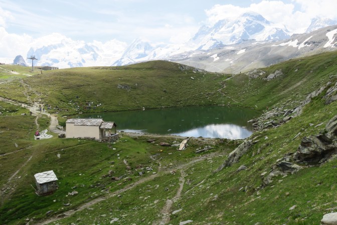
Approaching the Schwarzsee was a pretty cool part of the hike, walking thru an open plateau of green and nobody around. Gave me my first glimpse that the clouds were going to be pesky today around the Matterhorn.

The Schwarzsee seems to be a place where a lot of hikers come to hangout. I quickly left it behind with higher goals in mind.
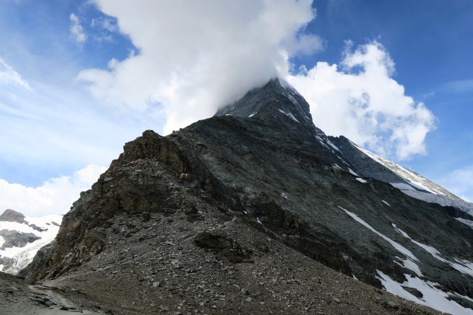
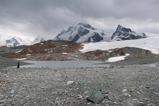
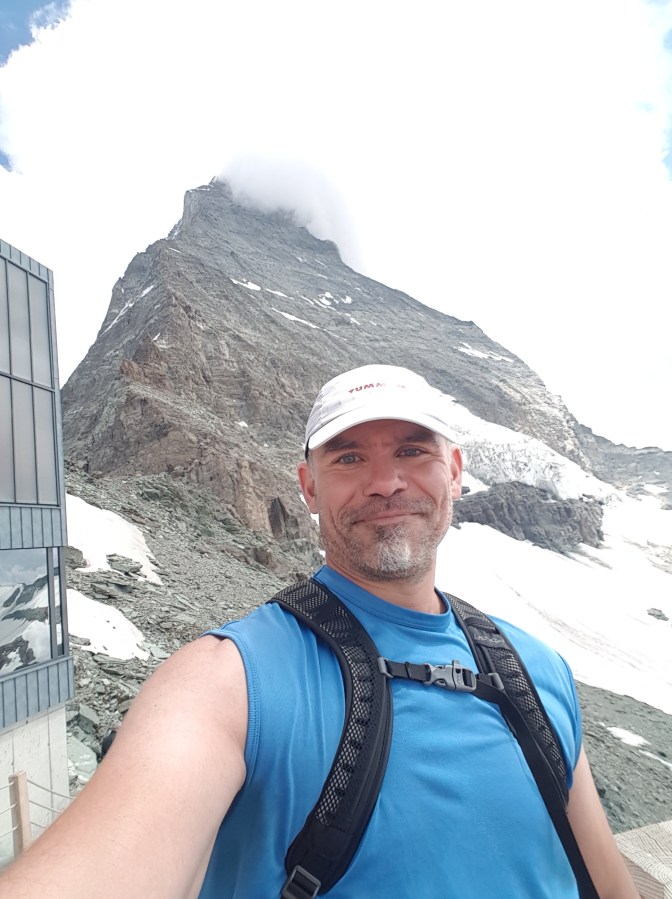
At the intersection with the Matterhorn Glacier Trail, the hike up to Hörnlihütte gives a great view of the Matterhorn.
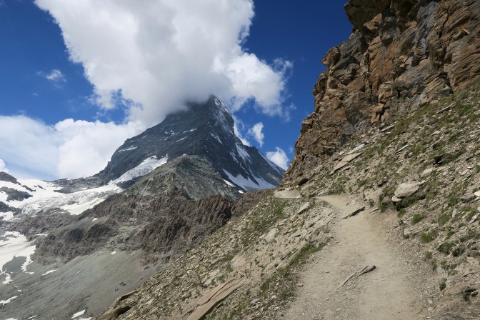
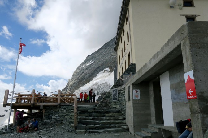
When the Hörnlihütte finally comes into view, the most difficult part of the climb begins.
After a lot of zig-zagging, finally the hut, some great views, and a beer with some goulash soup.
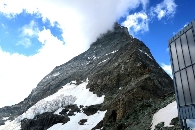

After a quick lunch break, back down towards the glacier trail.
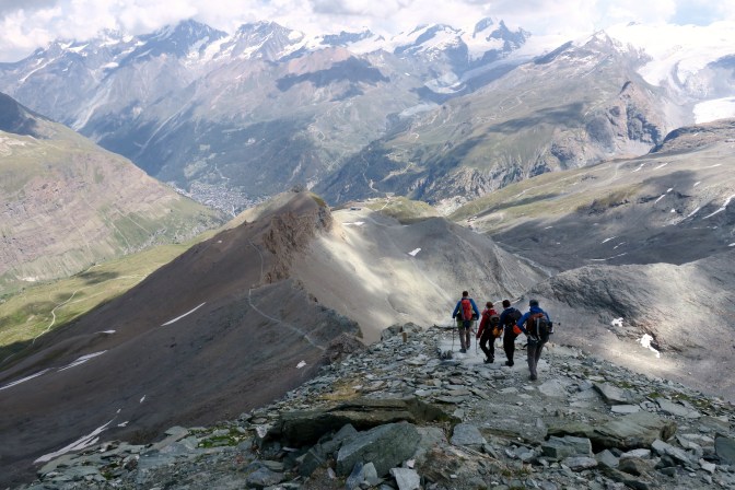
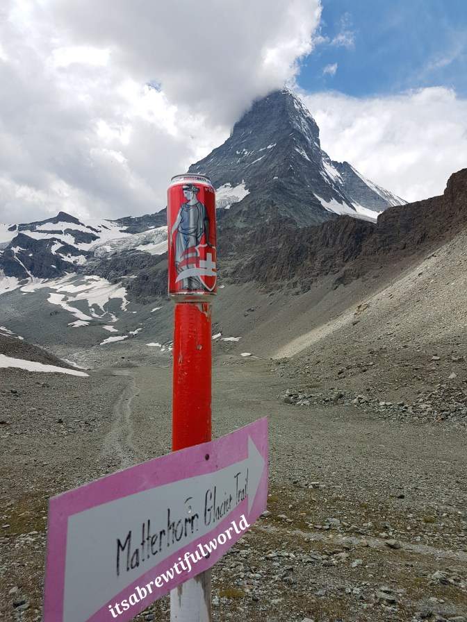
The Matterhorn Glacier Trail goes thru some beautiful, rugged landscape.
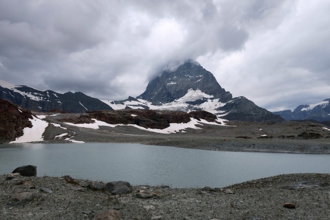
The weather was starting to get bad, so I hurried toward the Trockener Steg station. The final picture of the Matterhorn was taken under the duress of the start of rain. I have seen beautiful professional shots of the Matterhorn with this lake in front of it. This, however, was not one of them. Taken right next to the Trockener Steg station.
The Trockener Steg cable car was salvation from the rain and a relaxing ride back down to Zermatt.
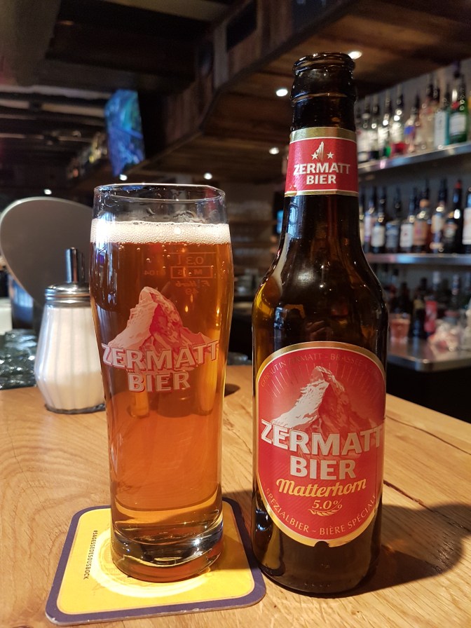
In Zermatt, I highly recommend stopping at the Hotel Post bar which is along the main drag back to the train station. Here you can enjoy the local Zermatt beer. A great way to finish off another epic hike.
Final Thoughts
In a week of setting personal hiking records, this hike added to the list by being the hike with the longest total ascending distance of 1590m. It was the hike I had dreamed about doing for so long. It finally brought a cartoon that has been lodged deep in my subconscience since I was in elementary school to life. I still have a couple days here to enjoy. As I write, the weather is not so good and I will take a rest day with a final hike hopefully planned for tomorrow before going home. I don’t yet know that this region will replace Lauterbrunnen as my hiking destination of choice. I doubt it, but looking at the tourist hiking map there are so many appealing destinations in the mountains. For now, I am content to bask in writing down one of the most memorable travel experiences of my lifetime.

Fantastic!
LikeLiked by 1 person