
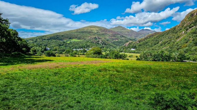
Yr Aran is a mountain in the heart of Snowdonia neighboring Yr Wyddfa, the highest mountain in Wales. It sits too far out of reach of the Snowdon Horseshoe to be included in it, but close enough to be able to sit idly by watching as its more famous neighbors on the horseshoe get all the attention. It’s modest 747m height generally keeps it below the oft-frustrating cloud level, and this helps it stand out when observing the mountain skyline from certain angles. Newcomers may be tempted to assume it is the mighty Yr Wyddfa when arriving to Beddgelert from the northeast, but Yr Wyddfa rises another 300m and is further back in the mountains.
For historical context, I could find little written about Yr Aran from more than a dozen classic texts that I researched. Only Roland Helliwell’s 1947 guide The Rambler’s and Climber’s North Wales mentions Yr Aran briefly as a “shorter day” option to climbing Yr Wyddfa. After last year’s two hikes to the summit of Yr Wyddfa, I decided this year to branch out and check off some of the other prominent mountains in the region.

Mt. Snowdon (Yr Wyddfa) Miner & PyG Tracks
Will Yr Wyddfa finally reveal its secrets on my third attempt to the summit?
Continue reading Mt. Snowdon (Yr Wyddfa) Miner & PyG Tracks

Mt. Snowdon (Yr Wyddfa) Watkin Path
Following in the footsteps of King Arthur’s fateful end.
Continue reading Mt. Snowdon (Yr Wyddfa) Watkin Path
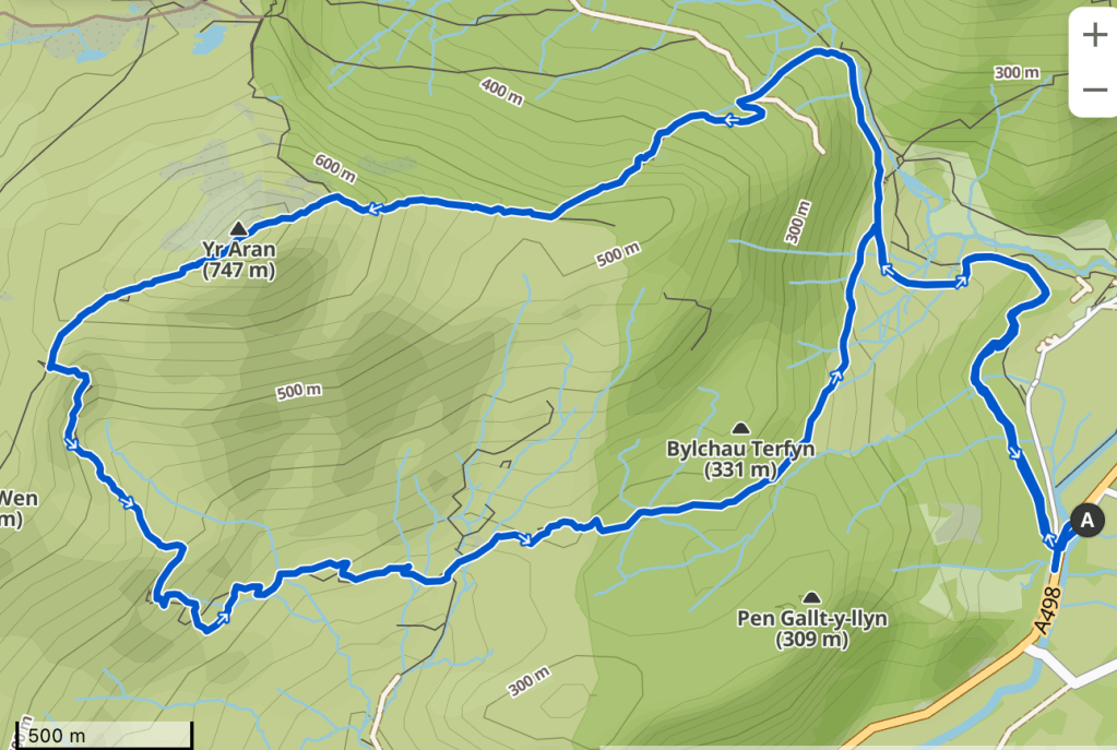
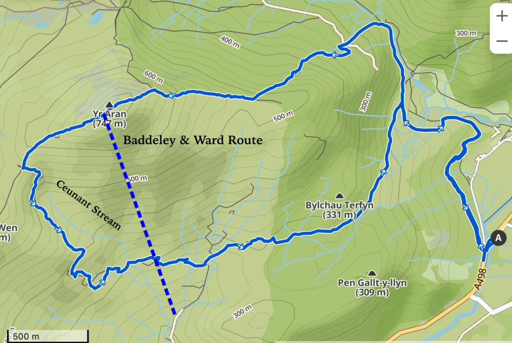
When I plan a hike, most of the time, I rely solely on Komoot. As I would discover, planning a route to Yr Aran was a good example of why you should compare sources from time to time. The obvious route based on Komoot incorporated the Watkin Path which is one of the main routes up to Yr Wyddfa. The final route turned out like this:
Hike Details
| Starting/Ending Point | Pont Bethania Parking Lot Pay with the touchless payment app on your phone, cash or with a card. |
| Distance | 11 km |
| My Moving Time | 2h 55m |

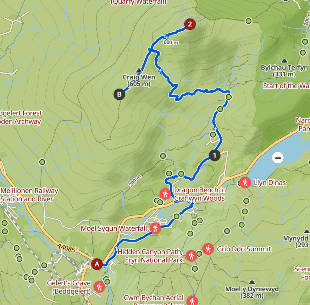
Helliwell’s guide suggests a route quite different:
“A cart track, half a mile below Llyn Dinas, leads up past Hafod-y-Porth farm to the summit in about an hour’s walking. Return can be made over Craig Wen, a rocky ridge on the direct descent to Beddgelert.”
The Rambler’s and Climber’s North Wales by Roland Helliwell (1947)
If you try to plot this on Komoot (see below), the ascent to the peak (2) is some form of what he was describing, even with ruins of the Hafod-y-Porth farm near (1), but the Komoot app cannot connect Craig Wen to Beddgelert.
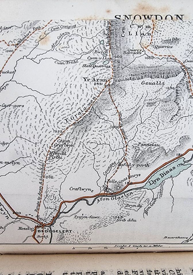
Fate was shining on me as I was writing this post. Today’s mail included the 1895 edition of Baddeley & Ward’s North Wales Part I that I ordered from eBay. In it, I found an invaluable map which shows the route in 1895 exactly as Helliwell was describing in 1947 right down to the Hafod-y-Porth farm.
Nevertheless, I didn’t have either the Helliwell book or the Baddeley & Ward guide before my trip to Wales so I followed the obvious route from the Komoot app.
It’s Not Just a Beer, It’s a Journey
The initial part of the hike follows the Watkin Path which leads back through the ruins of an old slate mine and then ascends up to Yr Wyddfa.
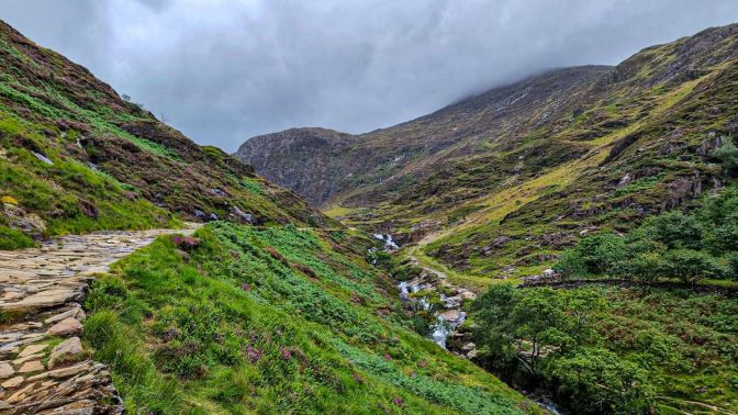
The route to Yr Aran branches off before reaching the slate mine.
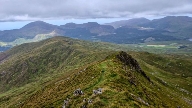
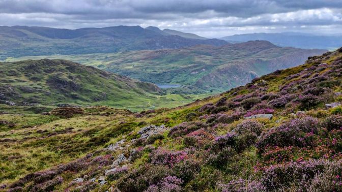
The peak of Yr Aran is already quite clearly visible from the beginning of the trail.

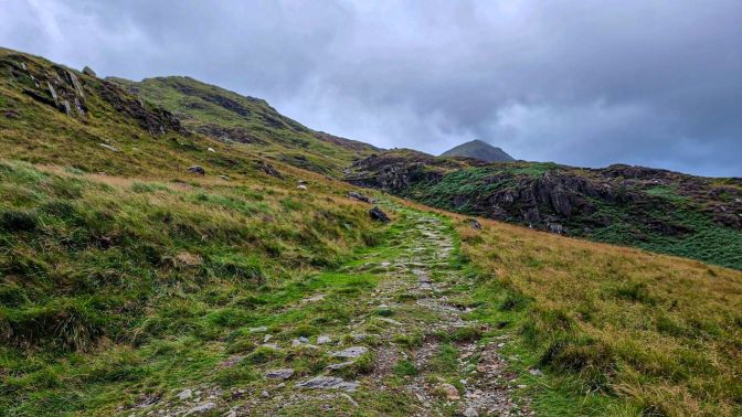
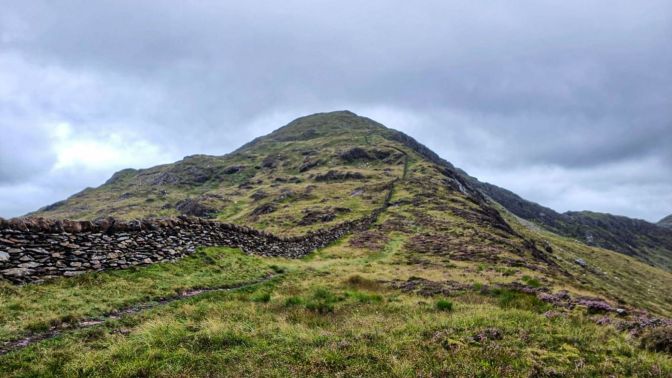
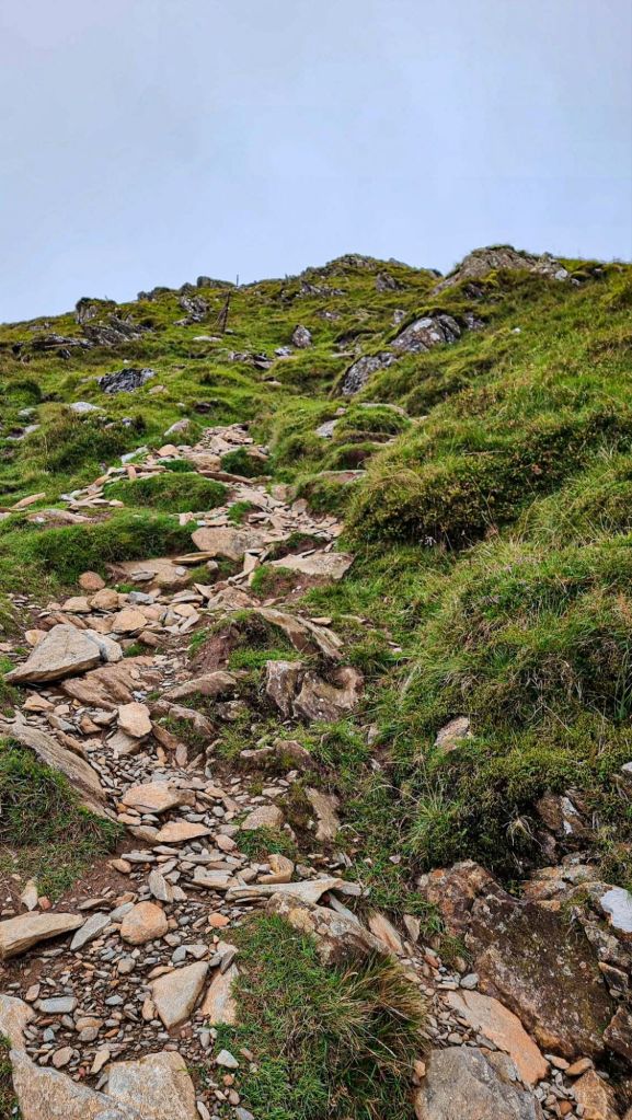
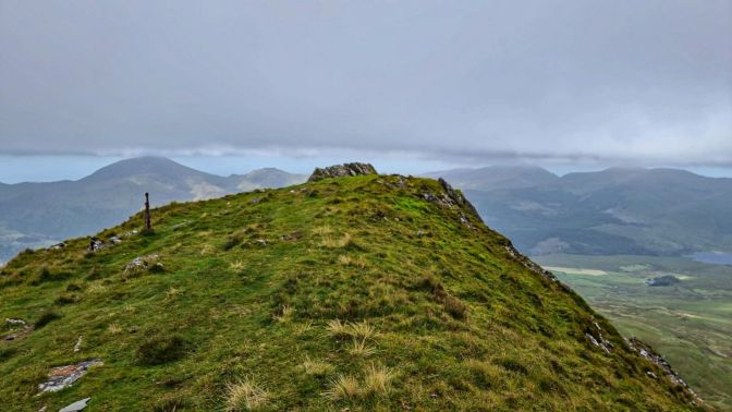
The climb up is rather straight-forward, more or less a defined path. Reaching the ridge, an impressive stone wall runs almost up to the summit; a lot of effort to keep sheep on one side of the mountain. From this direction, Yr Aran looks rounded.
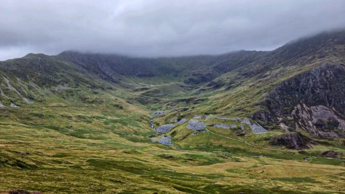
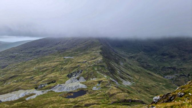
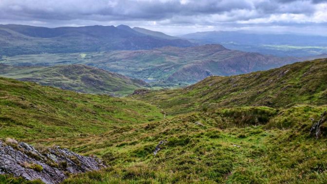
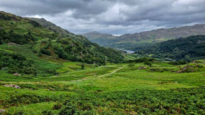
This is a good viewpoint to look over at the old slate mine, and on a clear day, it would be ideal for seeing Yr Wyddfa. This amphitheater-like valley is also believed to be the location of an ancient city during Arthurian times called Tregalan. The clouds floating above it are covering the peak of Yr Wyddfa.
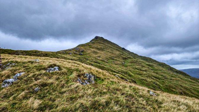
The final ascent is quite steep but easy to manage.
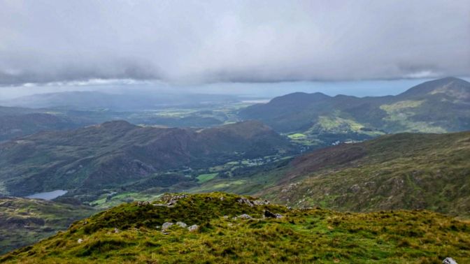
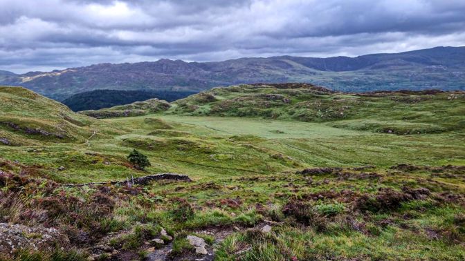
Here we have one of the prime views in all of Snowdonia. Clouds blanketed the sky just out of reach. It was like being near the ceiling in a huge enclosed room that went on for miles in all directions. Only the mountains over about 800m were getting caught in them.
The hike from the previous day, Craig-y-Llan, looks like a small nub in the center of the next picture, while Moel Hebog on the far right at 783m is the one nearly touching the clouds.
Starting my descent towards Craig Wen, it felt like all the wind coming from the sea was finding the path of least resistance directly over this ridge.
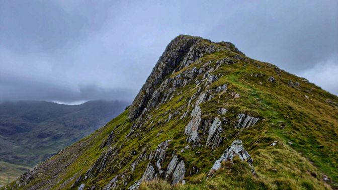
In contrast to one of the previous photos, from the south Yr Aran looks more jagged and triangular.
Instead of going over the top of Craig Wen as suggested by Helliwell (which I didn’t know about at the time), I followed the Komoot route down the ravine. Initially, there was a visible footpath. But within about 50m, all traces of any path were gone. Everywhere you looked, it was marshy grass, shrubs, heather, mountain streams, and a ton of sheep shit. No path. I was about to get an education in the purest form of hiking.
At best, there would be small segments where sheep had forged their own path, but these would soon peter out, and it was again testing each step to make sure my foot didn’t sink into the marshes or step in the middle of a sheep landmine. It went on like this for over 2km.
There are a few things to remind yourself when you are in a situation like this. One is that just because there isn’t a tidy path doesn’t mean you shouldn’t be there. Hikers have been passing this way for centuries without needing tidy paths. Two is that in Wales there are no dangerous snakes and critters hiding in the marshes waiting for one fateful wrong step. Should you hike like this in Texas? That’s a different story. Three is you know where the destination is. You just have to move your feet. Stop your b*tching. The third one was the most effective for me.
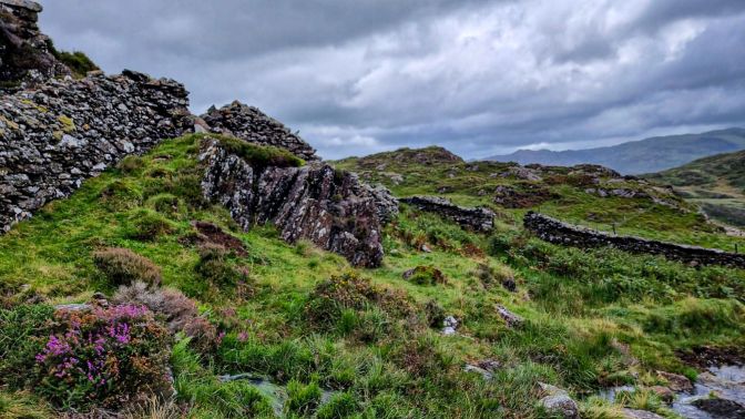
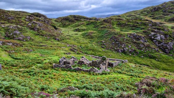
Eventually after zig-zagging, back-tracking, and maneuvering across small mountain streams, I came upon civilization again; or at least what used to be civilization in the form of a farmhouse ruin which was part of the Hafod-y-Porth farm described by Helliwell.
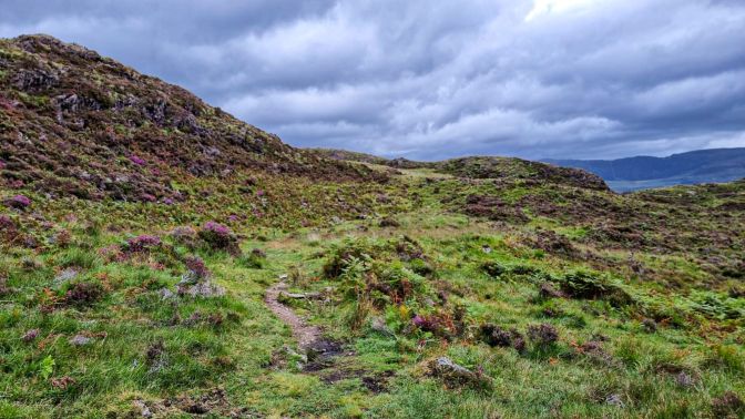
From here, the trail was quite well-marked and established.
Along the way, I was mesmerized by this large glade, which was remarkably flat and devoid of anything other that a small mound to blemish its smooth appearance; like a golf course made by mountain gnomes. In retrospect, if I had taken the Helliwell route, I would have missed this altogether.

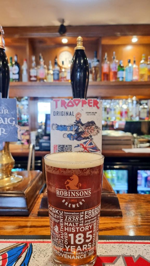
Unfortunately the place I was hoping to have my celebratory beer, Caffi Gwynant, just next to the Pont Bethania carpark, was closed on Tuesdays. So I went back to Beddgelert and celebrated with a Trooper beer at the Tanronnen Inn.
Final Comments
“…after surmounting Yr Aran,… strike S., as shown on the map and, keeping above and to the left of the Ceunant stream”
North Wales Part I by Baddeley & Ward (1895)
The descent I took from Yr Aran, according to the Komoot route, took me along the right of the Ceunant stream which always kept me within the drainage zone of all the water flowing off of the peaks. The route described above takes a direct descent straight down from the peak on a higher path presumably a bit more boot-friendly. I would be surprised to find a visible trail there, but I am curious now to explore it next year if I return to Beddgelert.
In the end, this hike was a blast. Just when I thought it was going to be straightforward and easy as I stood triumphantly at Yr Aran’s peak, it presented a challenge which I wasn’t anticipating nor was I accustomed to. More than the peak views, I will remember the way the sheep looked at me as I was cursing with each pensive step down that ravine, each time cold water flooded into my hiking boots, or every time I paused and muttered “Where the *bleep* is the trail?” like a city boy. Sometimes where your feet happen to be is the trail. This is the lesson of the day. That and… when you hike, hike like it’s 1895.

Thanks much, Matt, for your reflections about hiking, travel, beer, and life. I look forward to catching up with you soon.
Best,
Jay Dickerson
LikeLiked by 1 person
May your feet always find the path. And avoid the sheep stuff. Enjoyed the post!
LikeLiked by 1 person
That’s a nice view on the summit.
LikeLiked by 2 people