
The Schilthorn is to the Jungfrau Region like the not-so-good looking and unmannered guy from the poor part of town who struck it rich, built a pretentious mansion in his own neighborhood where people from all over come to party and have fun all the time, while the more beautiful and dignified neighbors across town who are less accessible to the common person roll their eyes.
If my count is correct, the Schilthorn at 2970m is just the 92nd highest peak in the Bernese Alps which the Jungfrau Region is a part of. But it is the highest peak in the range on the less glamorous west bank of the Lauterbrunnen valley. By comparison, on the east bank, the majestic Jungfrau rules at 4158m.
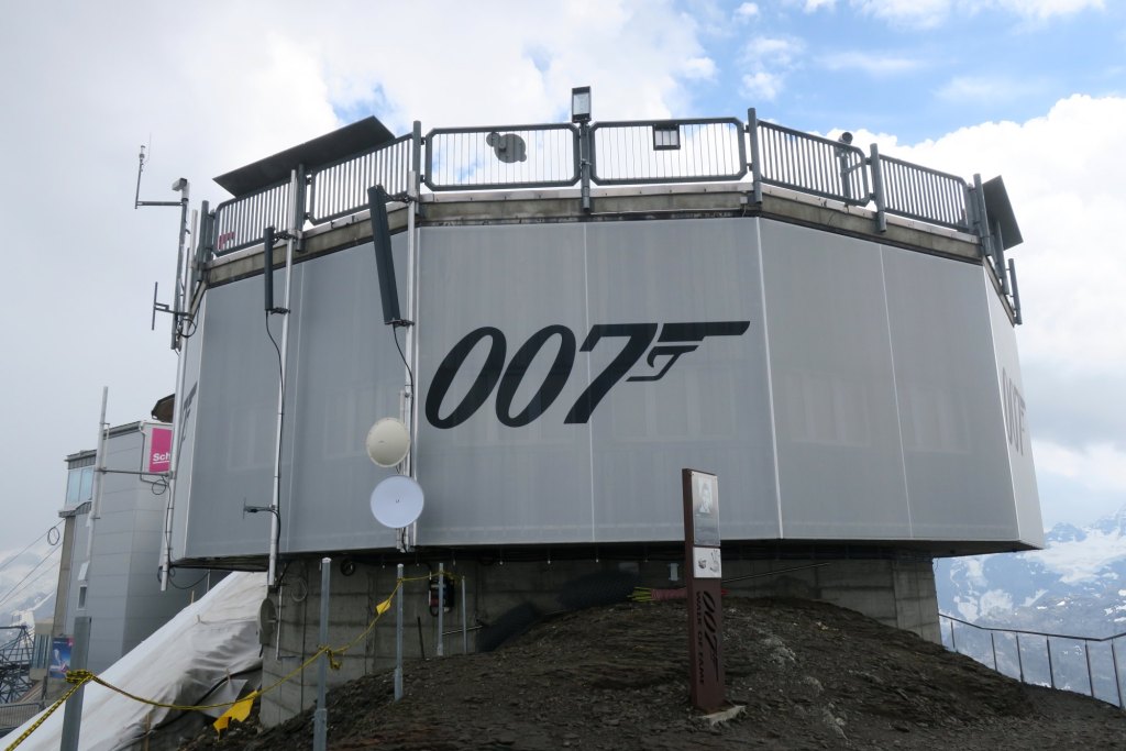
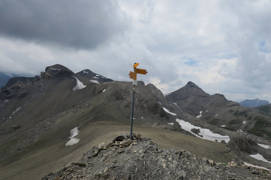
Schilthorn is unique in that it’s peak is obscured by the revolving restaurant Plz Gloria famously blown up in the 007 movie On Her Majesty’s Secret Service. It is possible to take a series of cable cars from Stechelberg to the peak. In 2016, during what would be my 2nd season in the Jungfrau Region, my daughter and I did just that. Then we hiked down. In fact, we hiked down what I would consider the front way towards Mürren and Gimmelwald.
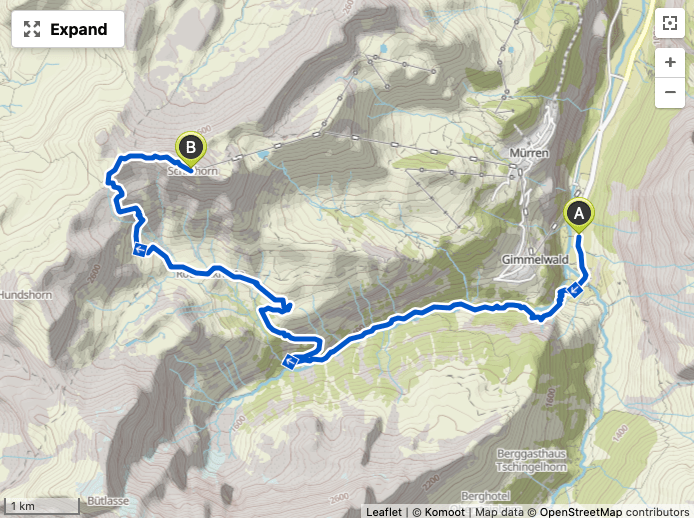
After the previous day’s hike attempt to Rottalhütte, which was amazing but ultimately ended with my tail between my legs, I needed a serious bounce back hike. Hiking up to the Schilthorn was already on my short list for this week and seemed the perfect candidate. From Stechelberg, there are essentially two routes that can be taken. Either take the cable car up to Gimmelwald or Mürren and hike the front way or hike up the Sefinental valley and up to Rotstockhütte where it is then possible to make the ascent to the Schilthorn by the back way. The latter option would allow me to start the hike from the moment my foot stepped out of my Airbnb and would overlap with my Chilchbalm and Rotstockhütte hike from 2018.
I chose to take the back way. The weather forecast showed afternoon showers, so I got my start just after 7am. If all went well, by the end of the day, I would shatter my personal record for ascent. But about 500m up the road, a small setback. Once again I forgot my hiking sticks.
Highest personal ascents
| Hike Start | Hike Peak | Ascent |
| Grindelwald (Camping) | Uf Spitzen | 1370m |
| Zermatt | Hörnlihütte (Matterhorn) | 1360m |
| Stechelberg | Schmadrihütte | 1360m |
| Ben Nevis trailhead | Ben Nevis peak | 1340m |
| Grindelwald (Camping) | Eiger Trail near Eigergletscher | 1300m |
| Grindelwald Grund | Männlichen | 1270m |
| Stechelberg | Rottalhütte (Bärenflue) | 1230m |
Segment 1. Sefinental
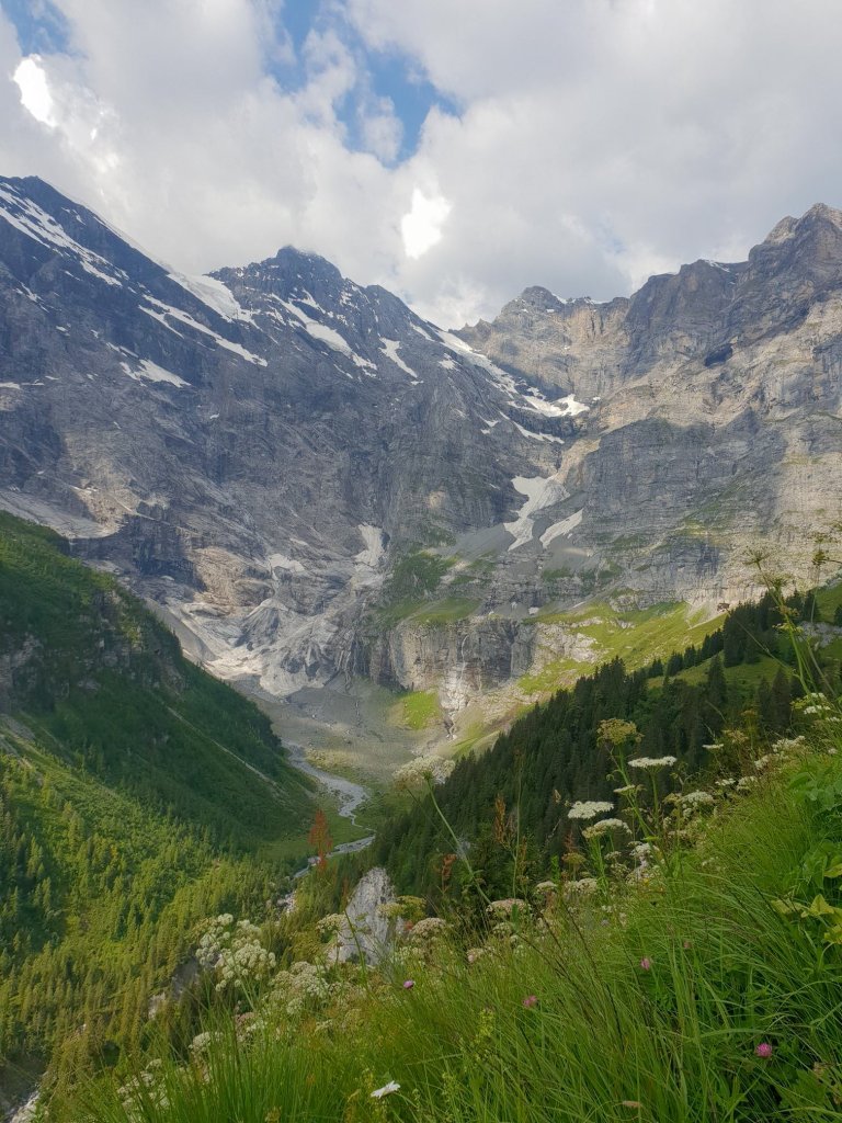
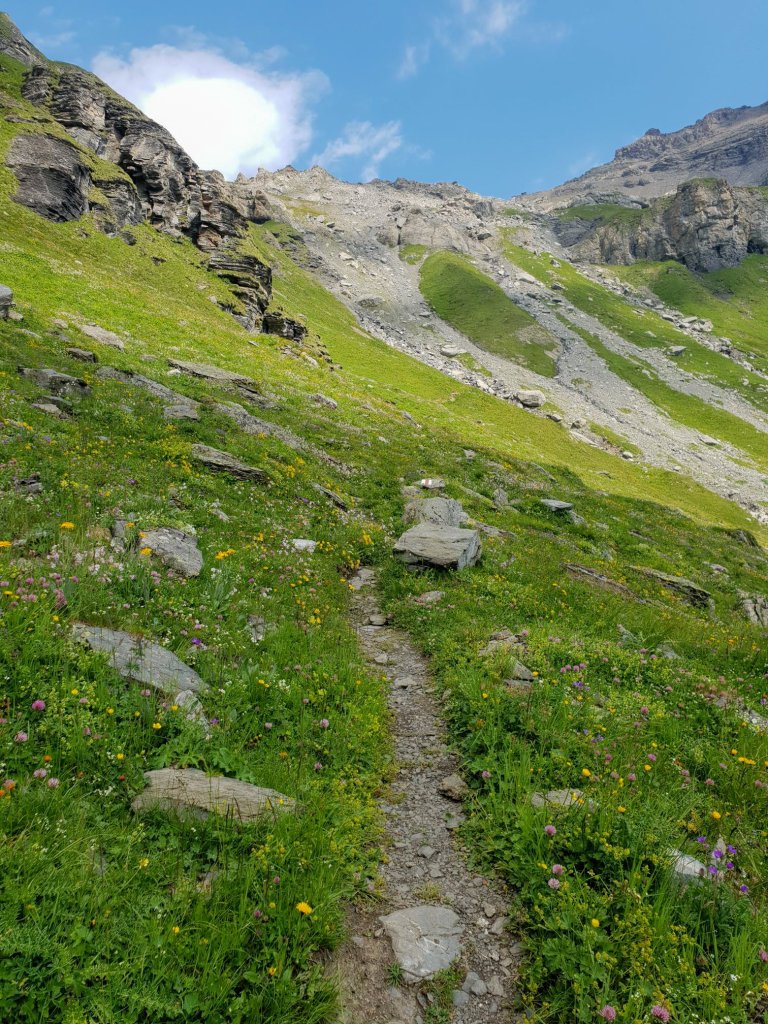
This valley may be one of the more hidden, under-appreciated areas of the region. Starting with a relentless uphill zig-zag (reaching a grade of 37%) from the Stechelburg floor, eventually you reach the main trail.
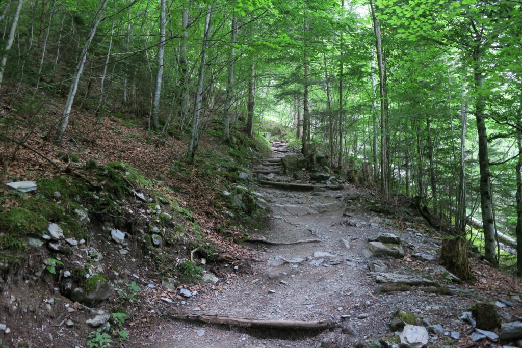
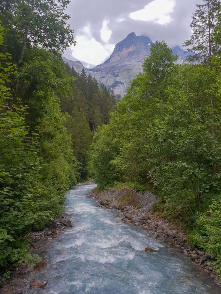
The trail follows the Sefinen Lütschein mountain stream which blankets the valley with it’s spuming white noise. Along the way you pass an old sawmill and the occasional farm chalet (I don’t know what else to call them) which always give off an air of mystery. The plume of chimney smoke coming from one of them indicated life, but no one was in sight.

The end of this trail is the amazing Chilchbalm which I highly recommend to visit, but on this hike, I am skipping that and directly taking the route up to Rotstockhütte.
| Ascent counter | 540m |
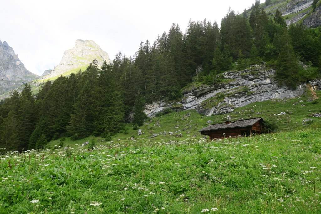
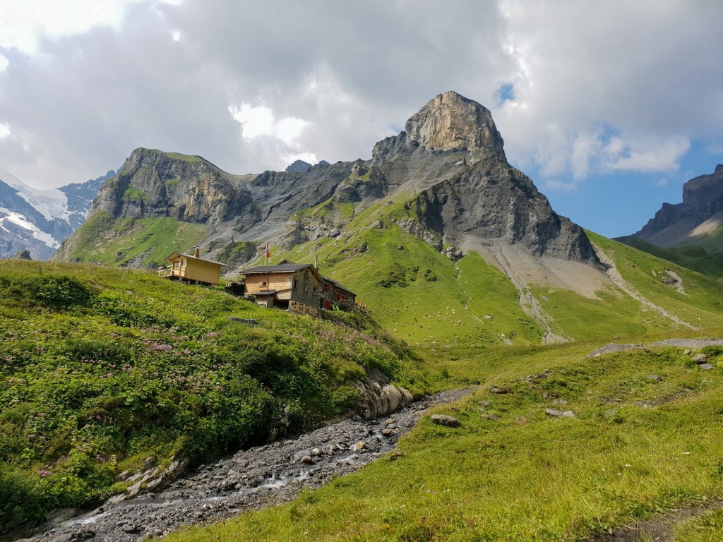
Segment 2. Rotstockhütte
The ascent to Rotstockhütte is where the real effort begins. There are definitely a few wow sights on the way up, but of the various segments on this hike, this is the least interesting. If you are lucky, you will spot some playful Alpine marmots. They were too fast for me though. By the time I could pull out my camera, they were gone.
Lining the road on the way up were several piles of dead branches, probably cleared off the trail after storms. I managed to find a couple decent branches to serve as my hiking sticks. I am a firm believer in their benefit to re-distribute some of your body weight on the uphill climbs and reducing the pounding on the downhill climbs. I could immediately feel the benefits climbing up a grade in the mid-30% range.
Near the approach to Rotstockhütte, the most direct trail was roped off. I assumed this meant it was unpassable so I took a detour up to a two-structure village called Oberberg and then over. There is a lot of muddy terrain in this area. To make matters worse, when I got to Oberberg, I missed the turn to the trail and ending up unnecessarily traversing a seriously muddy patch and with one swift slip of the boot, the snap of one my hiking sticks rattled my mood. Now that I was above the tree line, there was no finding a replacement so with my one precious remaining hiking stick, I bushwhacked across the pasture to regain the trail.
In my previous hike to Rotstockhütte, I had a meal and afterwards turned and headed down to Mürren. This time, I skipped the goulash and beer and forged on to the next ascent.
| Ascent Counter | 1160m |
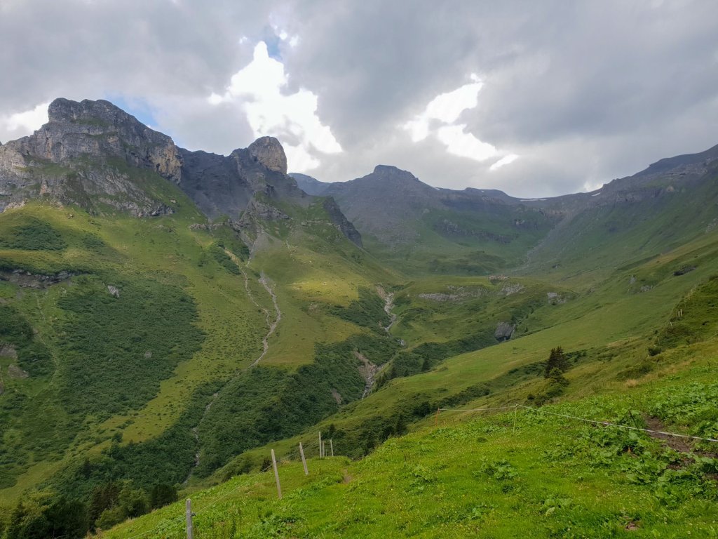
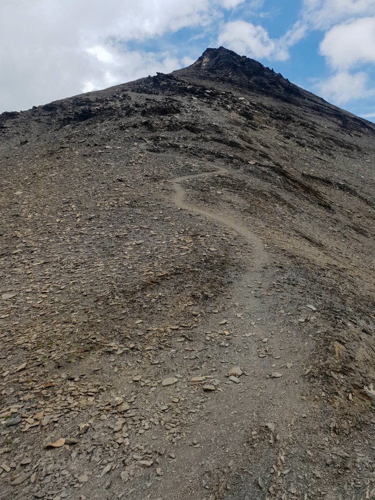
Segment 3. Rote Härd
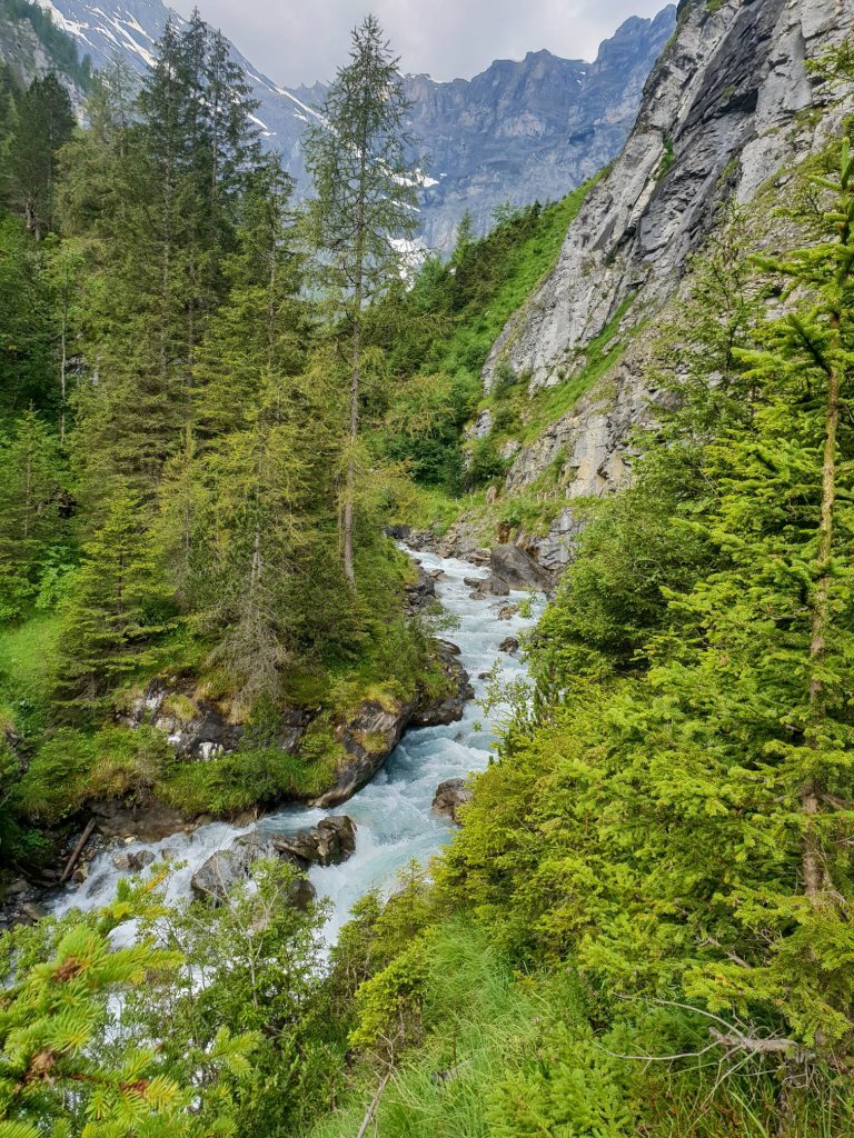
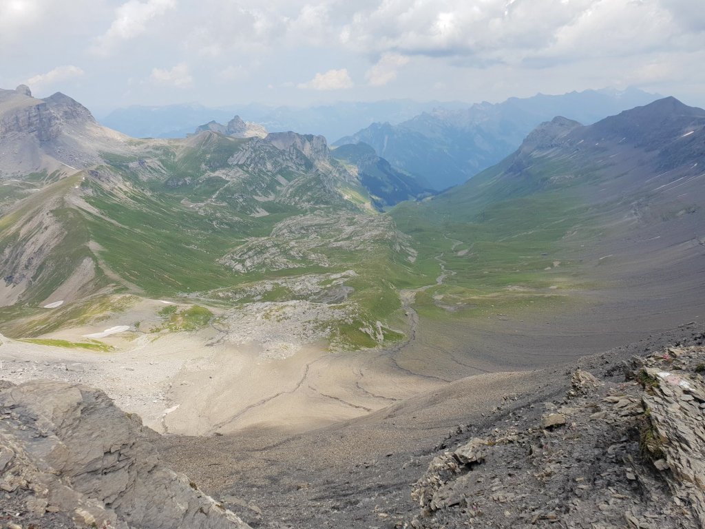
The route up to Rote Härd is the type that as you stand back from a distance, you wonder how you are ever getting up there. It always amazes me how the vastness of the scenery can completely toy with your depth perception. As I made my way across the basin from the Rotstockhütte, my eyes scanned the rocks perpetually frozen in motion from avalanches or melted glaciers of the prehistoric past. Soon the path began to take shape like tilting a two-dimensional image to reveal it’s three-dimensional depth.
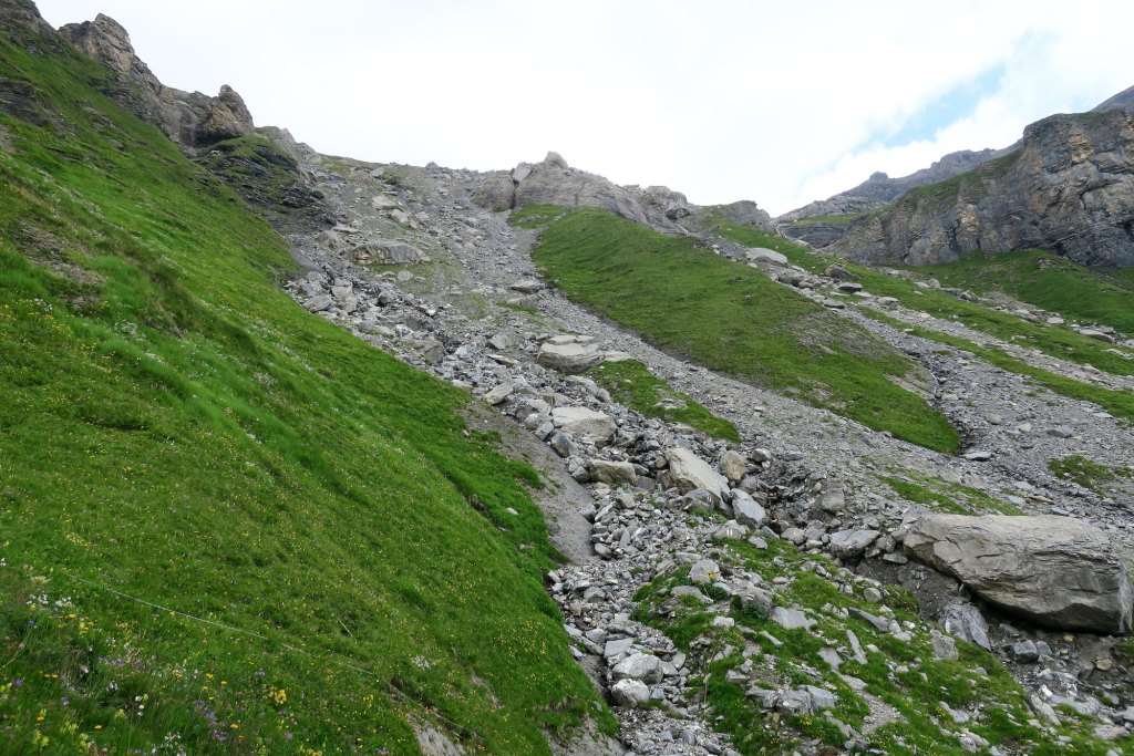
The hike up to Rote Härd was the most intense part of the ascent so far. A steep zig zag, sometimes highly exposed with a few sections of boulder crossings. My singular hiking stick was hanging in there with each stab into the rocky earth. Meanwhile, the views became grander and grander.

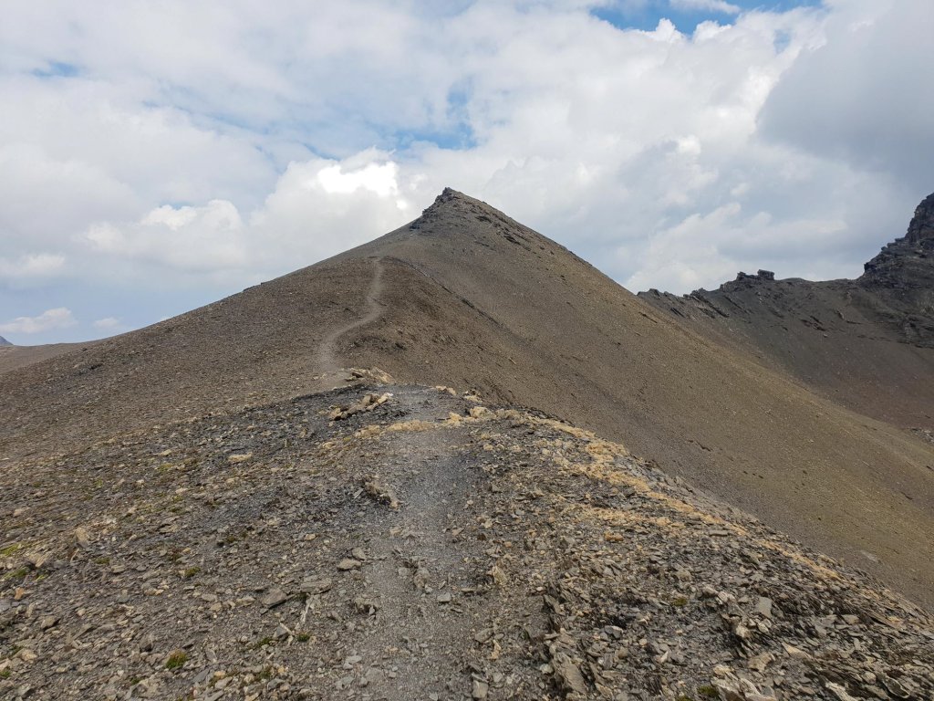
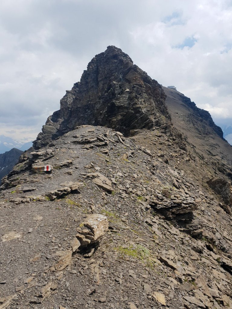
The formation simply called Horn which dramatically looms over you down in the basin eventually succombs to the height of your ascent and seems like a humble bump on the landscape. Meanwhile the Schilthorn Plz Gloria sits perched up on its rocky pedestal at the end of a barren ridge which continually puzzled me as to how the approach will look. Climbing higher and higher presented no new clues.

I knew at this point that I was reaching some unprecedented achievement in my own personal hiking history. I also knew that coming up to Rote Härd was going to mean seeing the mountains and valleys beyond the Schilthorn which I have never laid eyes on. The anticipation was as relentless as the climb.
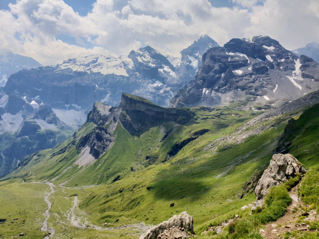
Reaching Rote Härd (meaning Red Hardness), the views opened up like the unlocking of a new area in a video game.
I soaked it in for a few minutes just as dark clouds started to roll over the basin which I just climbed out of. At this point, the hike had gone without a hitch. And suddenly, it felt like a race against time as the clouds looked like the dust from attacking hordes of Mongols. Then I looked towards the Schilthorn…
| Ascent Counter | 1763m |
Segment 4. Schilthorn
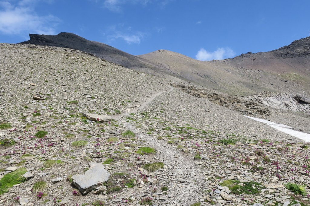
After Rote Härd, it is necessary to climb higher up on the ridge. The sudden cloud cover behind me brought with it surging winds which accentuated the sensation of exposure. For the first time of the day, the weather became a factor. I felt a rush of adrenaline to get up over the top of this formation so I could see the rest of the way to the Schilthorn.
When I reached the top, I could see that between my current location and the Schilthorn peak was a shelf of steep rocks. From down in the basin, it looked like that perhaps the trail would simply run behind it, but for the first time I could see that the ground drops completely off on both sides of it.
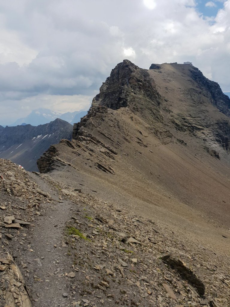
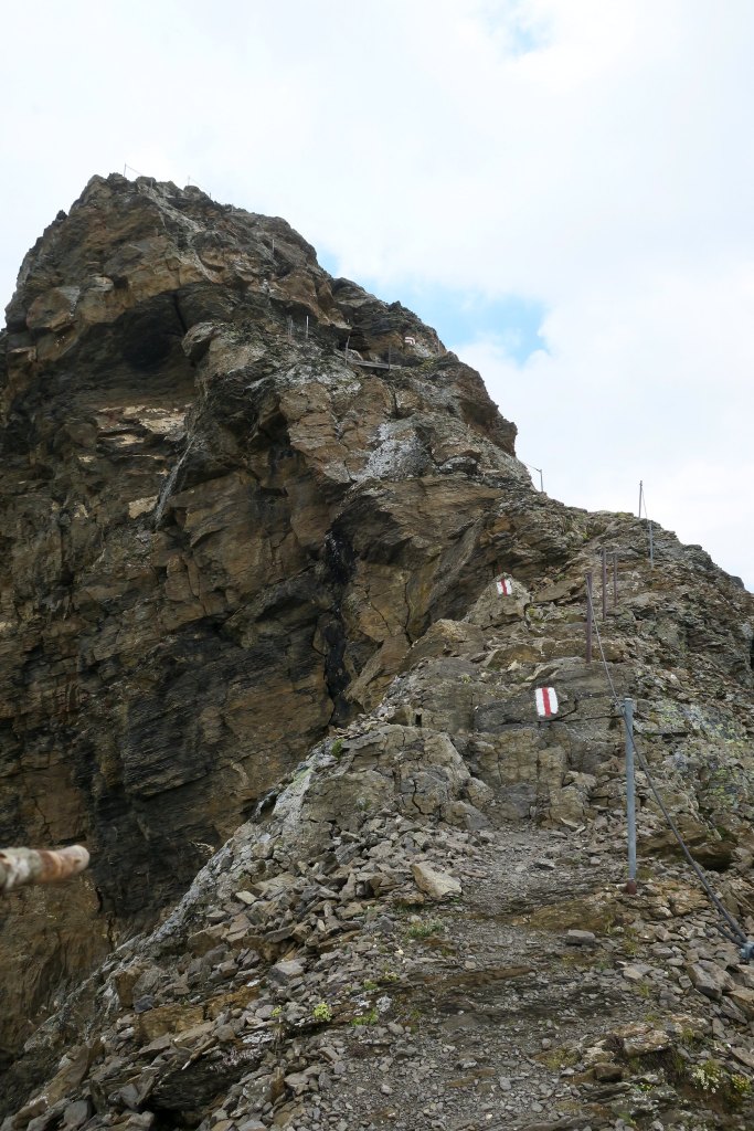
There was no way to the Schilthorn except up those rocks and then the reflection of something metal caught my eye and before I could take another step, the words Oh no escaped into the stinging wind. From my distant vantage point, it looked like there was a ladder perched precariously over nothingness. I cursed myself for not doing better research but I kept going.
Turning back was impossible. The sky to the south was looking more ominous by the second. I was just going to have to get closer and see how bad it was going to be. Then I started to get a glimpse of some cables, which meant the metal structure was just one obstacle. My heart was racing like speed metal double bass drums to the chorus of Please be stairs, please be stairs. As I reached the rock shelf, to my great relief, they were.
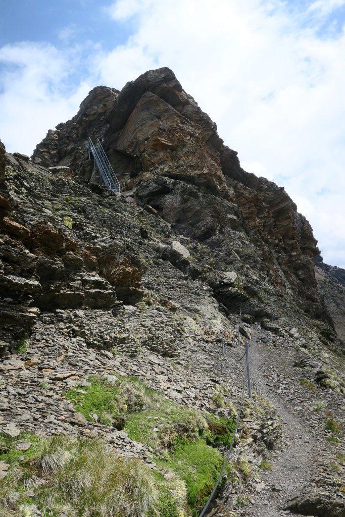
Once my mind adjusted to the real dimensions of this climb up close, the internal undefinable calculations in my psyche determined that this was well within acceptable parameters and I felt momentarily relieved, while a bit ashamed at the same time for worrying in the first place. The climb is well-lined with metal poles, rubber coated cable, and the path weaves up the rocks without any severe exposure to the drop-offs on both sides. It became clear that this was securely designed to give anyone riding up on the cable car a chance to hike out to this ridge for some amazing views and a little extra Alpine excitement.
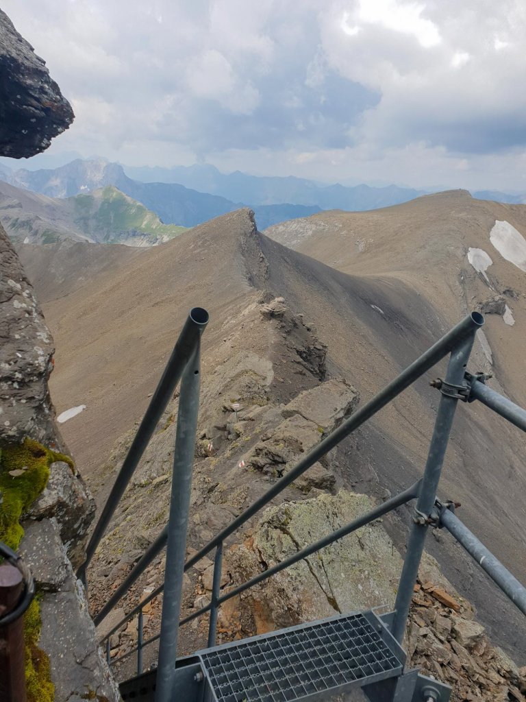
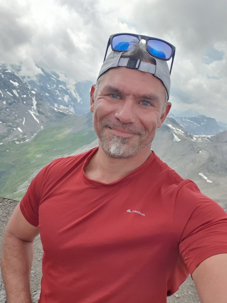
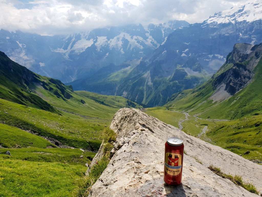
When I got past the stairs, I knew it was going to be a piece of cake and that the unnecessary stress I just put myself through over the last few hundred meters was over. I finally took the time to stop and soak in the views and the emotions of the moment brought tears to my eyes.
But I made sure you couldn’t tell when I took the selfie…
| Final Ascent Counter | 2050m |
Hike Details
| Starting Point | Stechelberg |
| Ending Point | Schilthorn Plz Gloria |
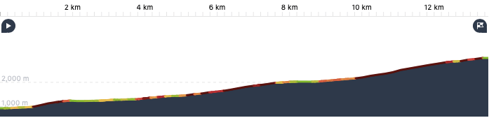
| Distance | 13.5 km |
| Ascent | 2050m |
| Moving / Total Time | 3 hr 44 min / 6 hr 20 min |
| Eating Place | Rotstockhütte, Plz Gloria |
Final Words
I trust I can be forgiven for not hiking that bad boy back down. Downhill is the scourge of hiking and I wasn’t about to do 13.5 km of it. So I dished out the roughly 65 euros for the cable car ticket. As you wait for the cable car, you are subjected to a large screen TV replaying the scene from the 007 movie involving the destruction of the Plz Gloria. I am one of the few people who has never seen a 007 movie prior to the Pierce Brosnan era. But now I know that scene by heart.
It was a strange feeling having the culmination of an intense and rewarding hike being shoved like cattle into a cable car full of masked people. Those roughly 30 minutes in transit felt longer than the hike going up. As I burst out of the final cable car onto the valley floor in Stechelberg and hobbled back to my airbnb, it occurred to me that it was a day like today that I have spent my entire 2020 waiting for. No matter what happened the next couple days, good weather, bad weather, this year’s trip to the Jungfrau Region felt fulfilled and the rest of the week was bonus.
As I arrived back to the airbnb, I solemnly retired my humble walking stick to the trunk of my car. Well done, my friend. Shortly after, like clockwork, the rain finally broke thru and pelted the wooden shingles of the chalet with a comforting rhythm for the rest of the evening. Thunder roared in the distance and it was as if the hiking Gods were throwing a party to celebrate. I could imagine a bearded one coming up to me, in full beer breath. We gave you a chance, Mate, and you didn’t blow it this time. Thanks, man. See you guys, tomorrow.


Looks like a beautiful area, well worth the effort to see those views. And more satisfying than the cable car.
LikeLiked by 1 person
Definitely better than the cable car 👍👍
LikeLiked by 1 person
Amazing views! 😮👍
LikeLiked by 1 person
Thank you Patricia 😊😊
LikeLiked by 1 person
that’s way up there! great job!
LikeLiked by 1 person
Wow- Those photos are amazing!
LikeLiked by 1 person
Thank you very much Allison 😊😊
LikeLiked by 1 person