
Every summer brings the opportunity and excitement to make my annual pilgrimage to Switzerland, particularly the Jungfrau Region, for another series of hikes to feature on this blog. This was the first year where I was unable to find my preferred accommodations in the Lauterbrunnen area, so this year I found myself staying in the too-touristy-for-me hub of the area, Grindelwald.
This year also brought another change from previous summers and that was a bout of bad weather. The first two days of the week had about a combined 20 minutes of actual sunshine, while the rest of those two days was at best dry with low cloud cover and at worst a steady rain. I was adamant to enjoy a hike every day, so the first day, which was forecasted as the worst weather of the week, I chose to revisit the Eiger Trail. My previous Eiger Trail post from 2017 is my all-time most visited blog post. So I figured this would give me a chance to check it out in a different way. This time in the uphill direction and in wet weather. I planned a hike from my campsite in Grindelwald to Kleine Scheidegg.

The Route Specifications
- Starting Point: Camping Gletscherdorf, Grindelwald
- Ending Point: Camping Gletscherdorf, Grindelwald
- Distance: 27.6km
- Moving Time: 7 hours 2 minutes
- Eating Place: Kleine Scheidegg
- Komoot Link: Hike Link
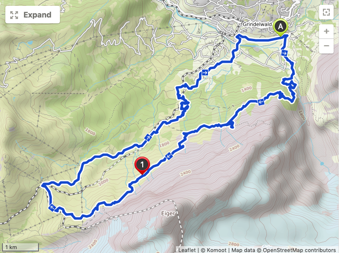

The Route Details
The route is essentially the opposite as my previous post on the Eiger Trail for the first half. I crossed over the Grindelwald Gletscherschlucht and followed the trail until it eventually meets up with the Eiger Trail. One word of caution that as of this post, there is heavy construction at the Eigergletscher train station, therefore it is not possible to follow the Eiger Trail all the way to Eigergletscher. Therefore, before reaching Eigergletscher, you are diverted toward Kleine Scheidegg.

Along the way, I noticed a sign pointing towards the Ostegghütte. Intrigued by its warning to be only for experienced or guided mountain climbers, I followed the trail up a bit to see for myself. The trail does start to get a bit treacherous and with the bad weather, I only explored a small section.

Arriving at Kleine Scheidegg, there is the option to take the train back to Grindelwald. As with everything in Switzerland, it is quite expensive, so I decided to rely on my legs. I did not backtrack over the Eiger Trail, but instead followed the trail down the valley towards Alpiglen and then thru Brandegg. The result was a 27.6km roundtrip which became the longest hike that I have ever recorded.
Photo Journey
The unofficial beginning (or ending) of the Eiger Trail for me is the Grindelwald Gletscherschlucht.

The forest in this section has a mystical feel under the cloud cover.

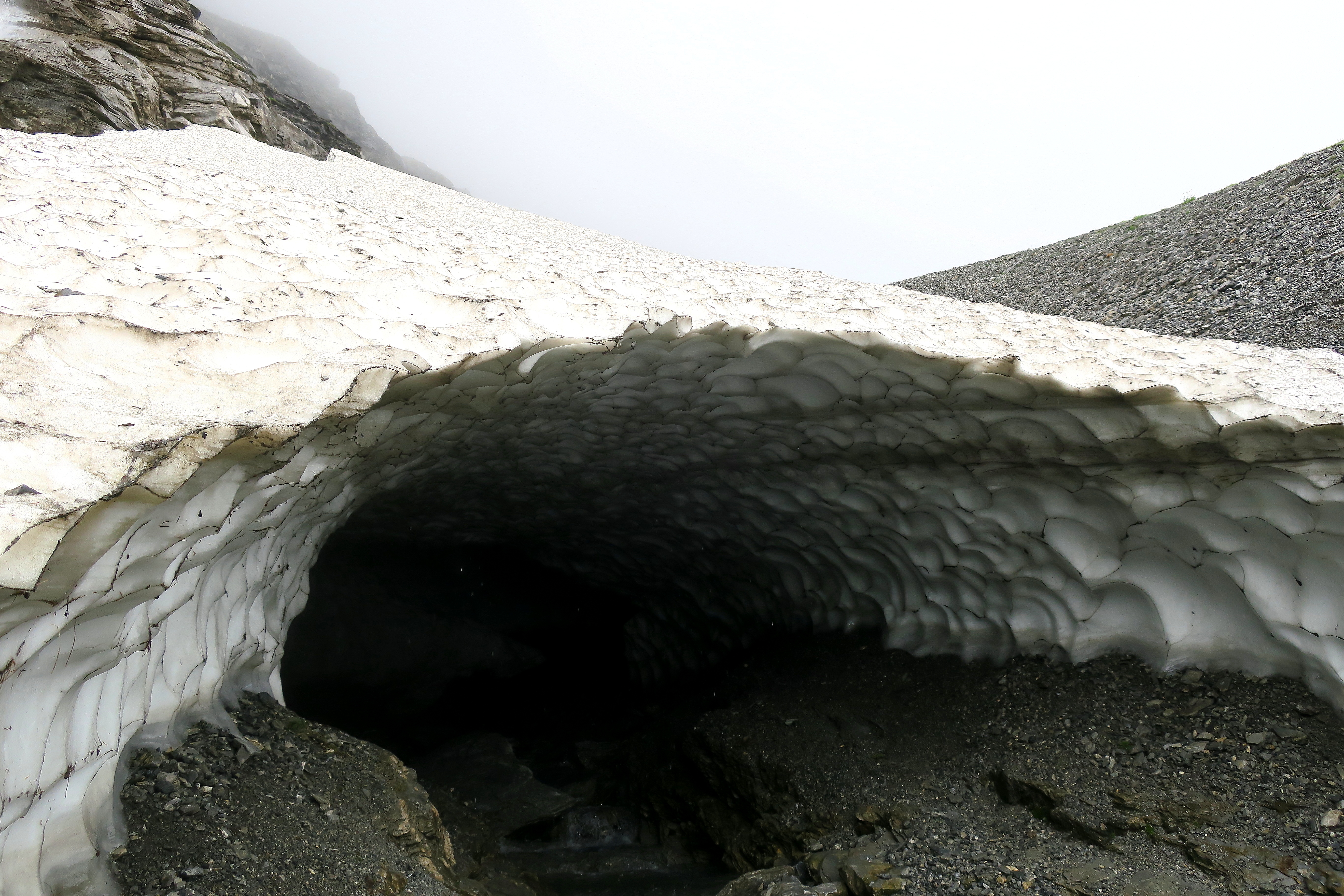
Staring into the mouth of a small glacier.
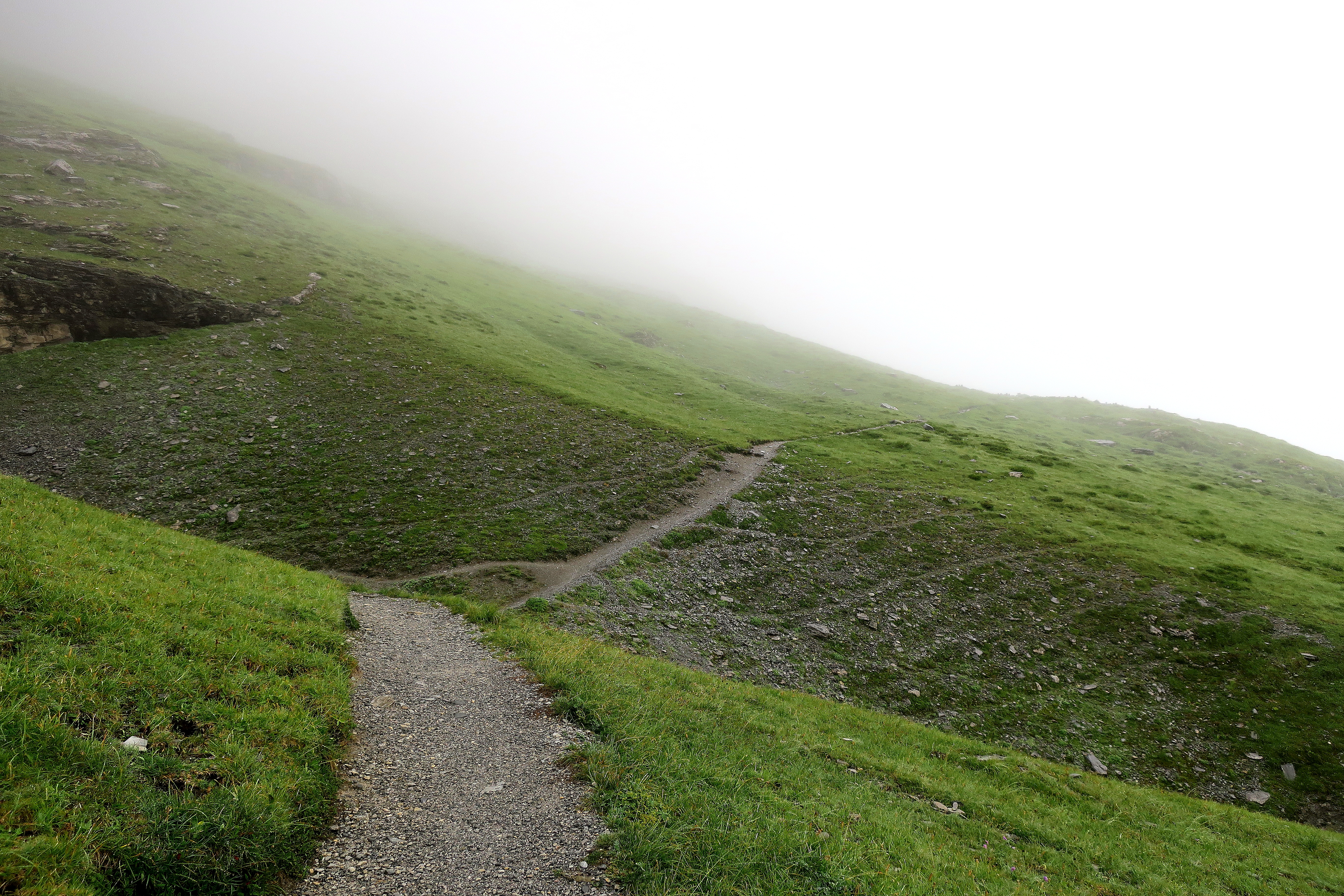
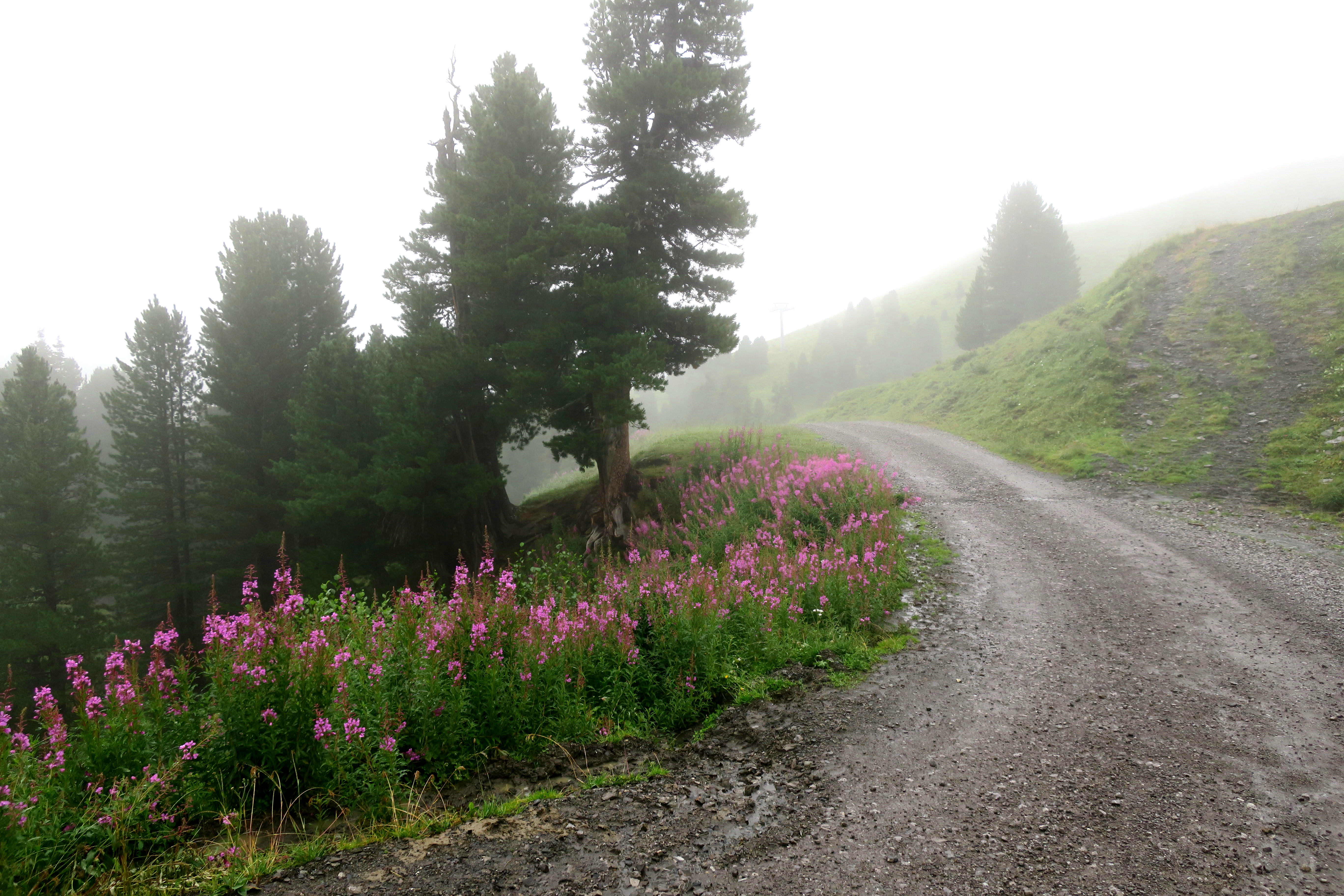
The Eiger Trail in the clouds has a special intimate character. It is hard to believe there are soaring vistas invisible thru the mist.

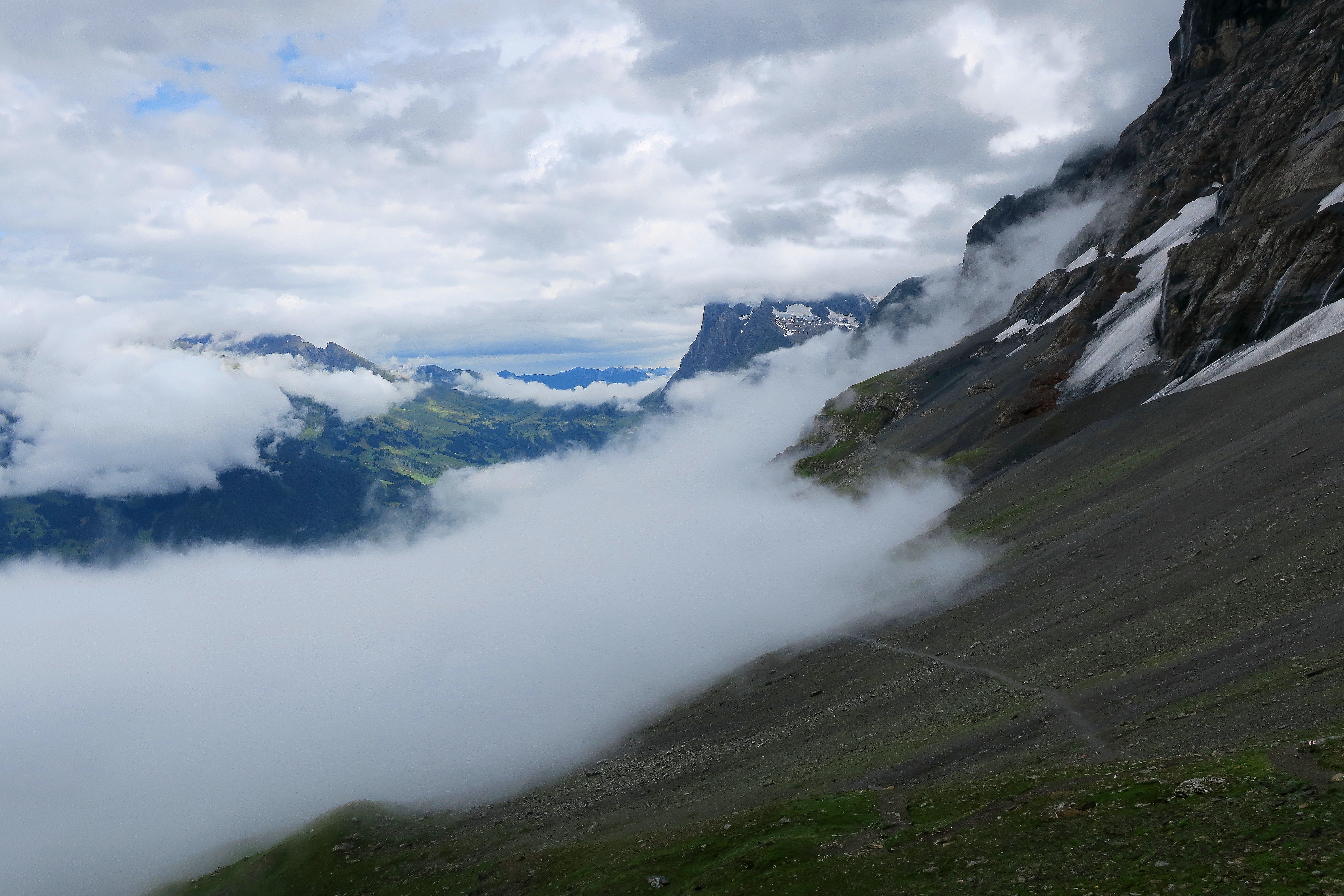
Looking back, the clouds creep up the rocks like a foreboding presence, but with breathtaking consequences. Some gaps in the clouds reveal the direction towards Grindelwald and beyond.
The famous Swiss cows make their first appearance, near the base of the Eiger.

Kleine Scheidegg….
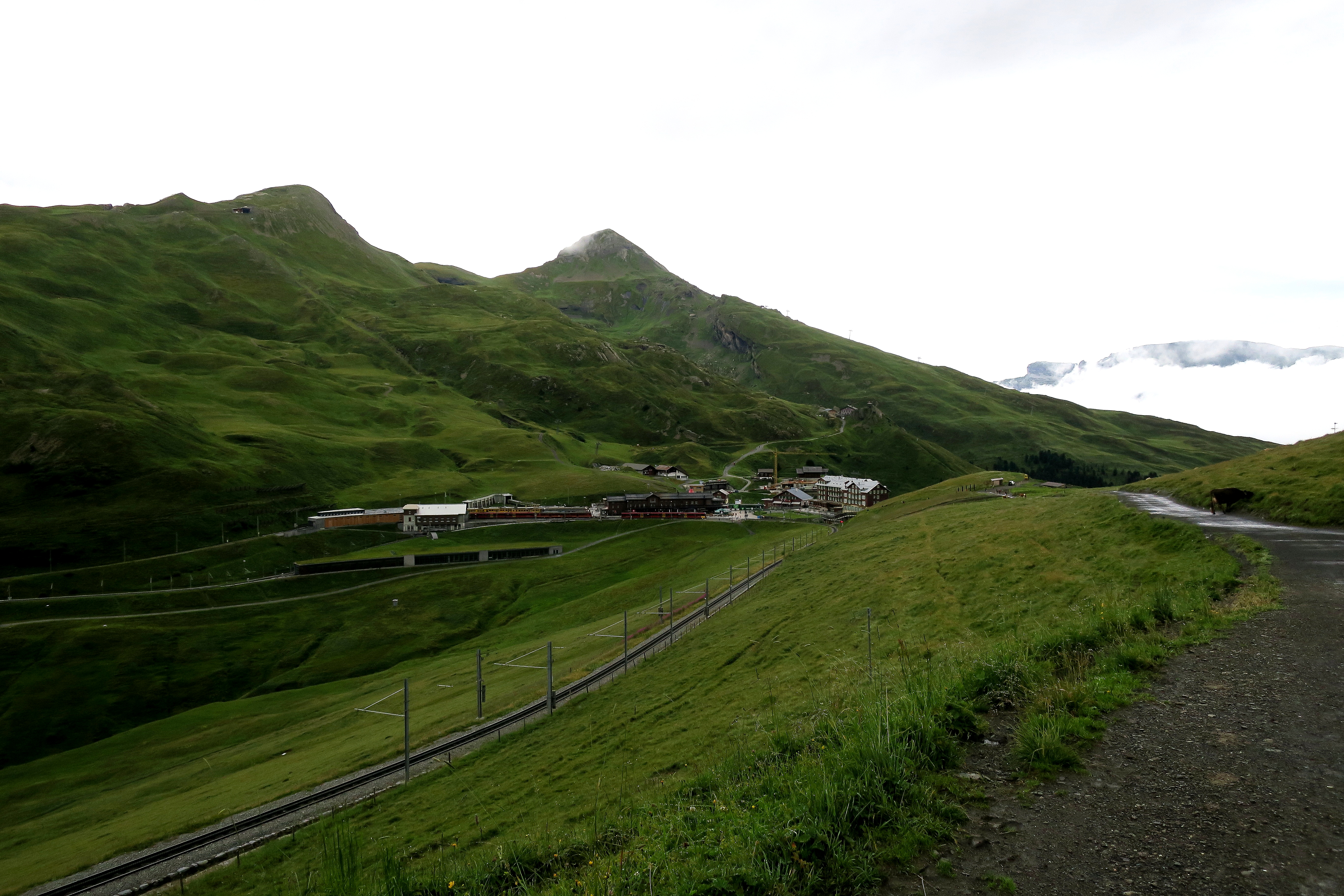
Here you can decide to take the train down to Grindelwald Grund or hike down. I chose to hike, and then the rains came. The path down is also a mountain road.
Alpiglen is a very cute collection of houses that you pass thru on the way down.

Final Thoughts
The rainy, cloudy day did not spoil the Eiger Trail at all. Of course, I have had the luxury of hiking it already in good weather. But the elevation plus the clouds gave the hike a mystic solitude that appeals to me when I hike. The construction at Eigergletscher only spoils a short and almost non-essential part of the trail and actually the alternative path to Kleine Scheidegg was quite nice.

Thank you, I enjoyed the hike. Lovely photos and congratulations on completing what looked like a tricky trail.
LikeLiked by 1 person
Thank you, Sheree 😊
LikeLiked by 1 person
Bad weather and it seemed like a difficult hike but the misterious pictures with the clouds are amazing and breathtaking!
LikeLiked by 1 person
Thank you Patricia 😊
LikeLike