
“Do you have a compass?”
In the hiking world, I call this compass shaming. I looked out from the Glen Nevis Visitor Center to the dark and ominous clouds hanging low over the mountaintops and then to a group of laughing teenagers who had clearly just completed the hike. I wondered sarcastically if all of them were so happy because they had compasses.
I let the question hang in the air for a couple seconds. I’ve been told that I sometimes have an intimidating glare. I have never discovered what that meant, but I hoped the look I was giving the 20-something attendant was one of those.
“No I don’t.”
The young man behind the counter could not disguise his doubt that I was able to reach the peak and back safely without a bloody compass.
“The trail ends here.” He pointed at a topographical map. “From this point on you are only guided by stone cairns set 50 meters apart. In weather like this, you may not be able to see them and there are steep cliffs on three sides.”
 His “you could die” attitude was not the encouragement I was looking for. I was in town for two nights and Saturday was the only chance to do the hike. Bad weather or not, I was doing it. But a little positivity would have been helpful. Instead I was standing there feeling like I was the only fool planning to do the hike. And without a compass even. I imagined the shocked looks of locals and tourists as I set off up the mountain trail. Crying women grabbing onto the back of my jacket begging me not to attempt it. Headlines flashed in my mind like “Stupid A-hole found dead. No compass found on corpse!”
I thanked him, probably not in the kindest tone of voice, and headed to my car. Screw the compass, but I was at least going to pick up some extra warm clothing just in case. The weather forecast gave the smallest chance of precipitation before noon. My best shot at a clean hike was to start out at the crack of dawn.
The Way to Fort William
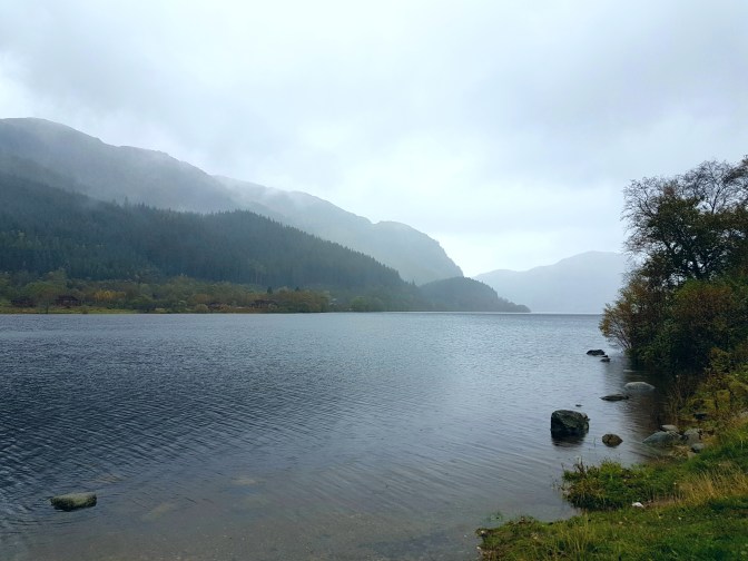
Ben Nevis is the highest mountain in the British Isles and is close to the city of Fort William in Scotland. I happened to be in Sterling on business and decided to stay the weekend for the sole purpose of this hike. Between Sterling and Fort William lies some of the most beautiful countryside Scotland has to offer, including Loch Lomond and the Trossachs National Park and Glencoe valley. So even before setting foot on the mountain, the entire pilgrimage to the peak of Ben Nevis started the day before on the drive to Fort William.
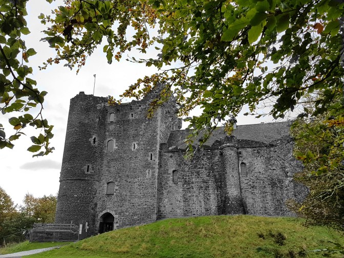
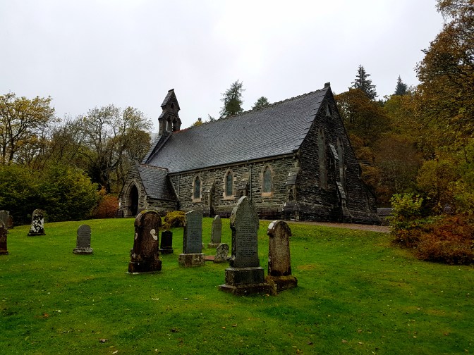
The real starting point on this journey was a site I’ve already written about, Doune Castle, where many of the scenes from Monty Python & the Holy Grail were filmed.
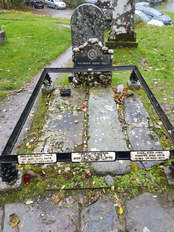
Further up the road, I saw signs for the gravesite of the Scottish folk hero and Jacobite rebel Rob Roy. So I took a small detour.
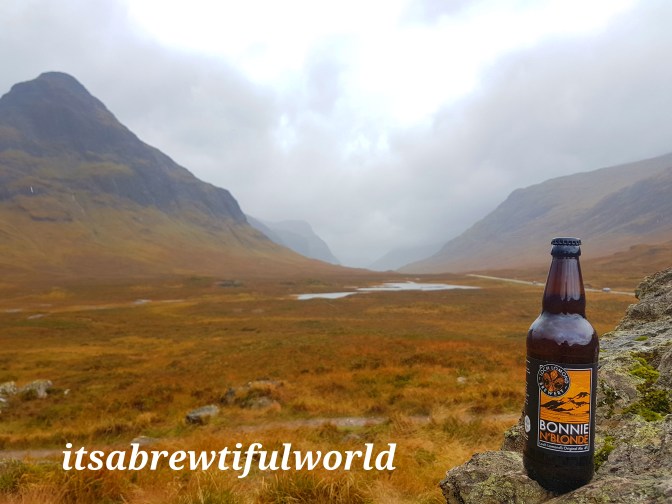
The real star attraction of the drive though is Glencoe. The valley is not long. The drive thru without stopping takes only about 20 minutes. But every pullover on the side of the road tempts you to stop and take photos. There are also places to pull over for hikes. I hope to be back another time to do the hikes in the area. For now I had to be satisfied to pose my Bonnie n’Blonde Ale from Loch Lomond Brewery.
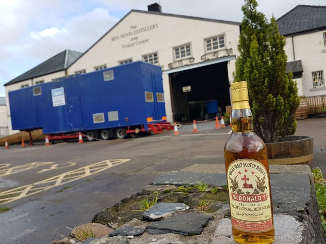
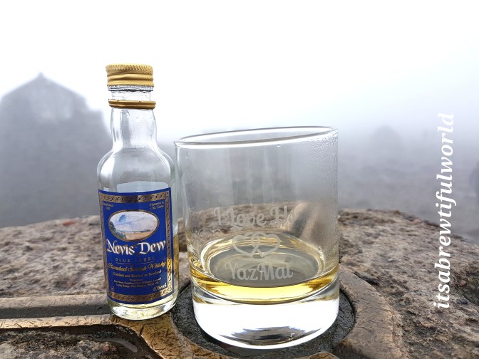
In Fort William, I made a pilgrimage to Ben Nevis Distillery. Here I bought a small bottle of Nevis Dew to take with me on the hike and also a large bottle of McDonald’s Traditional Ben Nevis Whisky, currently the only single malt produced at the distillery. The other one, the Ben Nevis 10, will not be available from the distillery for a couple years.
The Hike
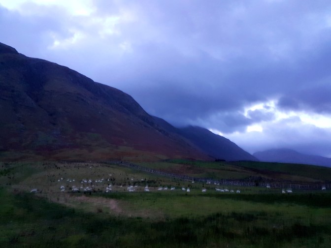
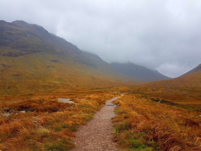
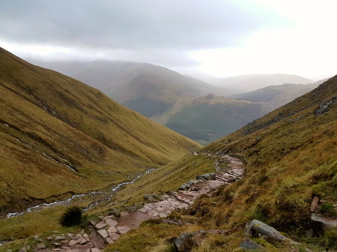
There are several ways to climb to the Ben Nevis summit, but probably the easiest and most used is the Pony Track (or Tourist Route) starting from the Glen Nevis Visitor Center. I arrived around 7:00 am and as I had hoped, the weather was dry. Thick clouds still blanketed the summit, but I had already made peace with the fact that I wouldn’t be seeing anything at the top. Nevertheless even in these conditions, the views on the way up were amazing.
In October, the temperatures on the summit can be below freezing. The expected temperature today was -5 deg. C. Fortunately, I picked up a fleece sweatshirt and winter hat the day before. I also had a quick dry long sleeve shirt underneath the fleece and a rain-proof jacket and gloves in my backpack for the higher elevations. On my legs, I wore my quick dry hiking pants and rainproof biking pants over them. At the summit, I needed every bit of those clothes to keep warm.
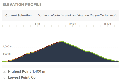
Here is the Komoot recording. The starting and ending point is A. (I left the app recording as I drove home, so ignore anything to the north of point A.)
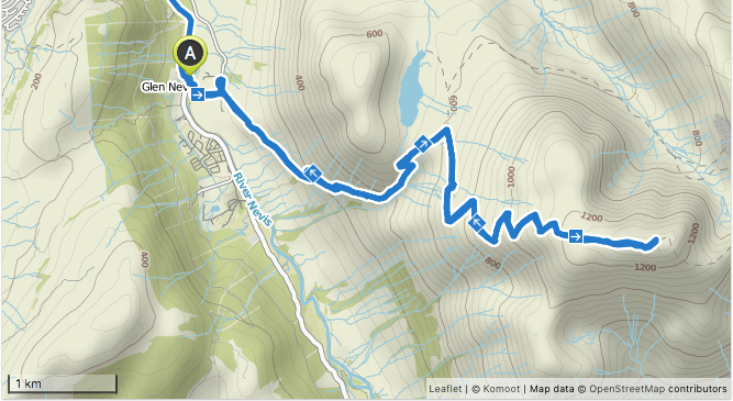
- Trail Name: Pony Track or Tourist Route
- Starting Point: Glen Nevis Visitor Center
- Ending Point: Glen Nevis Visitor Center
- Distance: 16,5 km
- My Time: 4:15
- Eating Point: Ben Nevis Inn
The Summit
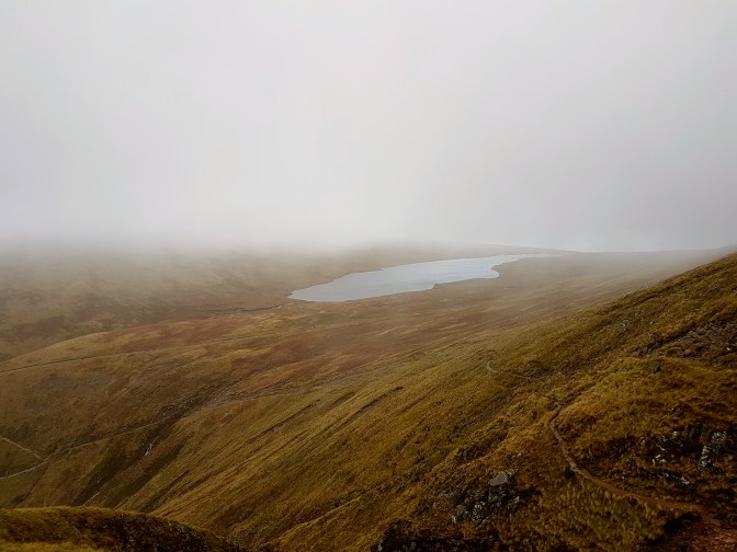
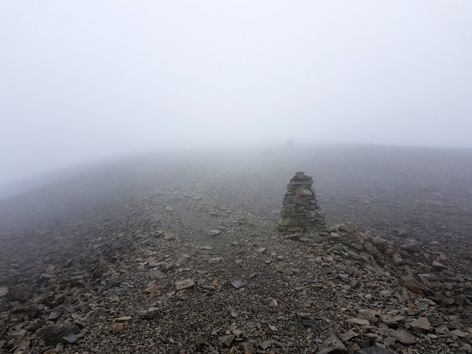
The visibility on the summit was poor but the cairns were visible. Although there is technically no path, the steps of thousands of people have worn a noticable path on the stones. However, if there was snow on the summit, only the cairns would indicate the correct direction. To be fair to the Glen Nevis Visitor Center staff who asked me about the compass, navigational error has lead to a few casualties and rescue efforts over the years, especially during the winter. Today, though, no compass was necessary.
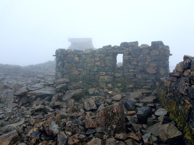
On the summit are the ruins of an observatory that was in operation between 1883 and 1904. It is a completely rocky landscape, treacherous underfoot due to the damp.
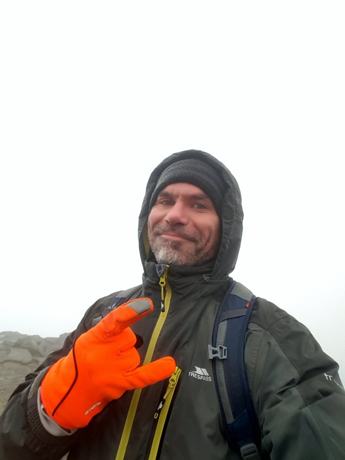
The wind was ruthless and cut thru my attire like needles as my body temperature was starting to cool down. I poured myself a dram of very cold Nevis Dew whisky into a special glass I brought along for the occasion and gave myself about 10 minutes to enjoy this achievement before heading back down.
Final Words
The predicted early afternoon rain finally came about halfway down the mountain. I passed several school groups who were attempting the National Three Peaks Challenge to climb the tallest 3 mountains in Scotland, Wales, and England within 24 hours. By this time, the conditions had worsened and several kids were already retreating. Scotland’s weather is not for the casual hiker. Rain, cold, clouds, and wind are all part of the experience rather than a deterrent. It is part of the mystique and in a way the weather makes you earn Scotland’s depth and beauty. I reached the bottom wondering how in the world I would manage to do this two more times in the next day like these kids. But for me, my pilgrimage was over and thankfully at the foot of the mountain sits a very cozy inn where I could grab a burger and a good blonde ale. The furthest thing on my mind at that moment was whether I should ever invest in a compass.
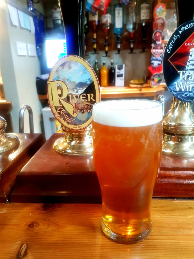
A well-earned beverage at the Ben Nevis Inn
