
For my 3rd and final hike during my August hiking holiday in Lauterbrunnen, I decided to do a hike closer to my campsite in Camping Jungfrau than the previous two – The Eiger Trail and Schreckhornhütte. I had never been to the village of Isenflüh or the area surrounding it so I decided to make that a waypoint on the hike and go from there. Isenflüh can easily be hiked to from Lauterbrunnen, which meant that I wasn’t restricted to any morning train schedule. When I piece together hikes in the Jungfrau Region, I always try to look for huts where food might be served. The logical one according to the tourist map was Lobhornhütte. And then it was a matter of returning to Lauterbrunnen via any new way that appeared to offer the most scenic value. The result was an almost 17km beauty which offered some dynamic looks at the Eiger, Monch, and Jungfrau peaks as well as a dramatic view overlooking the Lauterbrunnen valley. An added bonus was the valley running thru Sousläger. The views there were my personal favorite on the basis that they were entirely unexpected. You will not get the impression of what is there by looking at the map. Both my surgically repaired knees still felt great on the third straight day of hiking, so I grabbed my hiking poles and my pack and headed out from the campground. The anticipation of what natural wonders lie ahead is a euphoric one for avid hikers. I was definitely not disappointed.
What You Need To Know
- Starting Point: Hotel Silberhorn, Lauterbrunnen
- Ending Point: Grütschalp cable car (click for timetable)
- Total Distance: 16,7km
- My Time: 4h 8min
- Eating Place: Lobhornhütte
The Route
Here is the route highlighted on the standard tourist trail map. The green highlight is the hike and the black highlight is the cable car coming down from Grütschalp.

Here is the route recorded with the Komoot app.


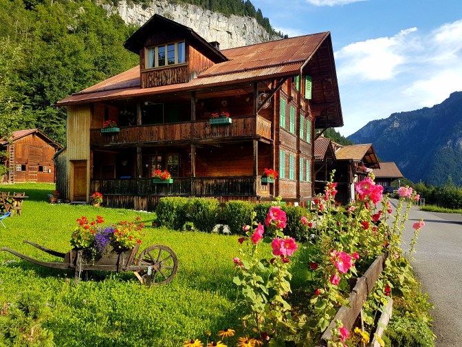
The hike starts next to the Hotel Silberhorn in Lauterbrunnen which is a short walk from the Lauterbrunnen train station. The trail is actually a road until you get close to Isenflüh. This part of the hike is easy but not very interesting.
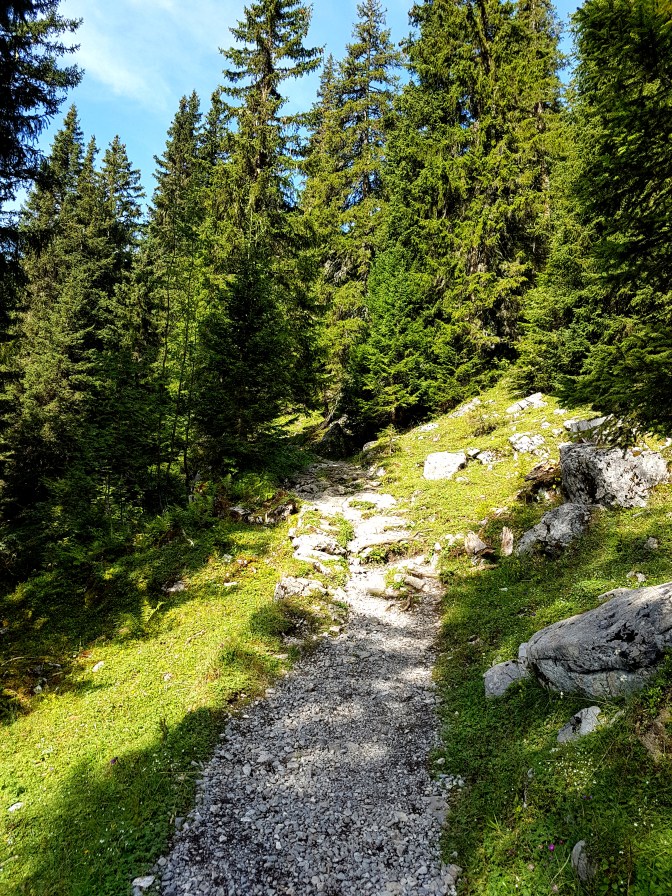
When you arrive in the village of Isenflüh, there is a decision to be made. I have highlighted in light orange on the Komoot map and outlined with a square on the elevation profile the section of the hike that I did but which can be skipped by taking the cable car from Isenflüh. This section is relentlessly uphill and also not very interesting.
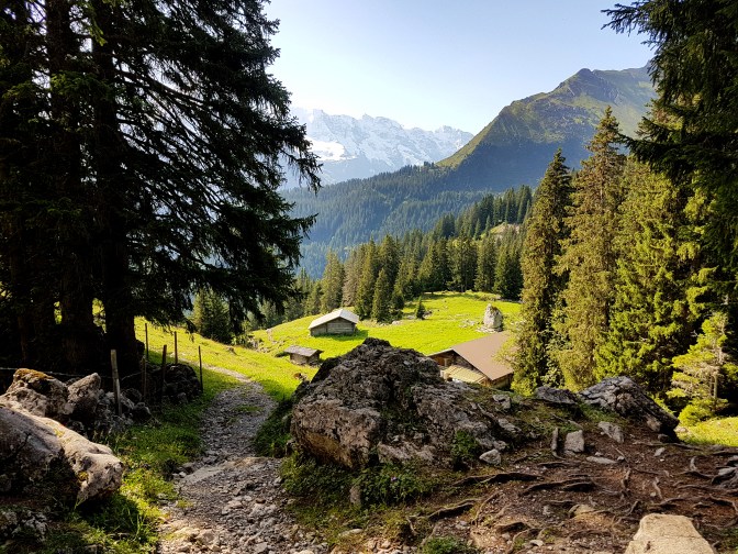
Once you get past this section and head towards the Lobhornhütte, the view really starts to get better, especially after Chüebodmi.
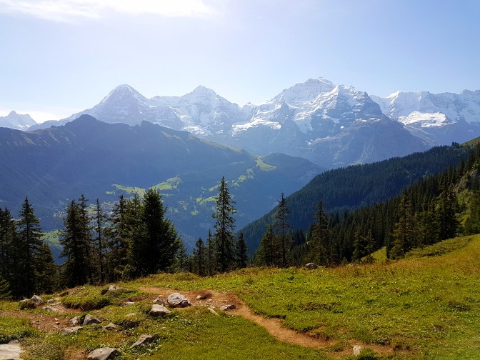
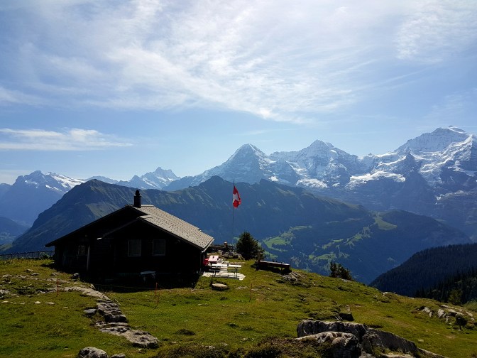
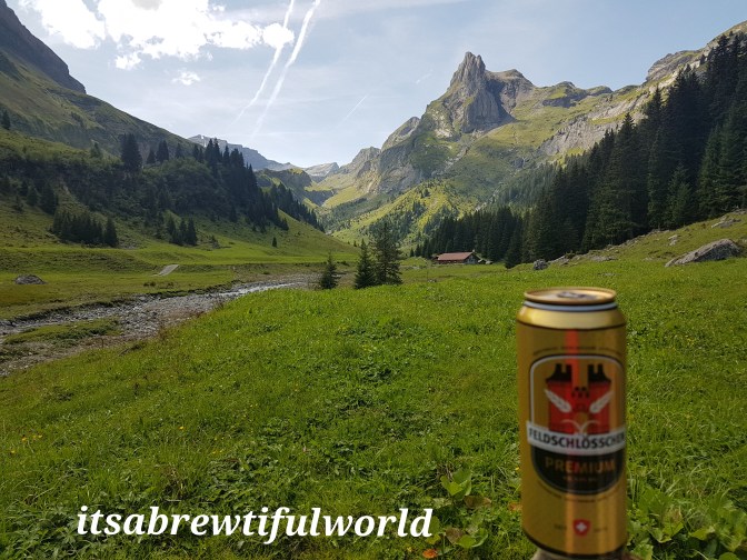
If you start the hike in the morning, you will reach the Lobhornhütte just in time for a nice lunch. This hut has the nicest views of any that I have visited. There is nothing like enjoying a spicy bowl of goulash and a cold beer while looking at the Eiger, Monch, and Jungfrau peaks.

After lunch, start to head back the way you came and I recommend to take the higher path towards Sousläger. This means when you see this bridge, cross over and take the path that you see on the right.
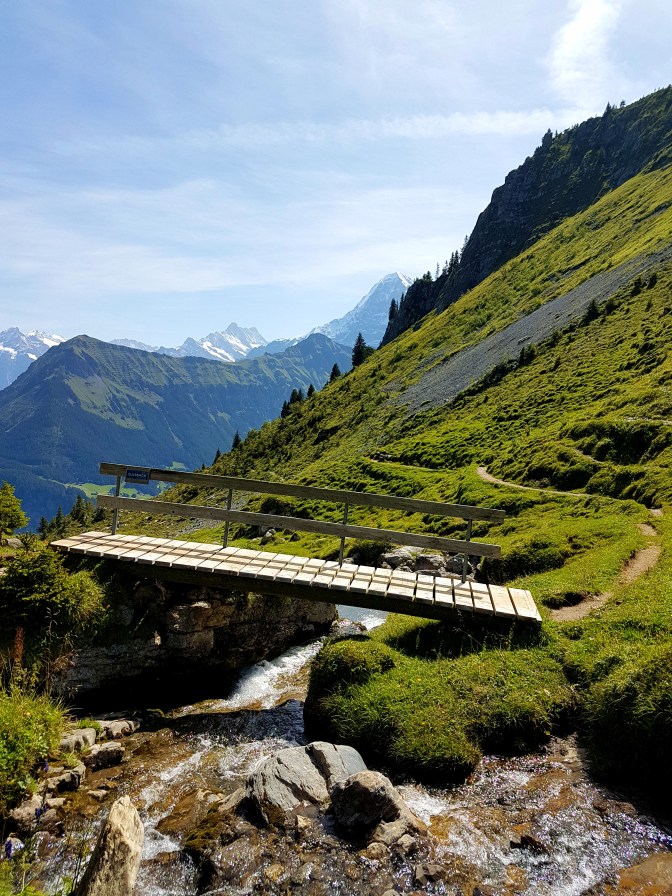
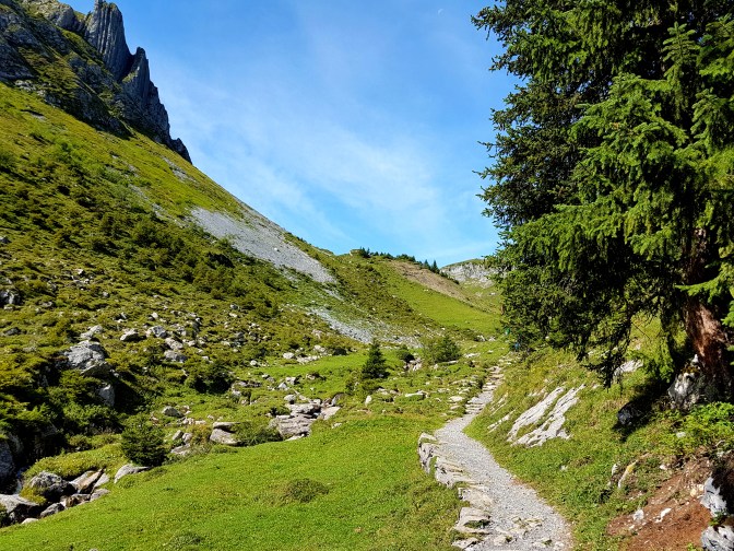
Follow the trail as it curves around the mountain. As you come around the bend, the scenery changes and the Soustal valley comes into view.

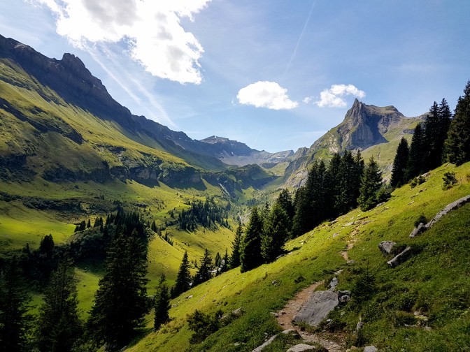
Eventually you will start to zig zag down into the valley. The few structures seen in the distance along the stream is Sousläger.
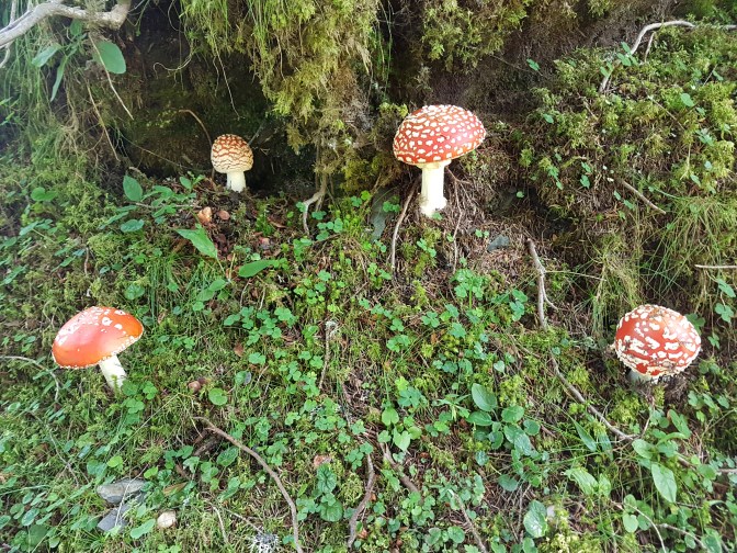
This spot is a nice place to take a break and was a personal favorite location on this hike. Probably you will find some hikers here having a picnic or taking a dip in the stream. Afterwards, it is a climb up to Marchegg. Along the way up, hopefully you can spot the giant colorful toadstools which I had never seen in person before.
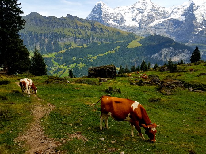
Reaching Marchegg, the view returns to the three mountains as well as a spectacular view of Wengen and the Lauterbrunnen valley.
Eventually you will come to a crossroads where it is possible to take the path down towards Grütschalpbahn.
Final Words
It is getting harder and harder to decide which hikes are my favorite in the Jungfrau Region. 2017 added three more to my growing list and 2018 will hopefully bring more. This one had a lot of variety and perhaps the best view looking down on the Lauterbrunnen Valley and Wengen that I have seen. There are several other directions that can be taken from the Lobhornhütte and I anticipate that I will be back to that spot and explore them. Thank you for reading and hopefully you found the information useful. Perhaps we will meet one day on the trails.

Thank you for the detailed instructions and advices!
This is a great hike with beautiful views and a variety of landscapes. We were 4 adults (kids preferred to spend the day at the pool in Wengen) and we started the hike in Isenfluh and did it in 3 hours. It’s only 10km but some sections are very steep (up and down) with 600m elevation gain.
Definitely an amazing hike to try!
LikeLiked by 1 person