
“Cnicht means… ‘the Knight’ and I can’t help feeling that the name is perfect for the mountain looks every bit a knight in the true Arthurian sense.”
Rambles in North Wales by Roger A. Redfern (1968)
Cnicht is a mountain which not only looks Arthurian but has a pronunciation that follows an Arthurian linguistic form that we learn from this historical Arthurian documentary1 (at time stamp 1:29). Cnicht has the same hard consonant ‘C’ like the Frenchman’s ‘K’ in Knight, as in kuh-nickt. Not kuh-nick-it as the video might suggest though. Just kuh-nickt. Another source suggests the word translates to icicle rather than knight.2. That’s certainly less fun.
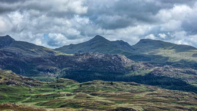
Cnicht and the Moelwyns (Mawr and Bach) are part of the mountain range to the East of Craig-y-Llan and Beddgelert. In fact, in my Pass of Aberglaslyn post, I had originally captioned this next photo incorrectly as showing Moel Siabod (it has since been corrected). The trio of mountains are from left to right, the knightly icicly Cnicht (689m), Moelwyn Mawr (770m), and Moelwyn Bach (710m).

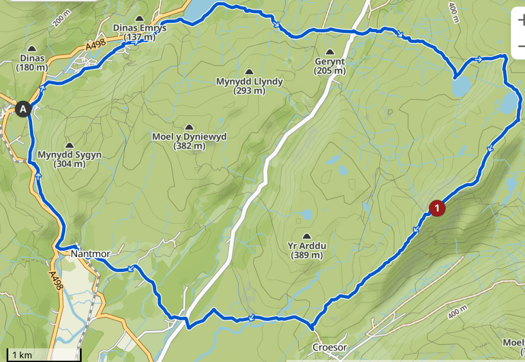
The distance to Cnicht from Beddgelert is actually close enough to make a circuit route from the village center. In fact, this is the recommended route suggested in 1895’s Climbing in the British Isle’s Vol II: Wales & Ireland by Smith & Hart, 1895’s North Wales Part I by Baddeley & Ward and 1947’s The Rambler’s and Climber’s North Wales by Roland Helliwell. Helliwell describes his route quite clearly and it is possible to chart it on Komoot resulting in a managable 20km loop (as long as the path through the Aberglaslyn Pass isn’t washed away)3.
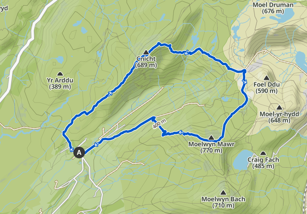
However, I wanted to climb Moelwyn Mawr along with Cnicht in the same hike. To do the hike properly, it is necessary to drive to the “unusual village of Croesor”4, which is just a few houses that sit at the base of Cnicht at the mouth of a large valley called Cwm Croesor (Cwm meaning “valley” in Welsh). There is a convenient parking lot for hikers here and a small cafe. The village hardly registers on a map and the long single lane narrow road leading to the village will test your nerves as well as the proximity sensors on your vehicle.
Hike Details
| Starting/Ending Point | Croesor parking lot |
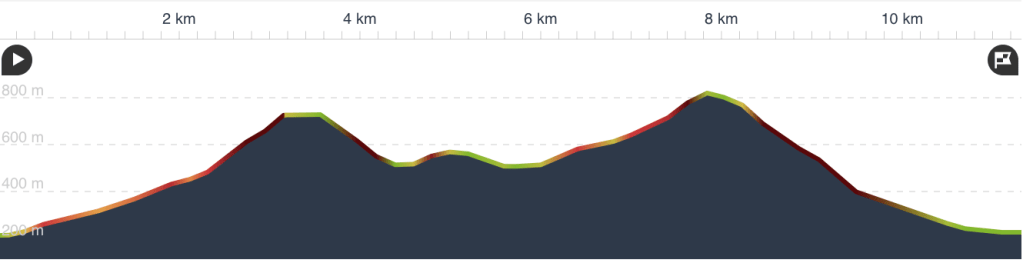
| Distance | 11.3 km |
| My Moving Time | 3h 2m |
It’s Not Just a Beer, It’s a Journey
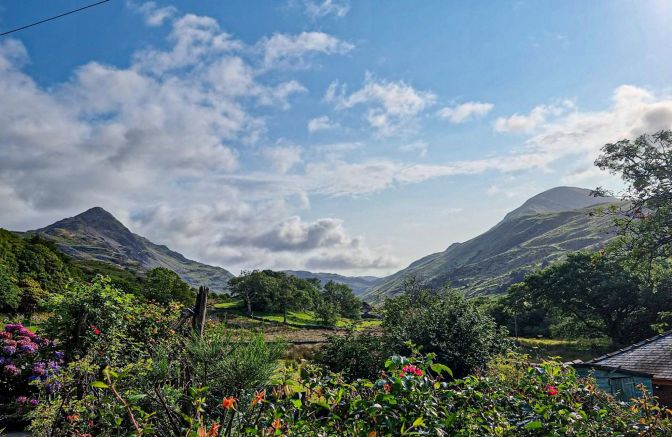
A few meters from the parking lot, someone has a nice view of both peaks from their backyard. The weather at this point was looking promising.
“By far the most interesting ascent is by the south-west ridge of the mountain.”
North Wales Pt. I by Baddeley & Ward (1895)
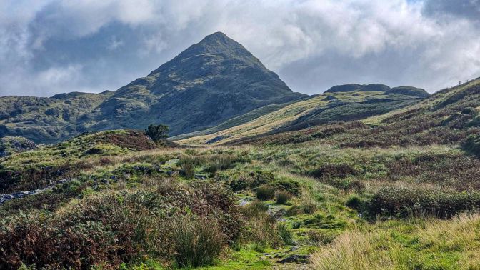
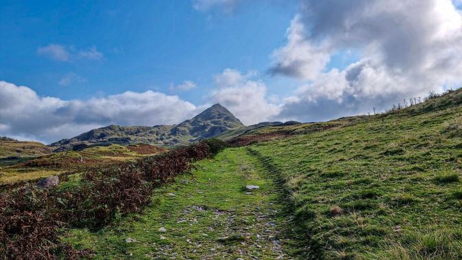
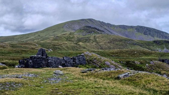
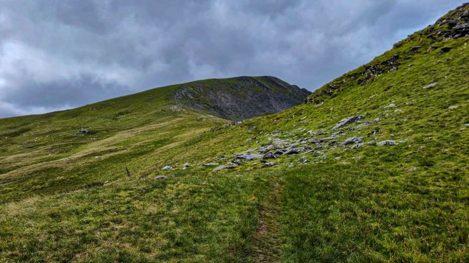
The approach is an easy-going grade providing ample time for reflection and soaking in the atmosphere of the “Welsh Matterhorn5“.
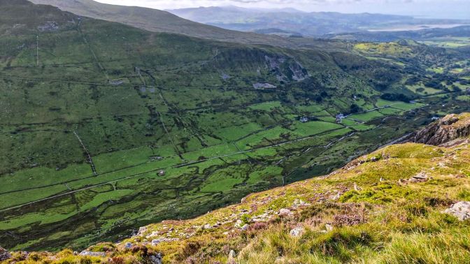
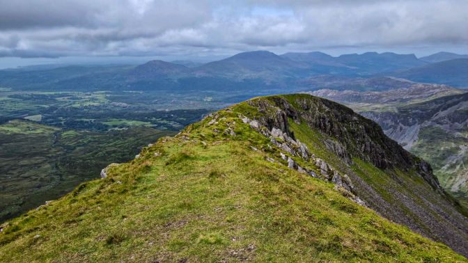
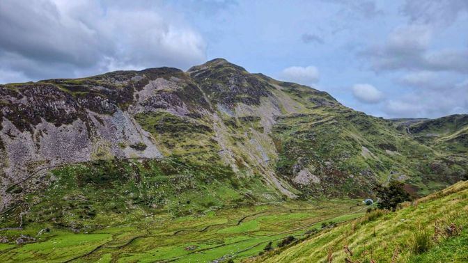
Atop the ridge leading to the Cnicht peak, there is a spectacular view overlooking the Cwm Croesor. This valley once had a tramway running through it which lead to a slate mine that will be encountered later on the hike.
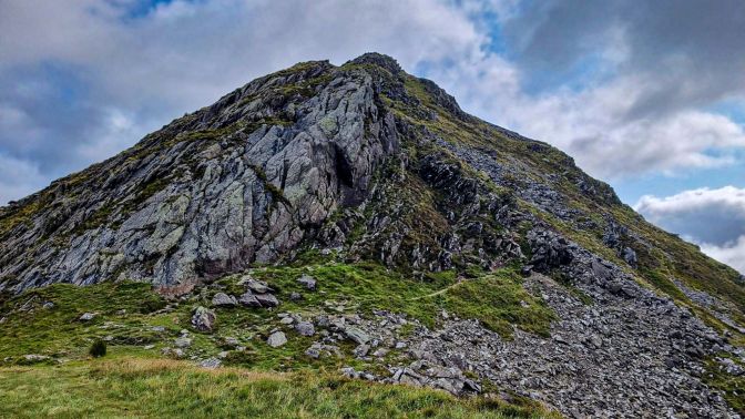
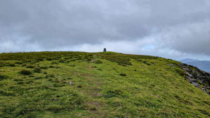
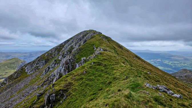
The final part of the ascent is a scramble up this face of exposed rock. It has been known to turn back “more than one timid climber6“, but I did not find it difficult. Far easier than the Grade 1 scramble of Moel Siabod.
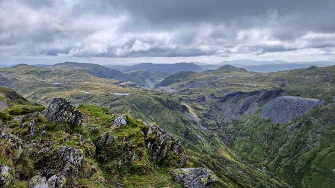
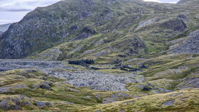
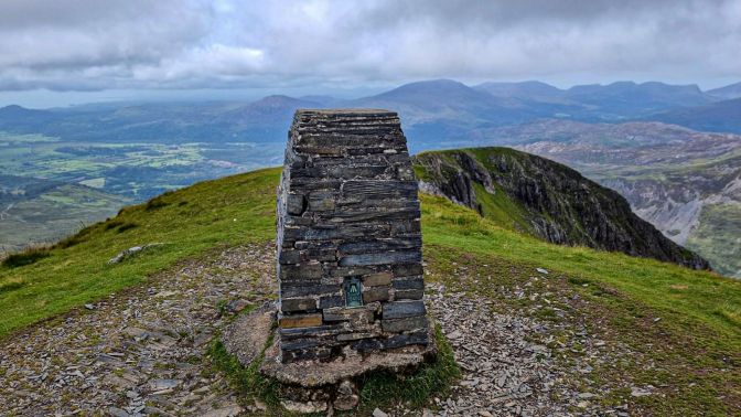
From the peak of Cnicht, you get a view of the rugged landscape that joins the two peaks; scarred by the mining activity of 150 years ago.
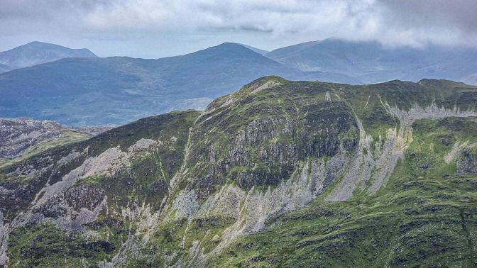
The real shape of Cnicht reveals itself as a ridge buttressed by a second peak only 1m lower in elevation called the Cnicht North Top.

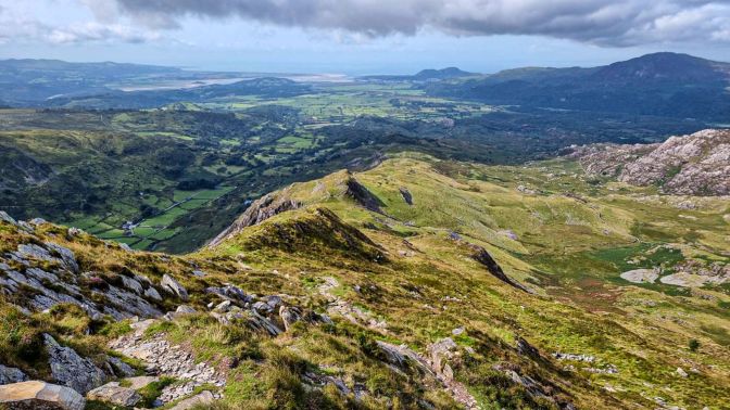
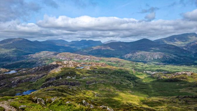
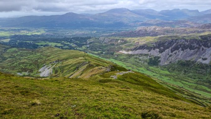
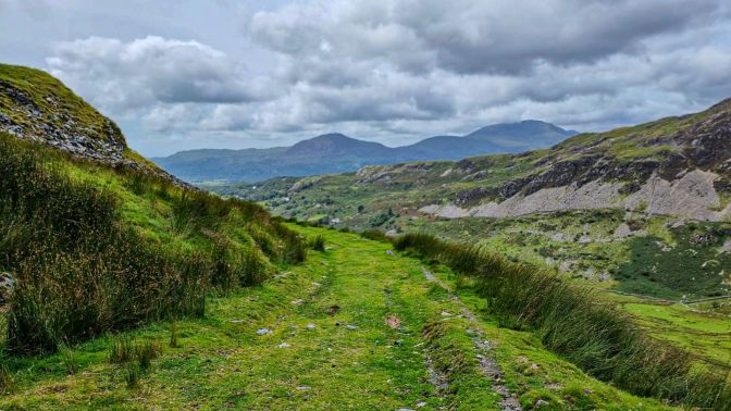
The next shot is the reverse view of the first photo in this post. It shows Moel Hebog on the far left, Craig-y-Llan and its fairy glens in the left-center, the triangular point of Yr Aran as you move right, and a quite clear view of the Rhyd Ddu ridge up to the Yr Wyddfa summit on the right.
Then comes the descent…
“This descent is over steep grass and broken rocks and the inexperienced rambler must take great care here. In poor visibility this descent can be dangerous… In any event, it is best to decide one’s route ahead from the top of Cnicht, over the broken and misleading ground between here and Moelwyn Mawr. It is a strange, forsaken land.”
Rambles in North Wales by Roger A. Redfern (1968)
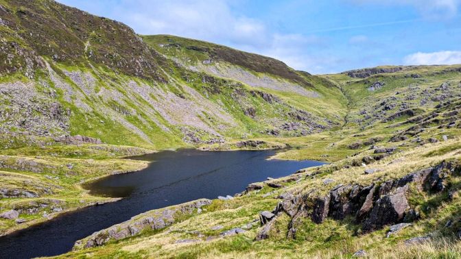
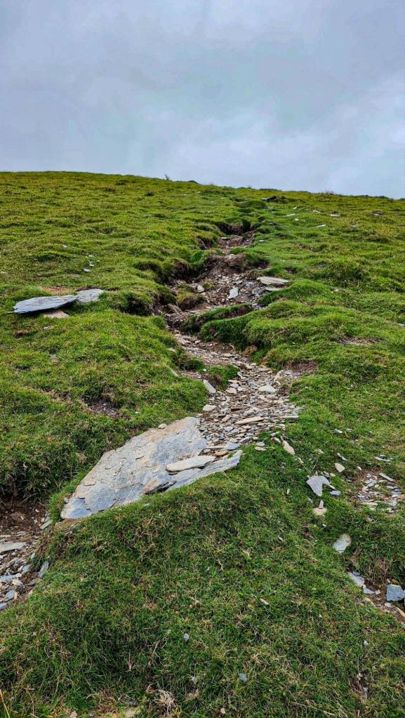
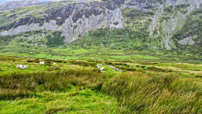
The hike down from Cnicht was quite an ankle buster and ends at the first lake, Llyn Cwn-y-foel. With each step down, the realization starts to set in that what appears to be dry solid grassy footing from a distance was actually something quite more sinister, with memories of my previous day’s hike down from Yr Aran still fresh in my head.
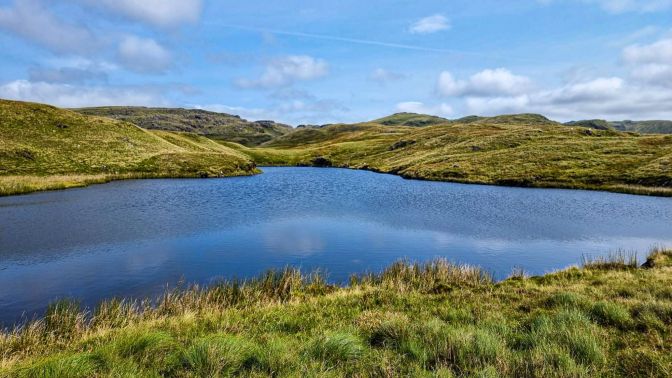
It was here in this harmless looking spot, which a photograph cannot adequately convey, where I fully realized what I was up against for the next 1.5 km. Every step across this grass coming from that small rocky mound will sink in up over your ankles. Don’t try to get cute here and zig zag around trying to find a better way (like I did). Take the direct route and be done with it. There were other bad spots but this was the worst.


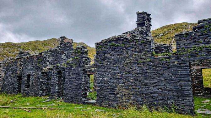
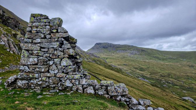
Back on dry, solid ground, you come to the most dramatic former slate mine that I have encountered yet in Wales. This is the Rhosydd Quarry, “a new quarry on Moelwyn, of great promise” mentioned in an 1860 publication7. It closed down in 1930.
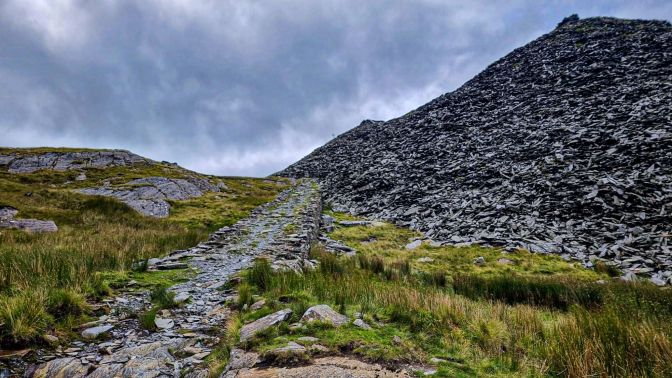
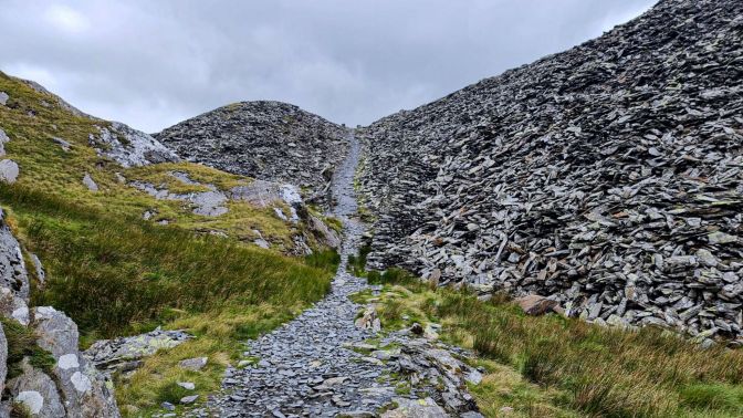
The hike climbs up through these huge mounds of scree before setting off across a field towards Moelwyn Mawr.
The ascent up Moelwyn Mawr is a steep but straightforward route.
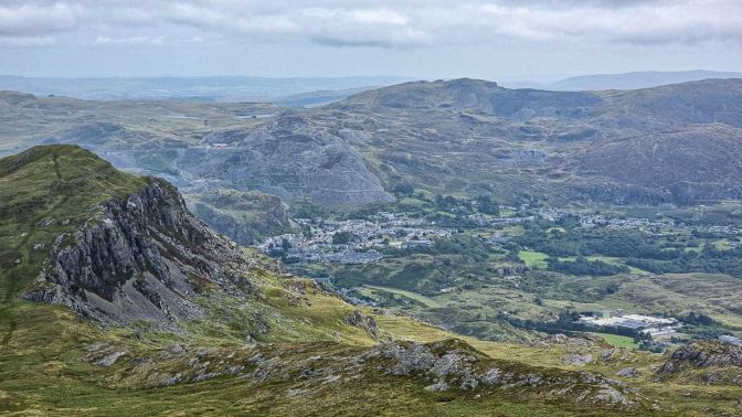
Along the way up, you get a birds eye view of Blaenau-Ffestiniog, the home of the railway that carried slate from several mines in the region to Porthmadog for loading onto ships.
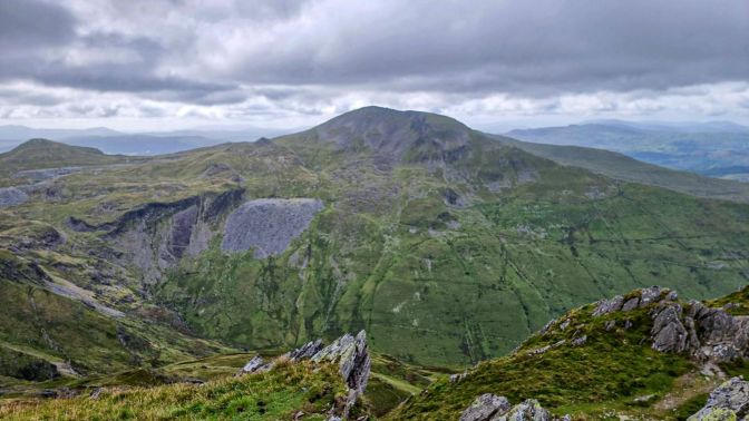
From Moelwyn Mawr, Cnicht looks like a side of beef laying on a butcher’s table. In the distance, the peak of Yr Aran and the cloud cover over Yr Wyddfa can be seen.
The way down starts along this ridge. It is narrow for a short distance, but it didn’t trigger my fear of heights.
The summit ridge spreads out into a wide grassy slope where it meets up with a lower ridge for the rest of the way down.
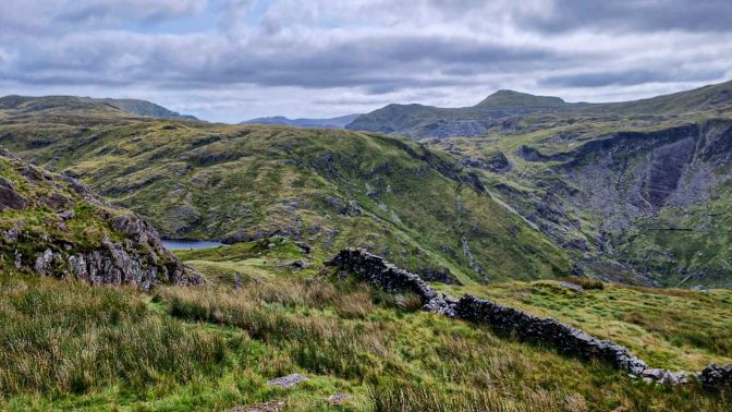
At a certain point along the ridge, the path comes to an intersection of fences. The Komoot route takes a sharp right here and follows the wire fence down to a point where it meets up with a stone wall. You will notice on the opposite side what looks like an old stone road which runs straight down the steep hillside, some of which is still visible and some which has been swallowed up by the grass. I wasn’t sure exactly what to do, but there was no other way around. Where the fence and the wall meet is the only spot where it is possible to get over the stone wall. So I climbed over and headed straight down the steep hill; another ankle buster of a slope. I was, of course, wondering what obstacle I would find at the bottom of the hill.
At the bottom, there was a barbed-wire fence, but fortunately there was also a locked gate which was easy to climb over. No Private Property signs, so as far as I can see, this is the permitted route. The walk from there was a gentle, peaceful stroll back to the parking lot.
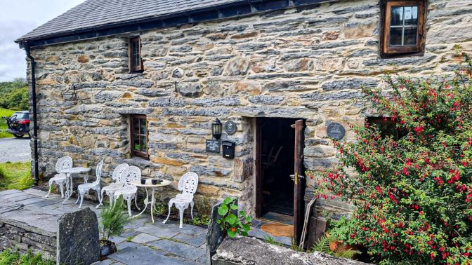
The small cafe in Croesor is a cute ending to a wonderful hike. There is no beer here, so I sipped a sparkling drink at one of the outdoor tables. They are known for their cakes but weren’t serving anything on this day. When I described my hike to the owner, she remarked “Oh, you did the horseshoe!” Having never done the complete Snowdon Horseshoe, to know that this hike had its own similar connotation gave a satisfying dopamine effect.
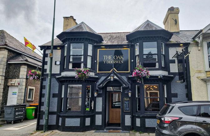
For the celebratory beer, I chose the nearest pub I could find, which was in Penrhyndeudraeth, just a few kilometers away. It is a fairly standard pub with the usual selections. They didn’t have any special cask ales on tap, so I went with the usual substitute, a John Smith smooth ale.

Final Comments
In the early parts of the morning, it was touch and go whether clouds would cover the peaks. At one point, both peaks were covered before I reached the summit of Cnicht and the skies were starting to look ominous. But it turned out to be short-lived. After all the remarks I made about cloud cover from my Moel Siabod hike earlier in the week, between Yr Aran, Cnicht, and Moelwyn Mawr, I was blessed with great views from all of them. Granted, Moel Siabod is a football field taller than those mountains, which certainly makes a difference. The scenery here is both stunning and accessible, intimate yet vast. In retrospect, this was my favorite hike of this year’s trip, and that is no knock on the one remaining hike I still have to write about. While I gained much from the spectacular views, certain experiences were withheld as the natural balance and compensation of life. One is trying the cakes at the Cafe Croesor. The other is the (re)opening of the Brondanw Arms pub which sits near the entrance to the long narrow road leading back to Croesor. I was 4 days too early and would be flying back to Belgium on the day of its resurrection. As of Sunday, August 10, 2025, it was put back on the beer pilgrimage map thanks to the collective effort of the locals. It that isn’t enough to lure me back next year, I don’t know what is.
- I am kidding. ↩︎
- The Mountains of Snowdonia by Carr & Lister (1948) ↩︎
- See my experience in Pass of Aberglaslyn & Craig-y-Llan ↩︎
- Rambles in North Wales by Roger A. Redfern (1968) ↩︎
- North Wales Pt. I by Baddeley & Ward (1895) ↩︎
- North Wales Pt. I by Baddeley & Ward (1895) ↩︎
- A Guide Through North Wales by William Cathrall (1860) ↩︎

One thought on “Cnicht & Moelwyn Mawr”