
Sometimes the best hikes are the unplanned ones.
A prime example of that was my Uf Spitzen hike in 2019. So there was some precedence when I woke up on Thursday morning in Mayrhofen, Austria without a plan. The epic hikes of Ahornspitze and Brandberger Kolm were already behind me, and it was my last day in Mayrhofen. How do I follow these up with a memorable hike that puts a capstone on an amazing week? I revisited the same method I used to pull the Uf Spitzen hike out of thin air. I perused a map looking for inspiration.
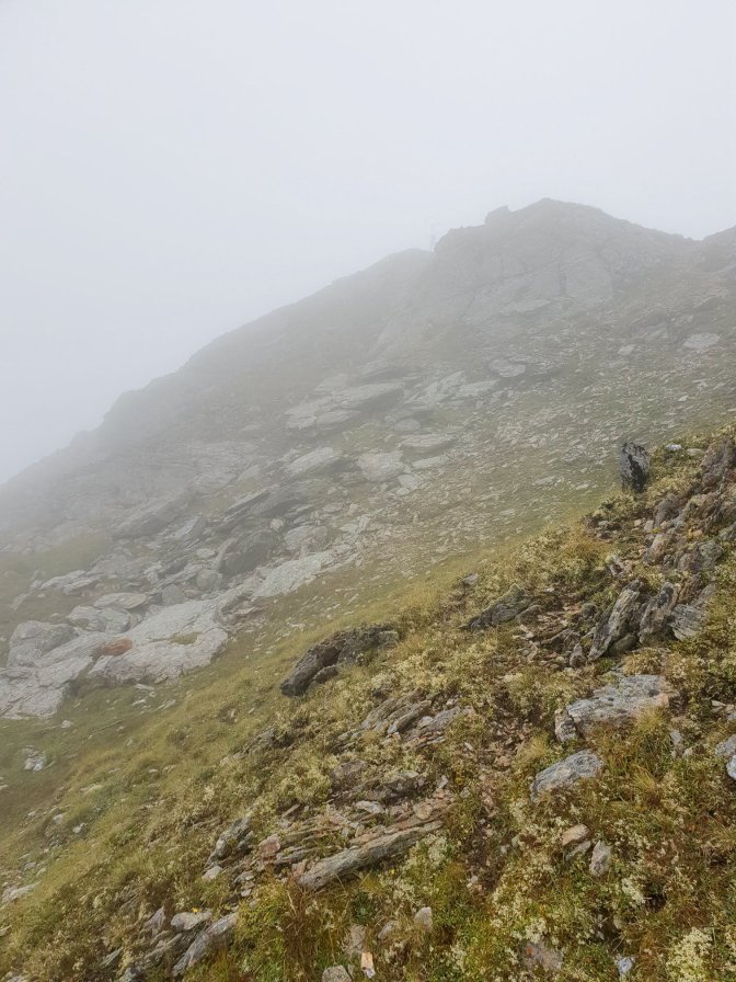
I felt inclined to focus my attention on the Penken side of Mayrhofen where a hike earlier in the week had been frustrated in part by clouds obscuring most of the panoramic views. The Monday prior to the Ahornspitze hike, I hiked to the Wangelspitze, a minor crest and common hiking destination above the Penkenjoch plateau overlooking the Zillertal valley. The low-hanging, sometimes smothering clouds made taking pictures suboptimal. However, Thursday’s weather was pristine. An idea began to formulate to redo parts of the Monday hike but extend it further into the range of mountains behind the Wangelspitze. Scanning the map for targets, one caught my attention. A spot called Rastkogel; literally translating to Hilltop Rest. I didn’t really know what to expect but it seemed like some sort of high point, so voila, a plan. I would head back up to Wangelspitze with a clear sky and from there head to the spot marked, Rastkogel.
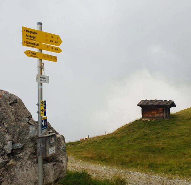
The best place to start the hike is at the top of the Penkenbahn. The beginning of the hike is a pleasant stroll on the Penkenjoch plateau past several enticing mountain restaurants. The most interesting structure here is the Granatkapelle, a wooden chapel representing the garnet, a gem which is mined in the region. Normally it is permitted to enter but closed as of this post due to COVID.

NOTE: A word of warning. The last cable car down was at 4:30pm so if you are hoping to enjoy a schnitzel and beer after the hike before riding down, make sure to give yourself enough time. Check the closing hours of the restaurants because one by the cable car station closed at 4:00pm.
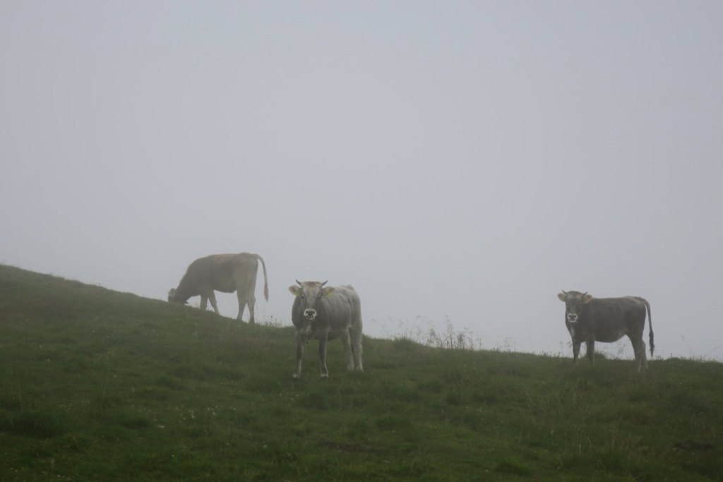
Monday’s and Thursday’s hike followed the same route up to the Wangelspitze. It became quite clear (literally) that the Monday skies were really holding back several beautiful panoramas.
But Thursday rewarded my persistence.

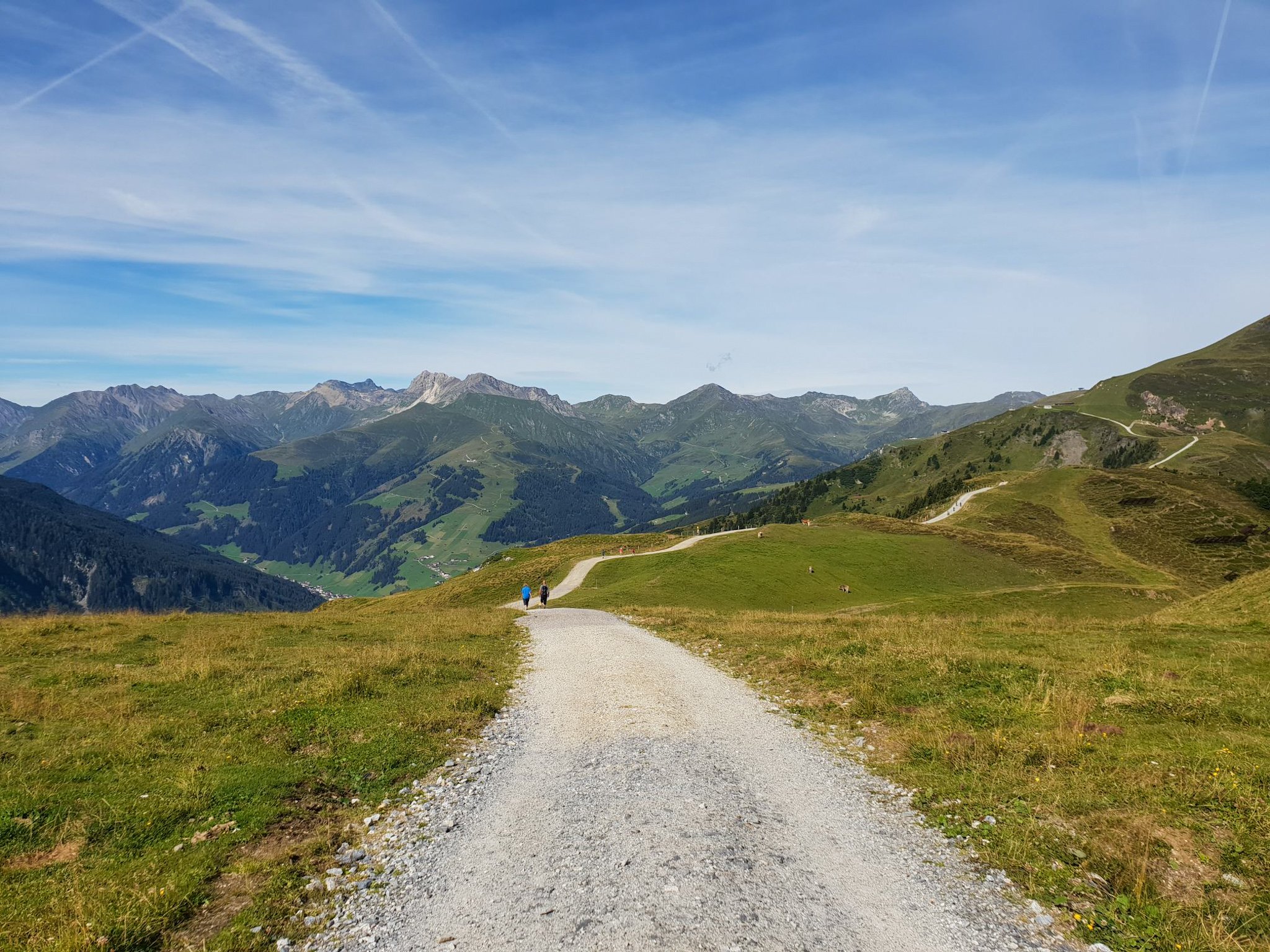
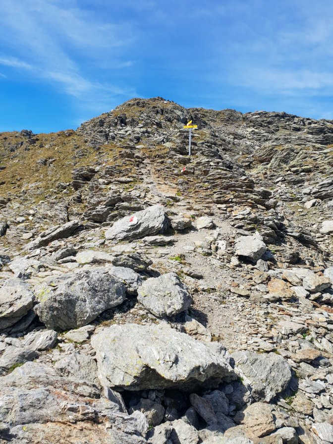
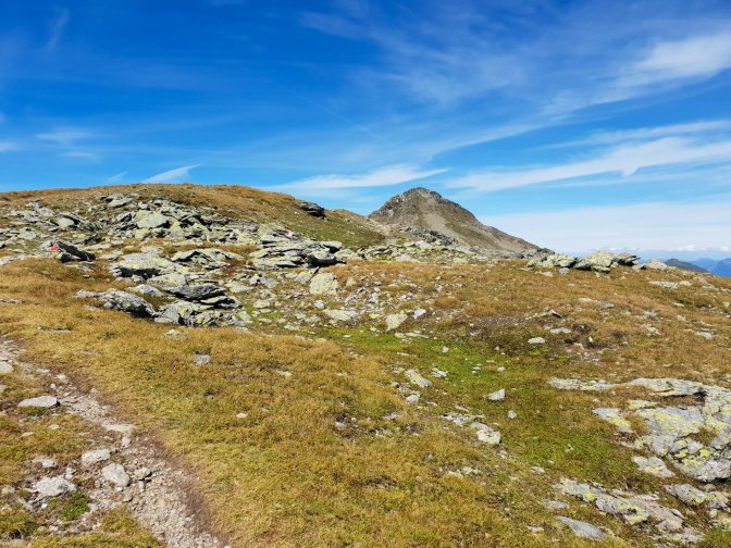
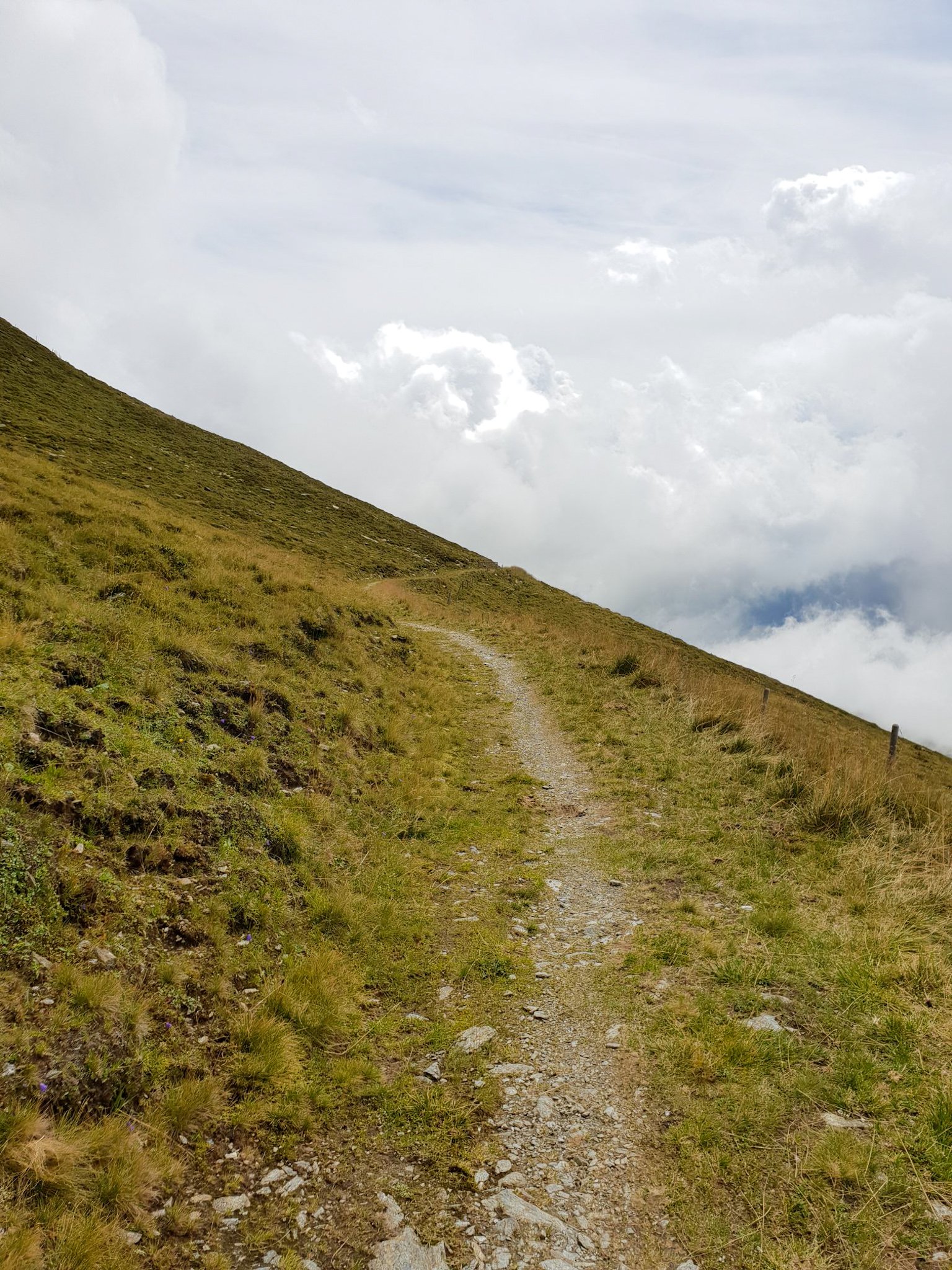
From the plateau, Wangelspitze looks like a peak, but when you reach it, you realize that it really is just a small crest. The landscape behind it in the direction of the Rastkogel is an enticing array of peaks and ridges . From Wangelspitze onwards though, this story becomes the tale of two hikes.


Monday’s Hike to the Unknown Peak
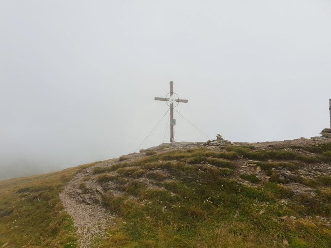
Rastkogel was not the only unplanned segment of the week. When I reached the Wangelspitze in the blanket of clouds on Monday, I was totally prepared for the reality that this would be the accomplishment of the hike. The route was now heading down a different way which would ultimately loop me back to the Penkenjoch plateau. However, I was intrigued by what appeared to be a peak behind the Wanglespitze. There was no trail on my trail map, yet it appeared to be a completely safe and doable ascent. There was no designed trail on the ground either but I could tell that I was not the first one with the idea. The ascent was safe enough that a trail was not necessary. At the top of this small peak stood a weather tower with a trail down on the opposite side of this peak. I have looked unsuccessfully on a few different maps for a name. But reaching it gave me an unplanned bonus to a hike marred by a slight bad luck in weather.


Thursday’s Hike to Rastkogel
On Thursday, I bypassed the unknown peak altogether on the way to Rastkogel. A very cool aspect of the Rastkogel hike is that you don’t actually see it until you are near the end.


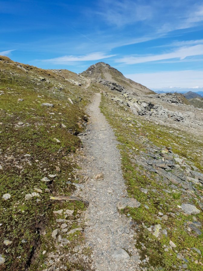

There were no Scaredy Bear moments on the way up to the top. The main difficulty are the loose stones, so sturdy hiking shoes and a careful step are recommended. And the rewards are spectacular.


Hike Details
| Starting Point | Penkenbahn (top station) |
| Ending Point | Roundtrip |
| Distance | 17.4km |
| Moving/Total Time | 4h37m / 6h6m |
| Eating Place | Several on the Penkenjoch plateau |


Final Words
As I was riding the Penkenbahn back down to Mayrhofen, the ache in my legs and feet reminded me of an eventful and awe-inspiring four days of hiking in the Zillertal Alps. As I was looking out towards the valley from the cable car window, I could see the main road to and from Mayrhofen. The road which my car and I would be taking the next day to start my long trek home. I tried to channel the enthusiasm I had when I arrived in Mayrhofen just a few days ago when the Ahornspitze, Brandberger Kolm, and Rastkogel were still undiscovered gems. That enthusiasm was replaced with a weary but satisfying acceptance that the trip was coming to an end. Not sadness, but mental and physical exhaustion that comes from pushing your body for four straight days. The overriding thought though was how the Zillertal Alps met and exceeded all of my expectations that I was hoping for when I was looking for a new hiking region; one that will carry the torch from the Jungfrau Region. Even after four days, I still felt like a novice, that there was so much more to be discovered here which had yet to even cross the boundaries of my awareness. But while the Zillertal Alps part of my journey was concluding, there was still one more stop before heading home. As I mention in my Zillertal Alps post, the route home goes thru Bavaria, beer capital of the world, so you can be sure I was going to take advantage of that. Still time for the blue butterfly to do her magic.

Featured Beer

| Beer | Schwechater Bier |
| Brewery | Brauerei Schwechat |
| City/Country | Schwechat, Austria (near Vienna) |

“So voila” 😂 Great post!
The pictures, the views are spectacular, wow Matthew! 👏👏
LikeLiked by 1 person
Thank you, Patricia. Your comments always mean a lot to me 🙂
LikeLike
It always amazes me how weather plays a huge roll in photography with each giving a beauty so different, yet remarkable. It sets the mood. Sometimes the drastic changes are evident in ‘days’ like you showed us, or like in my neck of the woods the saying is “If you don’t like the weather, wait a few minutes. It will change.” I love the contrasts and all the differences. How boring the adventures would be if sky was always perfectly blue and the sights never changed. Thanks for the comparisons images and for bringing us on your journey.
LikeLiked by 2 people
I agree Jennifer, clouds often make the best picture because they are so variable. A clear blue sky has no variation. 🙂
LikeLike
I really like the slide feature, comparing the same view on two different days — a feature perfectly suited to the point of your piece. Your technical expertise is matched only by your wanderlust, apparently. Amid smooth and compelling writing. Thank you!
LikeLiked by 1 person
That means a lot to me coming from you, Dad
LikeLike
Awesome post! I bet you enjoyed hiking out there!
LikeLiked by 1 person
It was amazing! Thank you
LikeLike