
I woke up on Day 4 in Switzerland without a plan…
That’s not entirely true. I was planning to eat the donuts I purchased the evening before for breakfast. One of the best fractions of a second in existence is that moment you realize that there are donuts for breakfast.
But after the donuts, my schedule was completely open. Having abandoned the idea of hiking to Glecksteinhütte and improvising a different hike, I was left a hike short in my agenda.
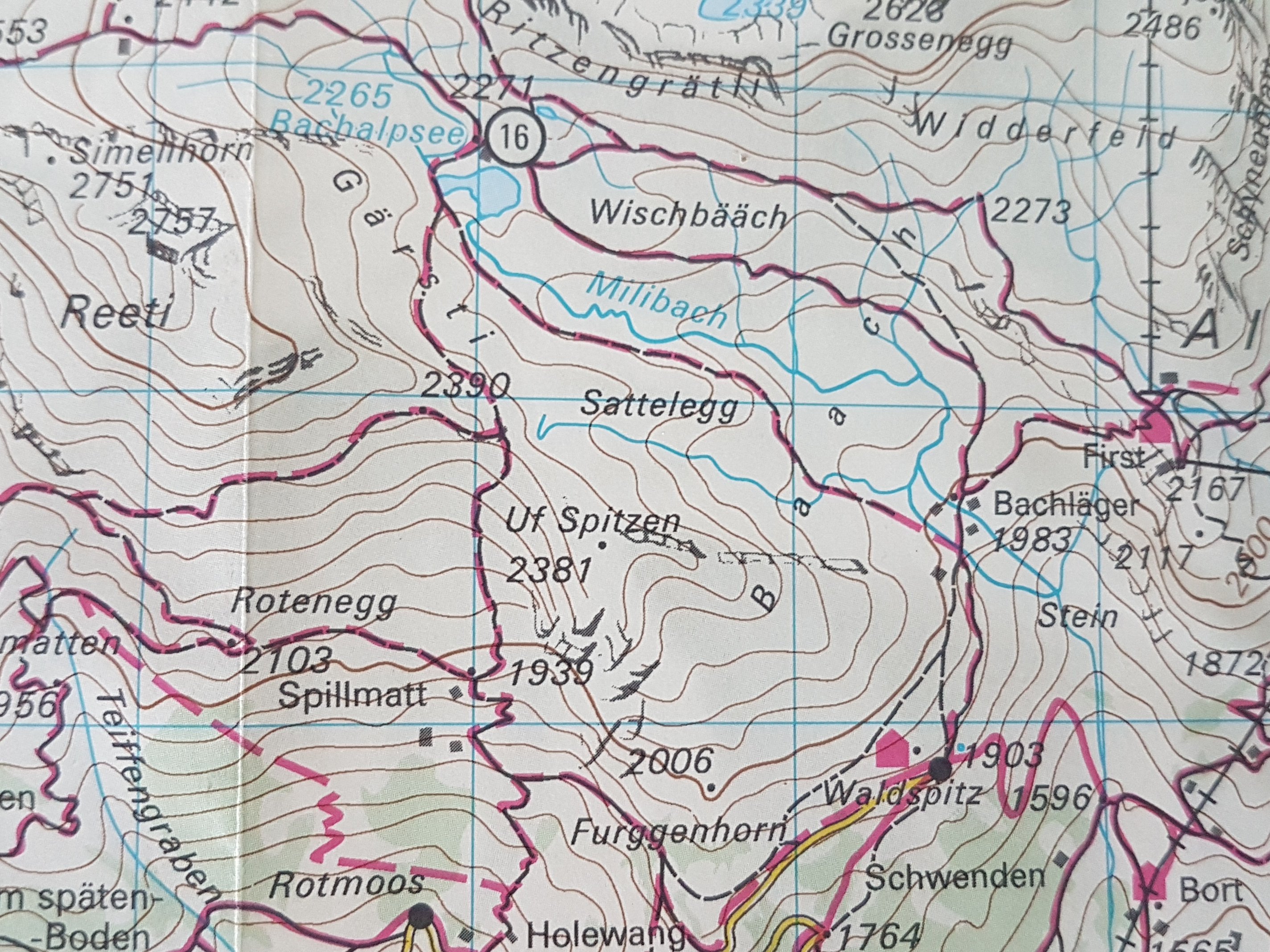
So I fumbled around with my Komoot app and a frustratingly unstable wifi connection. I started with a general idea that I should see what kind of hike I could make to the Bussalp area, a part I haven’t hiked yet. So I dragged the map with my finger from my Grindelwald location in the direction of Bussalp. A small section of trail suddenly caught my eye. One that dead-ended, which usually means a peak of some kind. As I zoomed in, the name Uf Spitzen appeared.
I pulled out my tourist map and my trail map of the region. Only the latter mentioned Uf Spitzen at all and neither showed a trail where Komoot was showing. I searched for it on the web and mainly found some details related to skiing nearby. Nothing specific about summer hiking. But there it was on the Komoot map. The mysterious Uf Spitzen. What was there and would it be worth it to find out? With a few clicks, I had set a course. So I downed the last bite of my donut and was back in business.
The hike started from my camping spot in Camping Gletscherdorf so there was some section at the beginning which may be unnecessary for most people following this route. The more typical starting point for this hike would be the Grindelwald train station, as the beginning of the ascent starts just across the street.
Photographic Journey
During the first half of the ascent I was entirely alone. The second half of the ascent, there was a couple about 20 minutes behind. At no time did anyone pass me coming the other way. This was by far the most solitude of any of the hikes I have done so far.
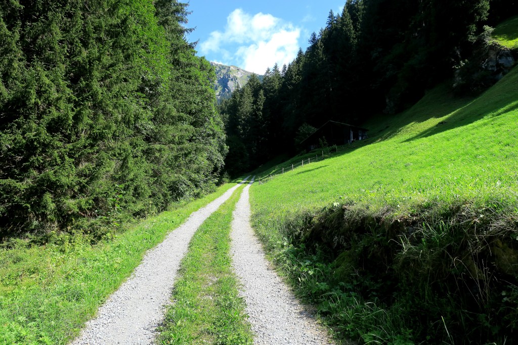
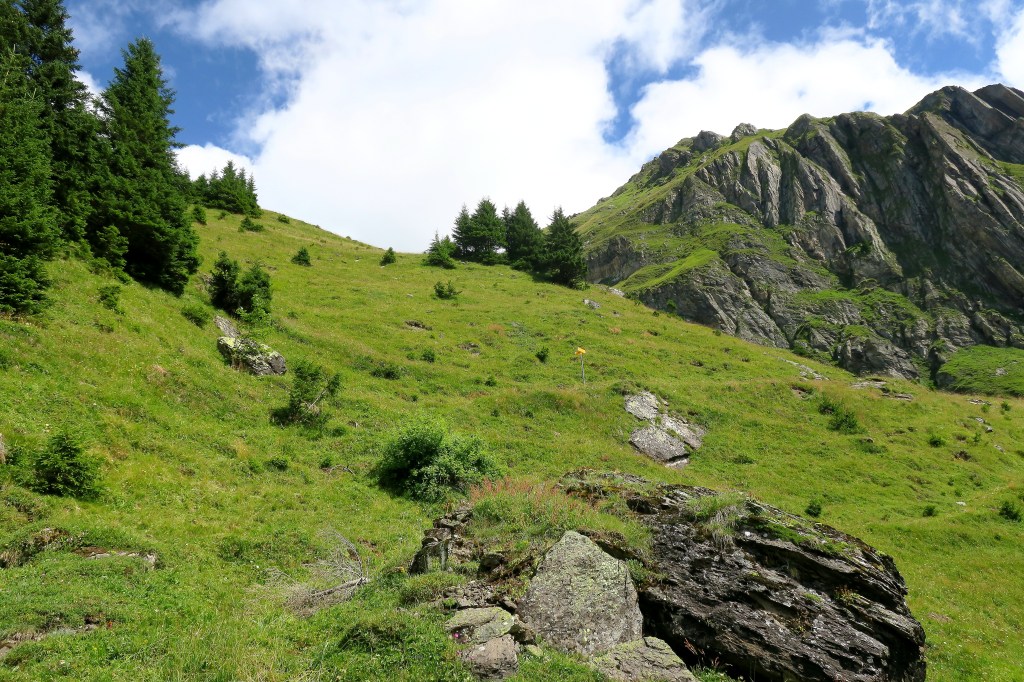
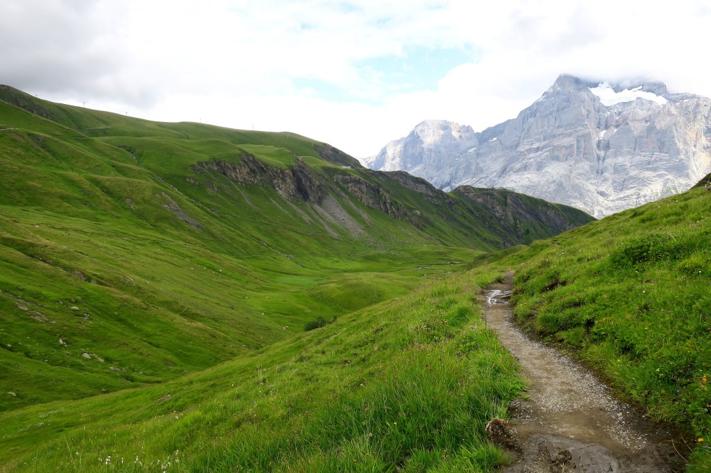
The first part of the hike takes you thru the forested lower elevation. There are some sneak peaks of the amazing views which awaited. The sky was as clear as it was all week.

One of my favorite kinds of pictures are roads leading off into the unseen distance. This to me is the epitome of what hiking is all about.
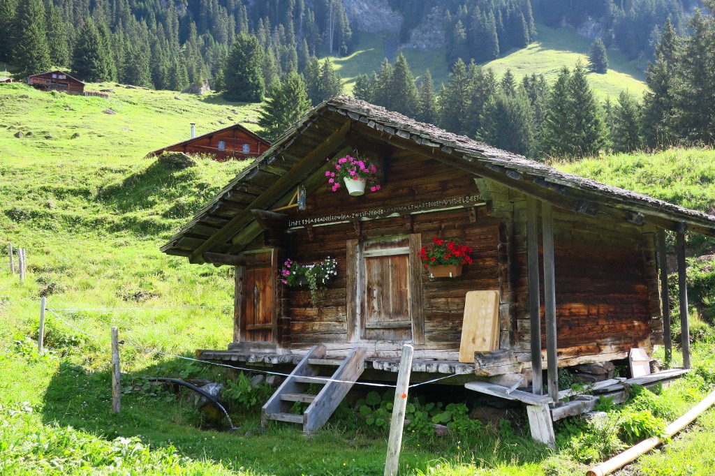
Where this road led was to a series of more and more remote Alpine cabins.
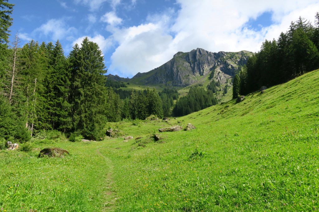
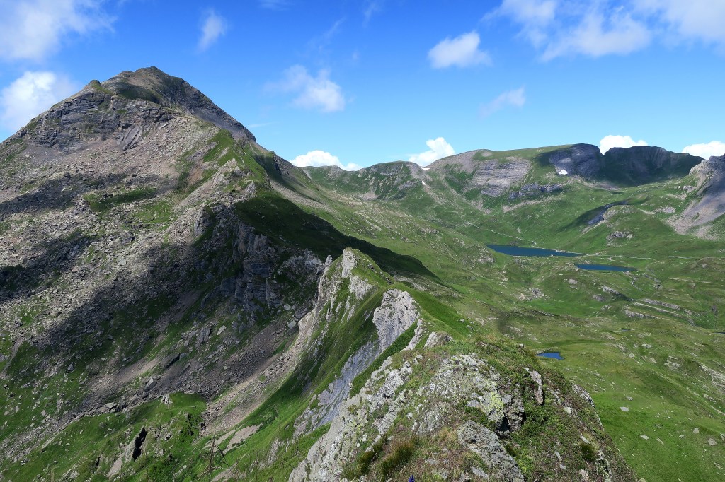
Uf Spitzen starts to come into view.
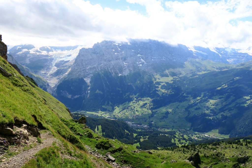
The higher you go, the more you get a wonderful look at the Unterer Grindelwaldgletscher. To get an up-close look at that glacier, you must do the Schreckhornhütte hike.

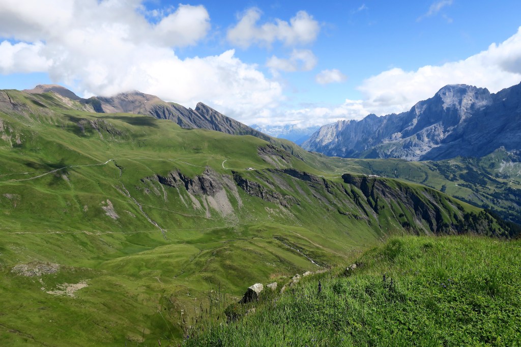
The ascent winds on. You will pass by several trail crossings with the customary yellow signs, but none of them mention Uf Spitzen.
When you finally get to the top, have a look back towards Grindelwald and see how far you have come.
At the top there are a few options for trails which are marked. Only one is not marked, but evidentally there. The one my Komoot app is telling me to follow.
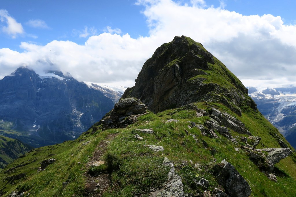
The trail does not go straight up that ridge but curls around to the other side to reach the peak.
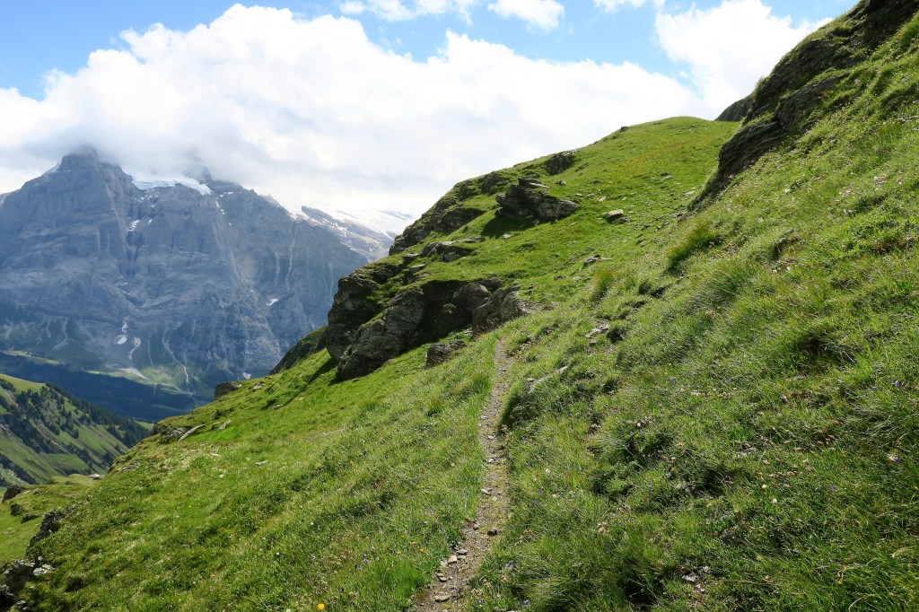
At a certain point, the trail disappears just before reaching the summit. The top is covered in short vegetation with only the remains of a small probably illegal campfire to indicate anybody had been there. I wondered to myself if I was allowed to be there. But those thoughts were swiftly replaced with awe…
What I had surrendipitously stumbled upon while eating my donuts in the morning turned out to be the single most glorious 360-degree viewpoint in the entire region.
View to the West/Northwest
This peak I believe is called Reeti. The Bachalpsee is off in the distant right.
View to the Northeast
The Schwarzhorn peak is slightly hidden under the clouds in the upper left. To its left is the bald Wildgärst peak from the hike the day before. The First cable car station is perched a bit right from center.
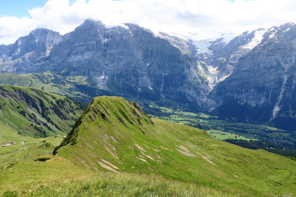
View to the Southeast
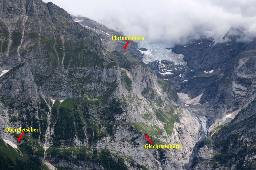
The Wetterhorn peak is under the clouds and the Oberer Grindelwaldgletscher is to its right. To get a closer look, do the aforementioned Glecksteinhütte hike.
View to the South/Southwest
The Eiger, Monch, and Jungfrau were still hidden by some stubborn clouds.

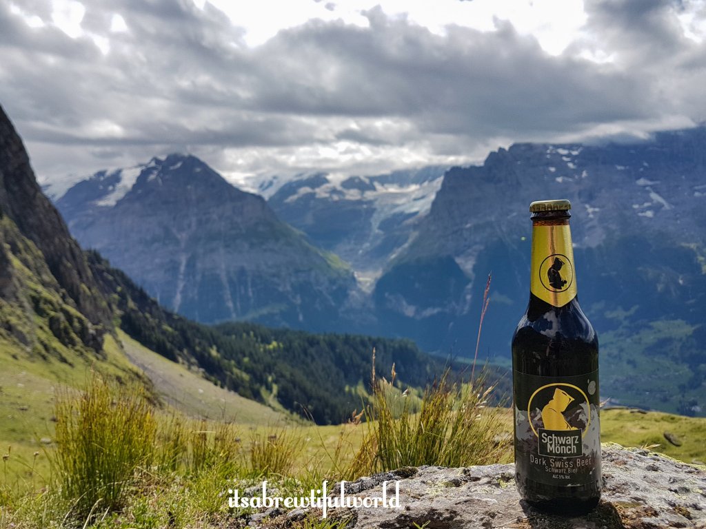
Suffice it to say, the hike down pales in comparison but it does lead past Waldspitz where there is a restaurant. There are also some amazing views of the Glecksteinhütte hike (see link at the top).

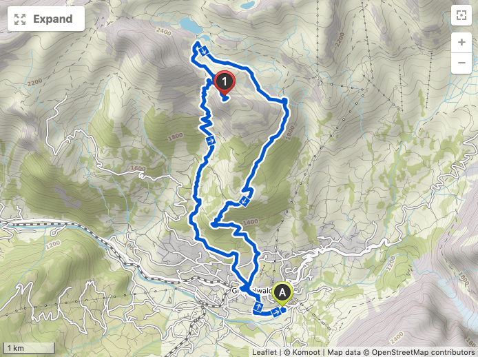
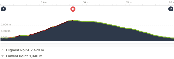
The Route
- Starting Point: Camping Gletscherdorf (Grindelwald train station recommended for everyone else)
- Ending Point: Same as above
- Distance: 20.1 km (shave a couple off for distance between the camping and train station)
- Moving Time: 5 hrs 37 mins
- Eating Place: Waldspitz
Final Words
What an epic hike! Maybe not my favorite end-to-end although it has to rank up there, but this was definitely the best viewpoint I have ever seen. In reality, it would be very easy to get to Uf Spitzen from the First cable car station. I can only imagine that the Swiss Tourism Board does not wish this location to be advertised to avoid it being overrun with the tour group crowd. As it is, it is left to anyone curious where the unmarked trail is leading or those serious hikers using apps like Komoot. I hope in either case, that those individuals who find Uf Spitzen preserve it and respect it. And definitely give thanks to the beauty of nature and joy of being alive. I cannot think of a better spot I would recommend doing that in this region. This marked the end of my holiday in Switzerland and I left on the highest of high notes. A 5th hike in a row was out of the question as I was both mentally and physically exhausted. But it did leave me looking ahead to what I still have planned for this entire region.
What the Future May Bring
First of all, there are the two hikes on my Scaredy-Cat list:
- Glecksteinhütte – Chrinnenhorn
- Schreckhornhütte finale
Over in the Lauterbrunnen/Stechelberg area, I still would like to do:
- Rottalhütte
- Silberhornhütte
- Gespaltenhornhütte
- Mürren to Schilthorn peak via Rotstockhütte
- Schilthornhütte
We will see what 2020 brings….

Your beautiful sharing is the absolute best petition I’ve ever read for the stunning difference that donuts can make in your day. 😉. I love roads like that as well. What a treasured journey ☺️🌷
LikeLiked by 1 person
Thank you Suzanne! 🍩🍩 are the best incentive to burn extra calories on a hike 😂
LikeLiked by 1 person
Yes! 😊🍩
LikeLike
Great post 😄
LikeLiked by 2 people
Thank you Passport!
LikeLike
The donut part. 😂 Great post and amazing pictures!
LikeLiked by 2 people
Thank you Patricia 😂😊
LikeLiked by 1 person
Amazing!!!
LikeLike
You captured my attention with the first words…Donut..🤣
LikeLiked by 2 people