
Day 3 in Switzerland this summer saw the return of two important components of good hiking. The sun and an epic hike. This particular hike which is essentially Route 5 on the Jungfrau hiking map has been on my radar since last year’s Schwarzhorn hike. I wasn’t sure what to expect as it is the only hike on my to-do list which doesn’t have a hut or a peak.
Or so I thought.
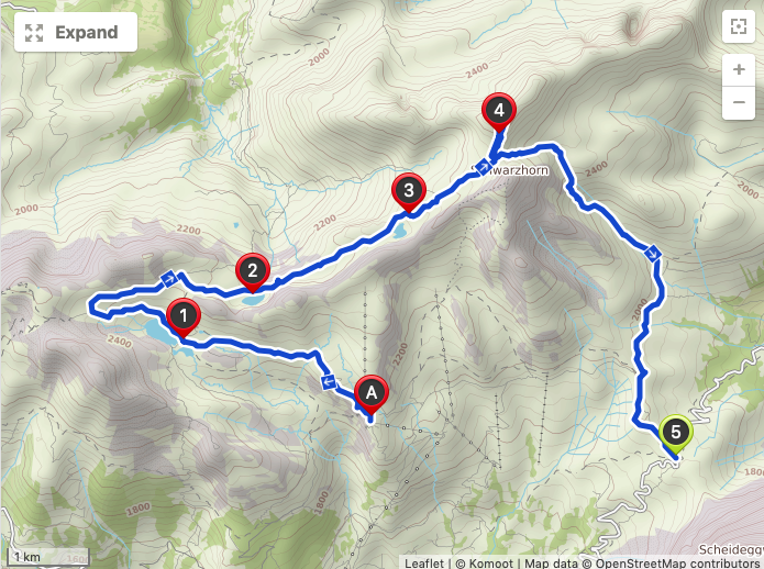
This hike starts with taking the cable car from Grindelwald to First (about 30 euros), heads along probably the most touristed trail in the region from First to the Bachalpsee. There I diverge a little from the tourist map and continue past the Bachalpsee up to a viewpoint before looping around and connecting back up to the rugged Hiendertellti section, curving around the back of the Schwarzhorn and ending up in Grosse Scheidegg. From there it is about 24 euros for a bus ticket back to Grindelwald.
But this hike which was already epic had something in store for me which I had not planned. Something not listed on the above map but visible on my Komoot app. And it was on this hike where I really decided once and for all to add something to my list of hates. Somewhere between Pittsburgh sports teams, the New York Yankees, cigarette smoke, and people eating apples in quiet places. And that is hiking downhill. I hate it. I bleeping hate it. Give me uphill any day of the week. And this one certainly had an epic downhill.
Route Specifications
- Starting Point: First cable car station
- Ending Point: Grosse Scheidegg
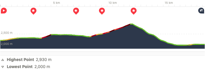
- Distance: 18.2 km
- Moving Time: 4 hours 44 minutes
- Eating Place: Hotel Grosse Scheidegg
Photographic Journey
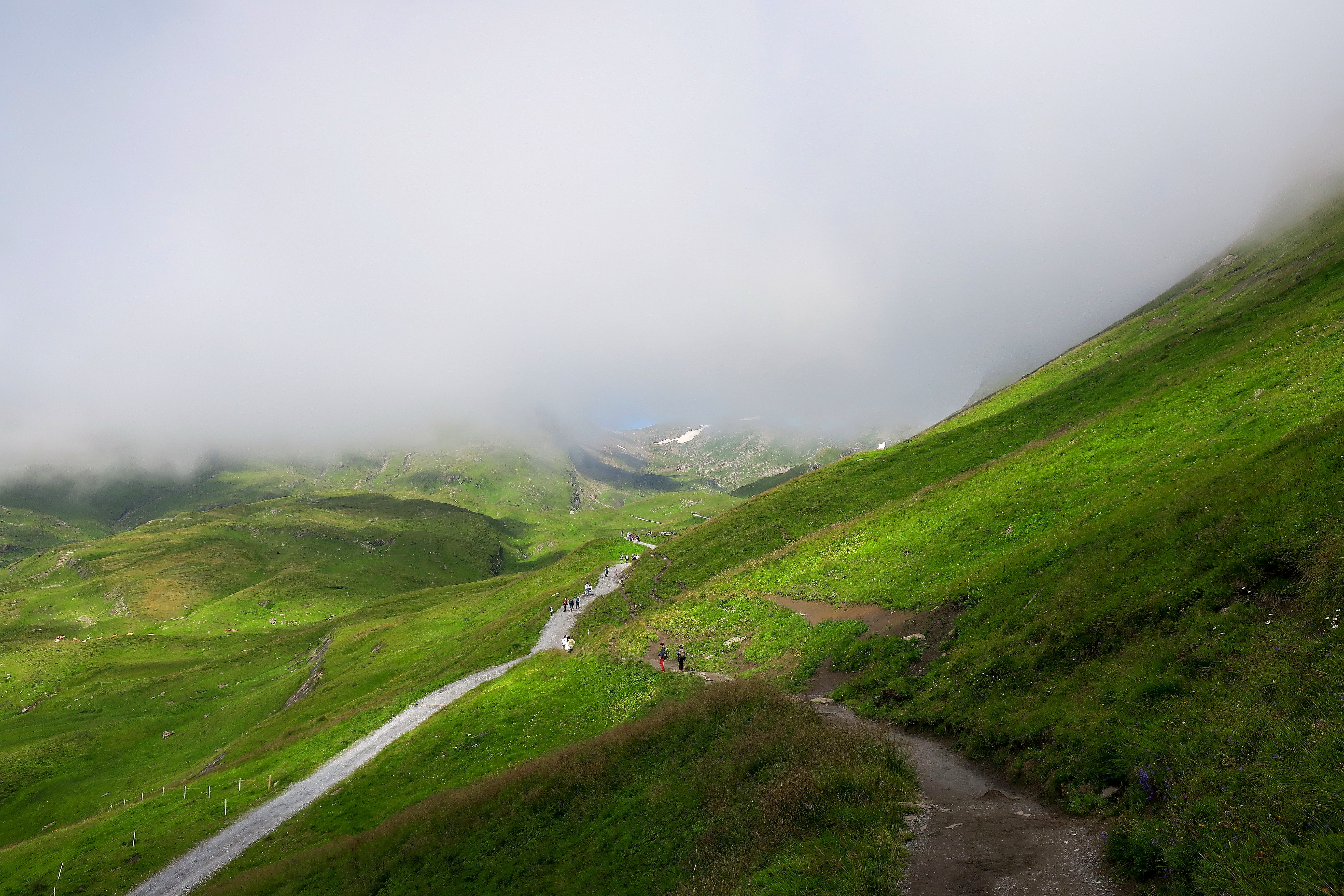
From the First cable car station, you will make your way to the Bachalpsee with dozens of tourists (I, myself feel more like a home-away-from-home local). You will get a good view of non-hiking hiking clothes. Pink pants, colorful dresses and tights, Dior backpacks, Italian sneakers, fancy hats. It will be a serious hiker’s least favorite part of the hike. But that doesn’t mean it is all bad…
The Bachalpsee simply is the place for the peace sign selfie crowd. And I don’t blame them. It is gorgeous. And it is still possible to get a photo that looks like you are the only one there (but I assure you I was not).
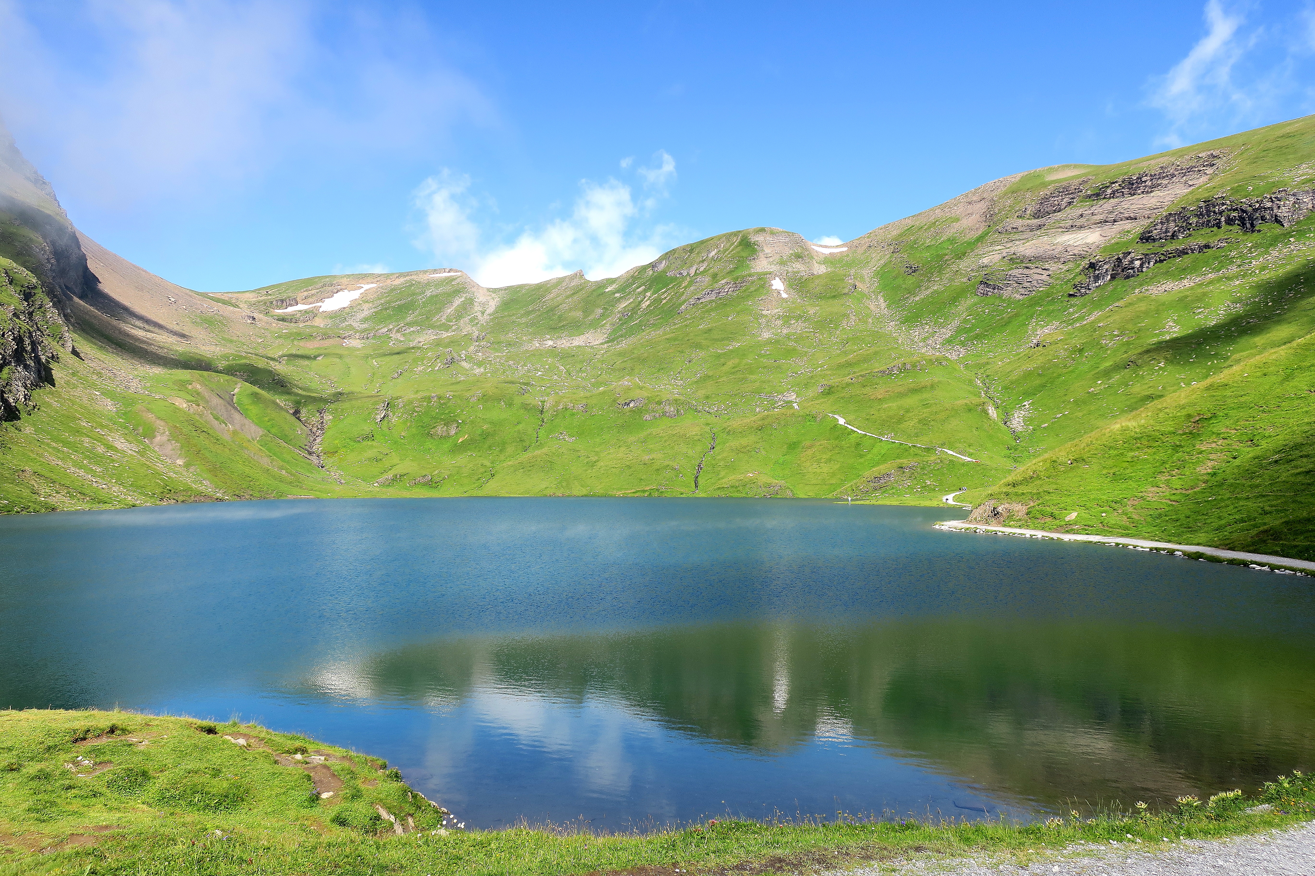
Then I recommend heading up that trail you see in the distant right center. From there you get a glorious look back at the Bachalpsee.
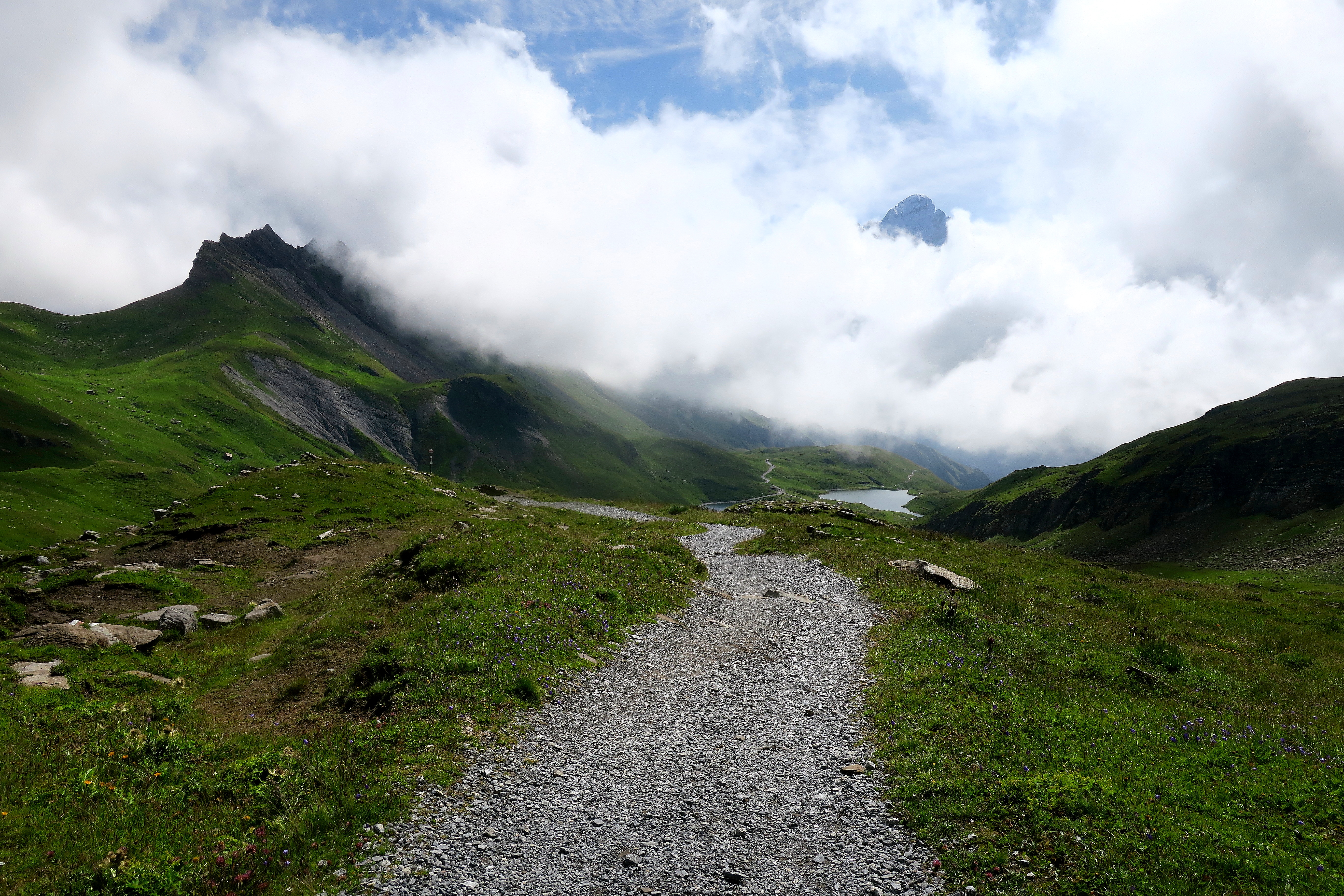
You then start to loop back towards Hiendertellti.
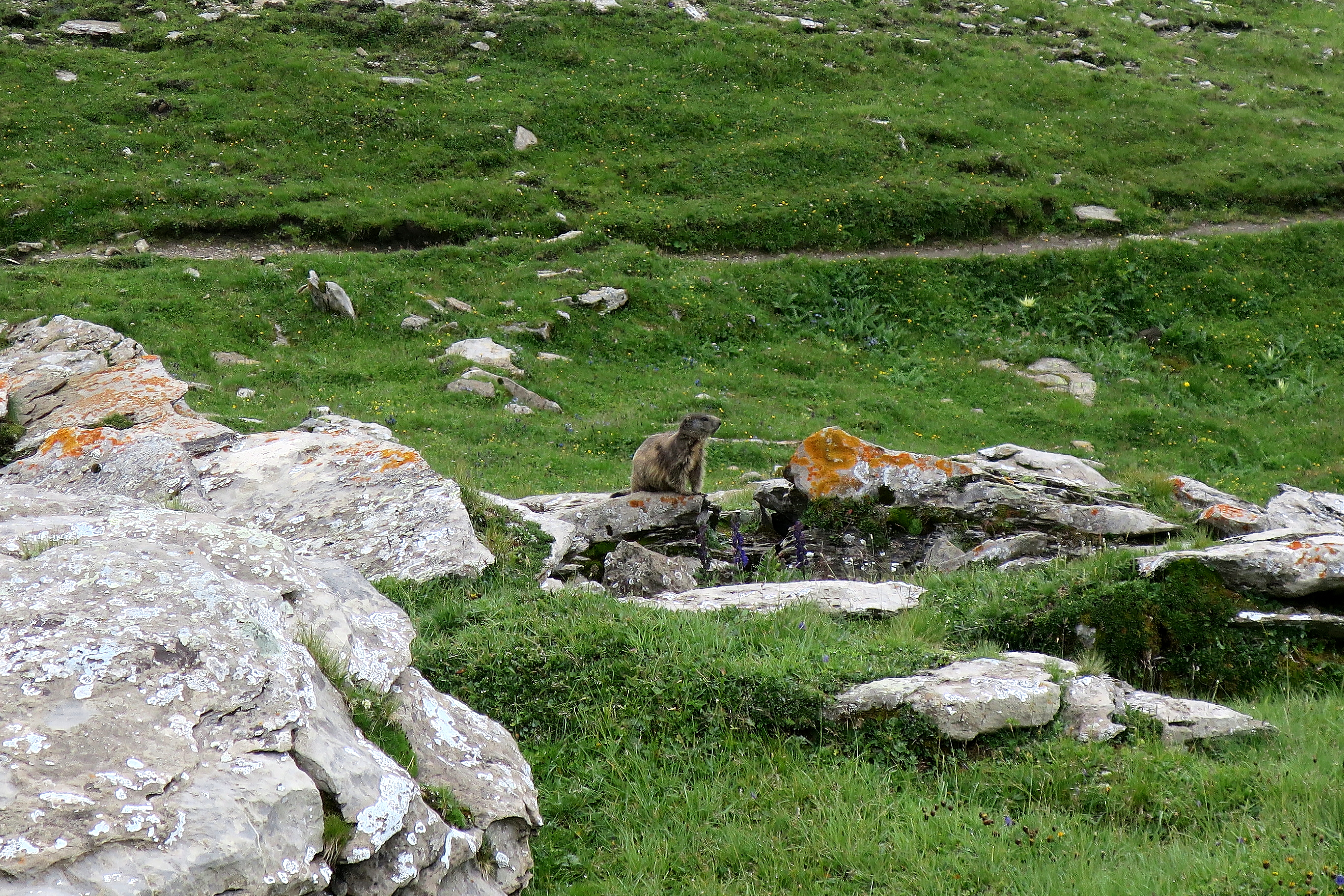
Once you get to the away-from-tourist places, especially where there are rocks, keep an eye out for the marmots.
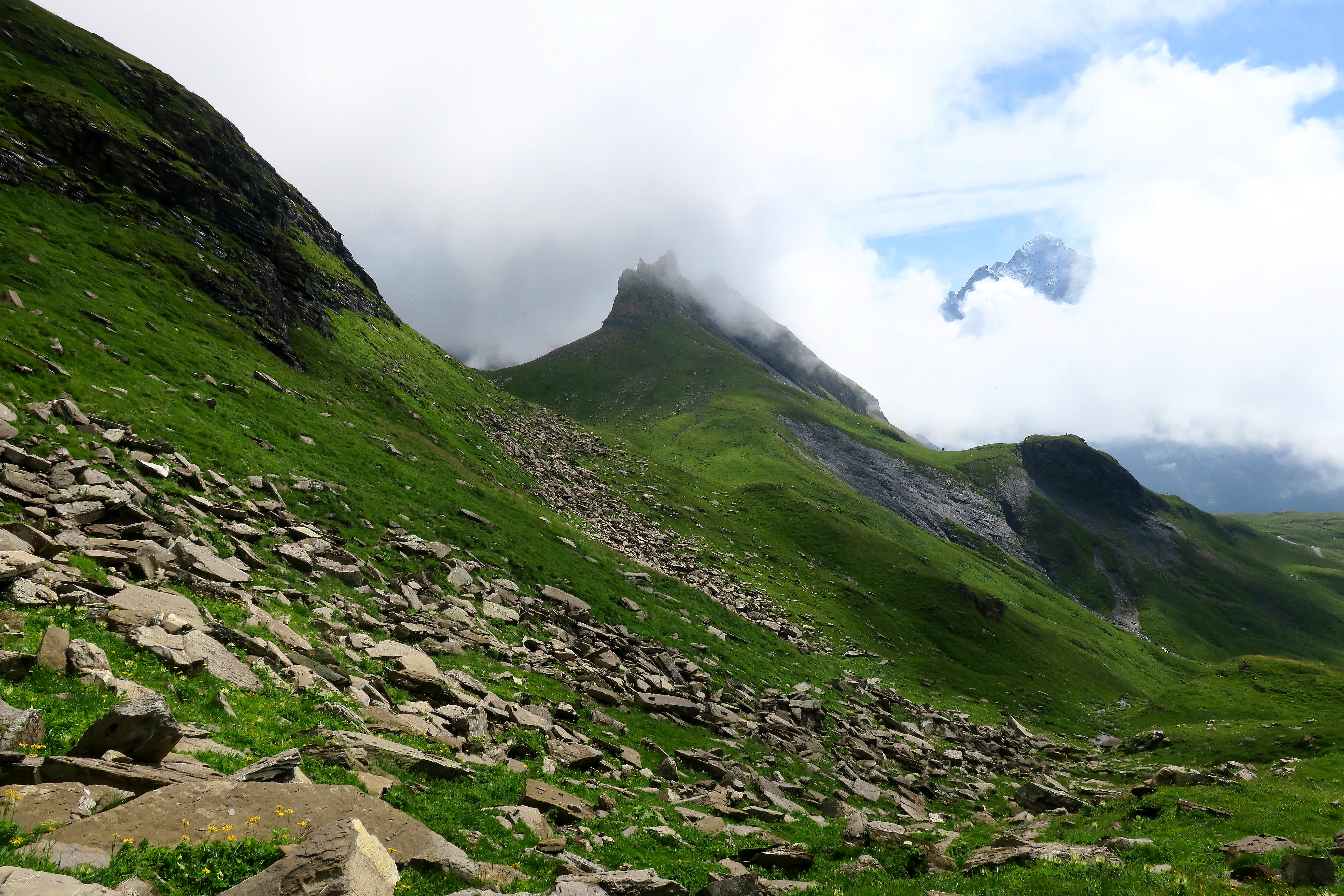
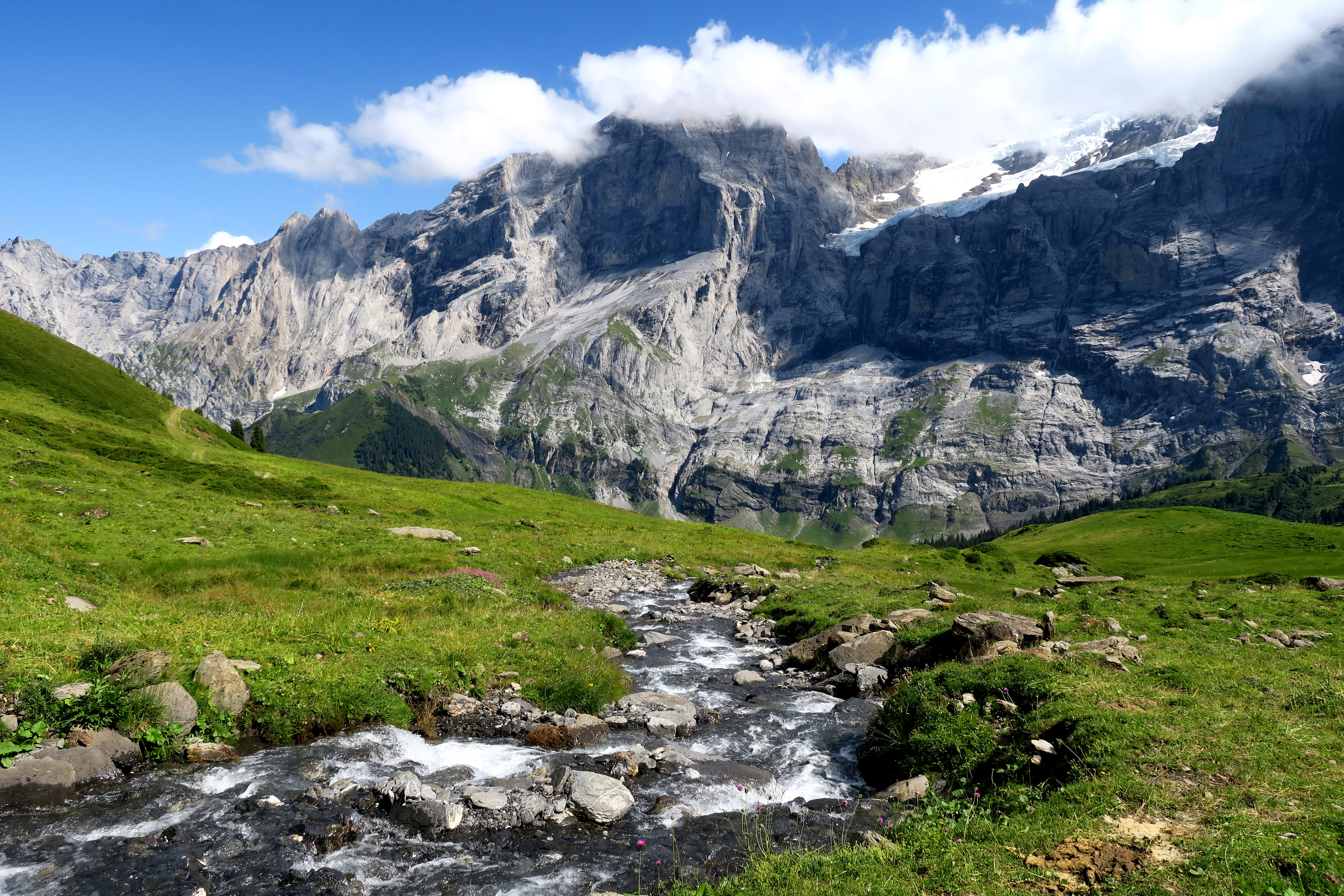
On the Hiendertellti section, the fun really begins. I love this hidden part of the Grindelwald area. The terrain varies and gives a different impression than the velvety green on the First side of this Hiendertellti ridge.
Another part I like about this hike is that you cannot always see far into the distance as you have up and down sections. This means your viewpoint is constantly changing. Some of the views feel so stark and barren, beautiful and lonely.
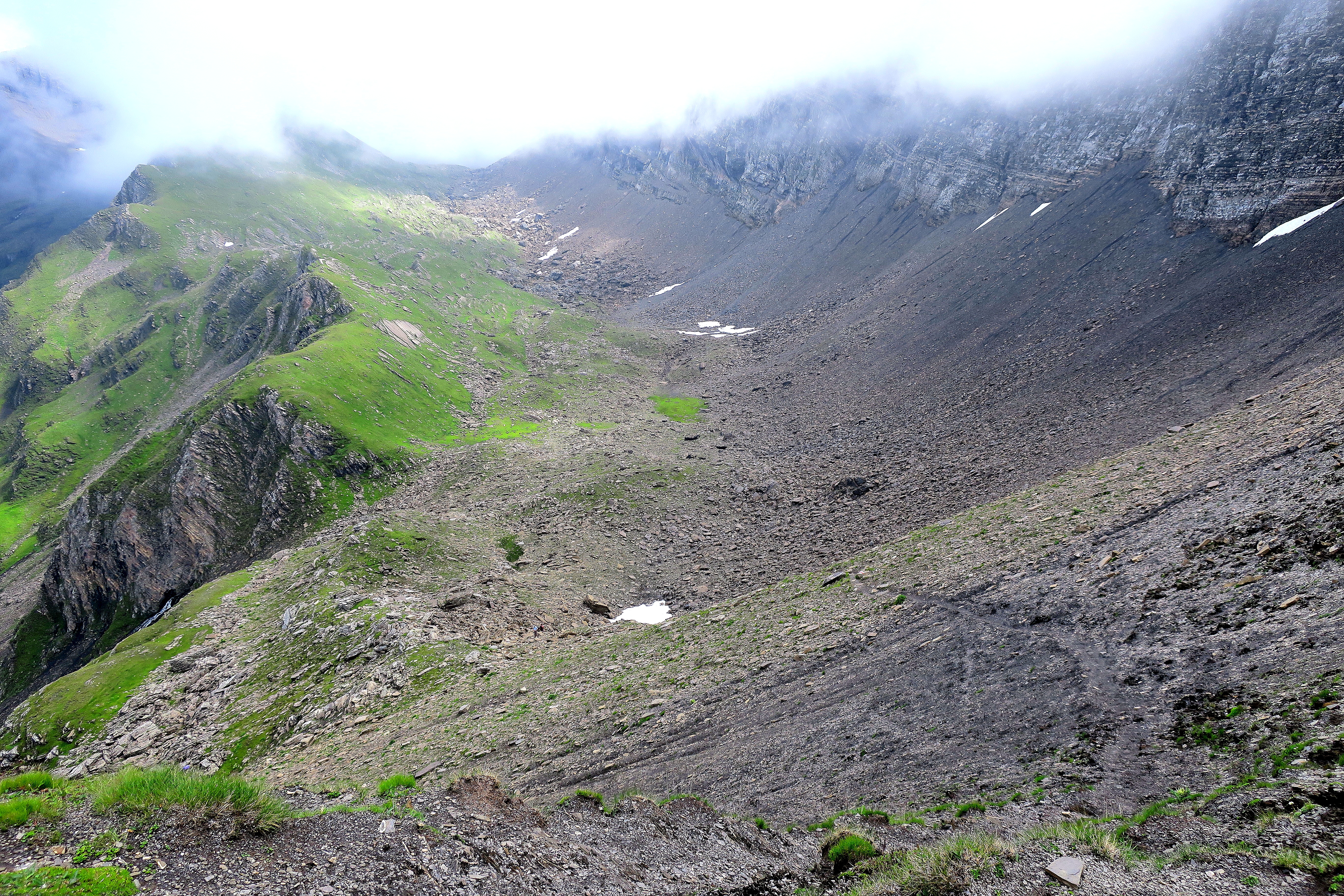
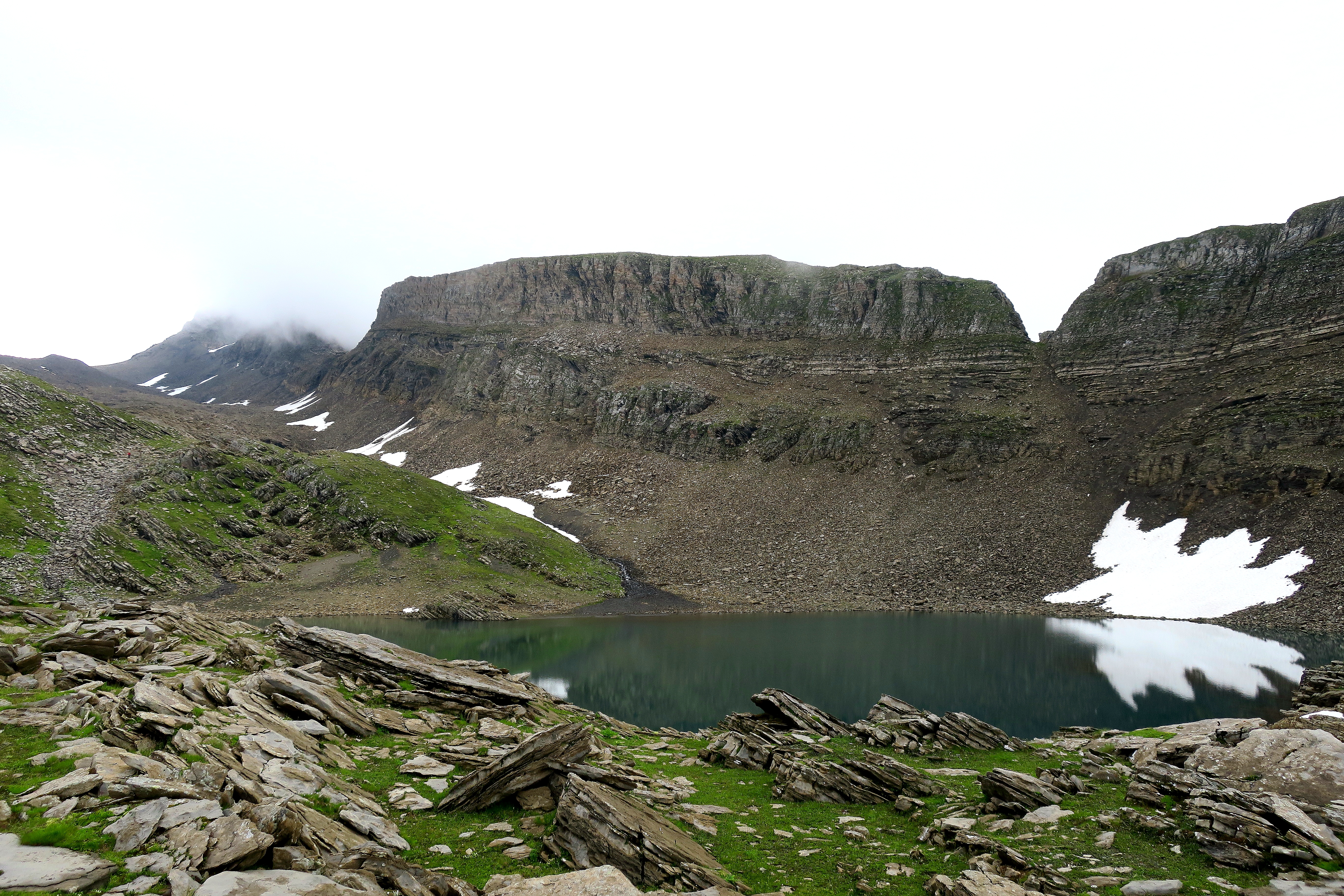
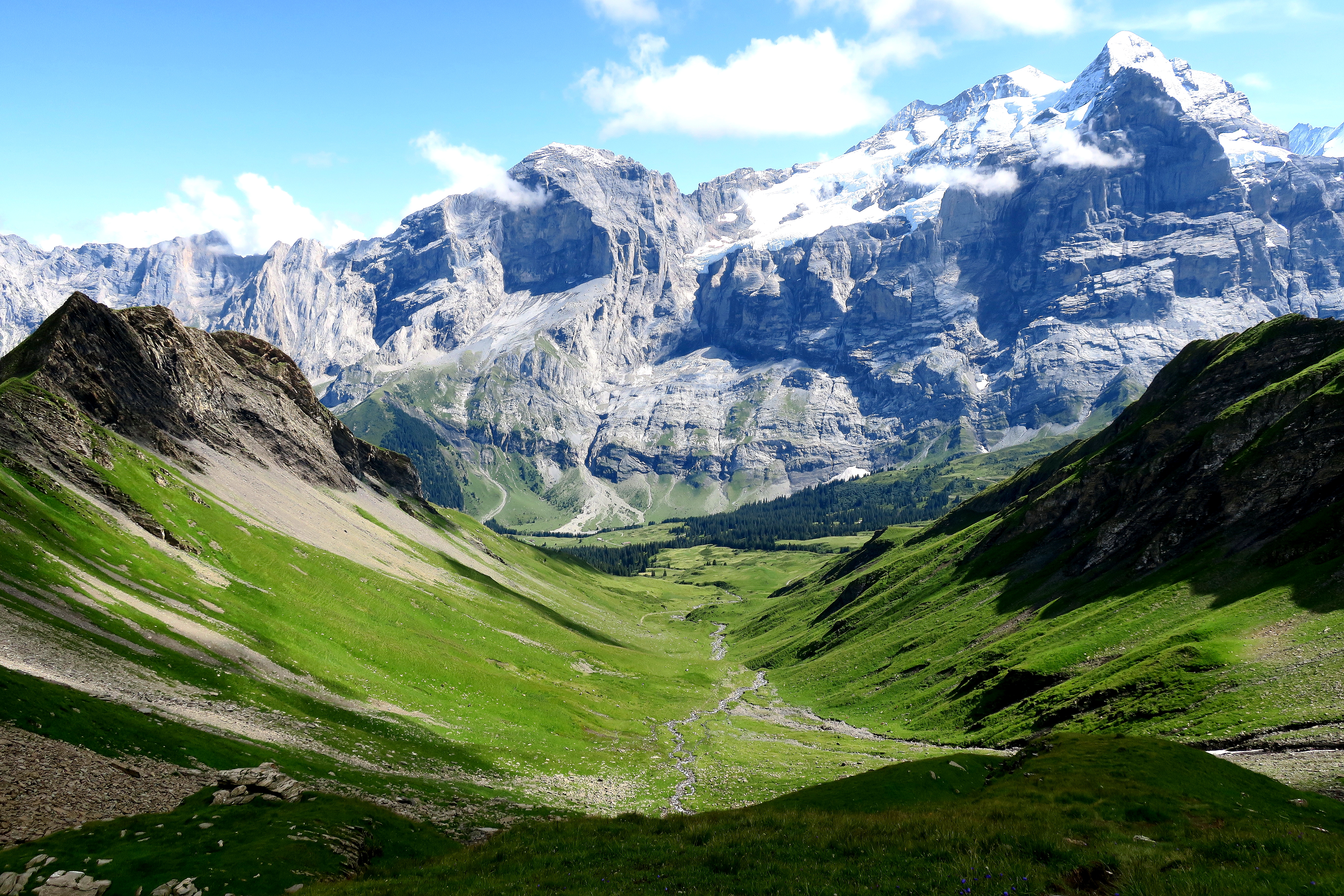
There are a couple small lakes and glaciers on the trail.
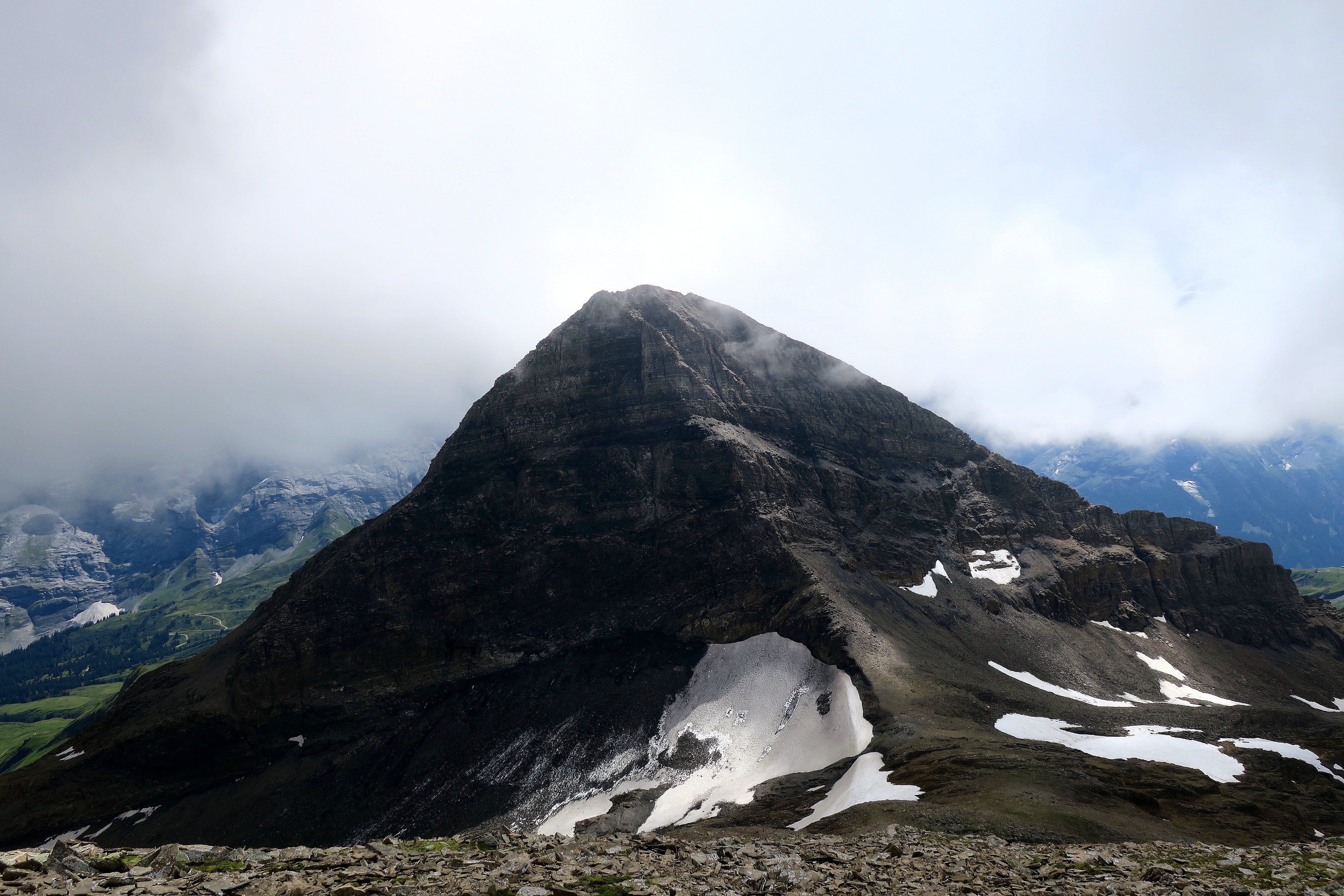
At this point you are starting to come up on the back of the Schwarzhorn which is where the path will become a relentless and foot pounding downhill. But partially hidden by the clouds on the left is a peak which appears on my Komoot app called Wildgärst. By this time, I was only curious.
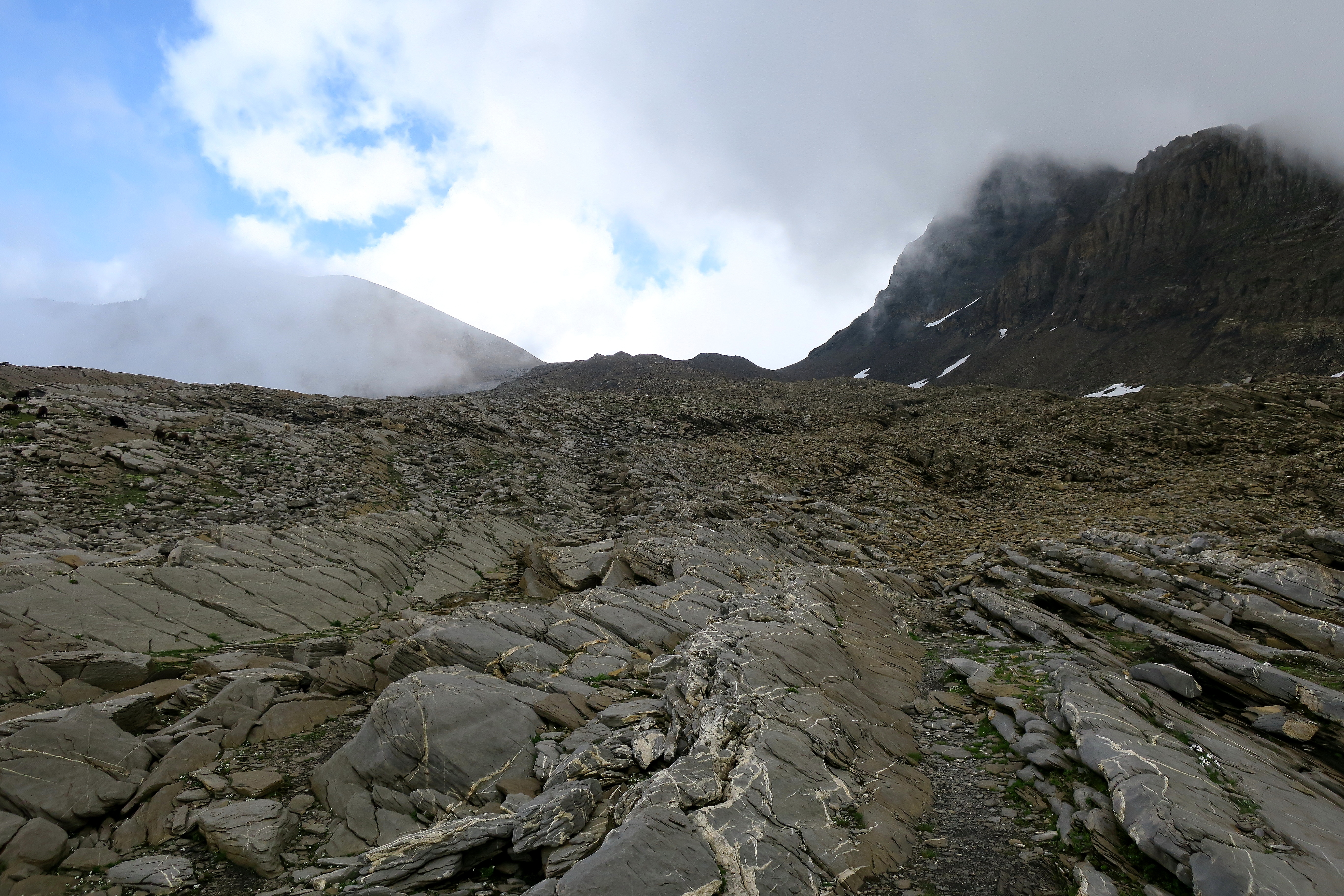
At the top of the ridge, Wildgärst comes into view. A mound of vegetation-less rock. Not a household name but here was a chance to add a special stamp to an already epic hike.

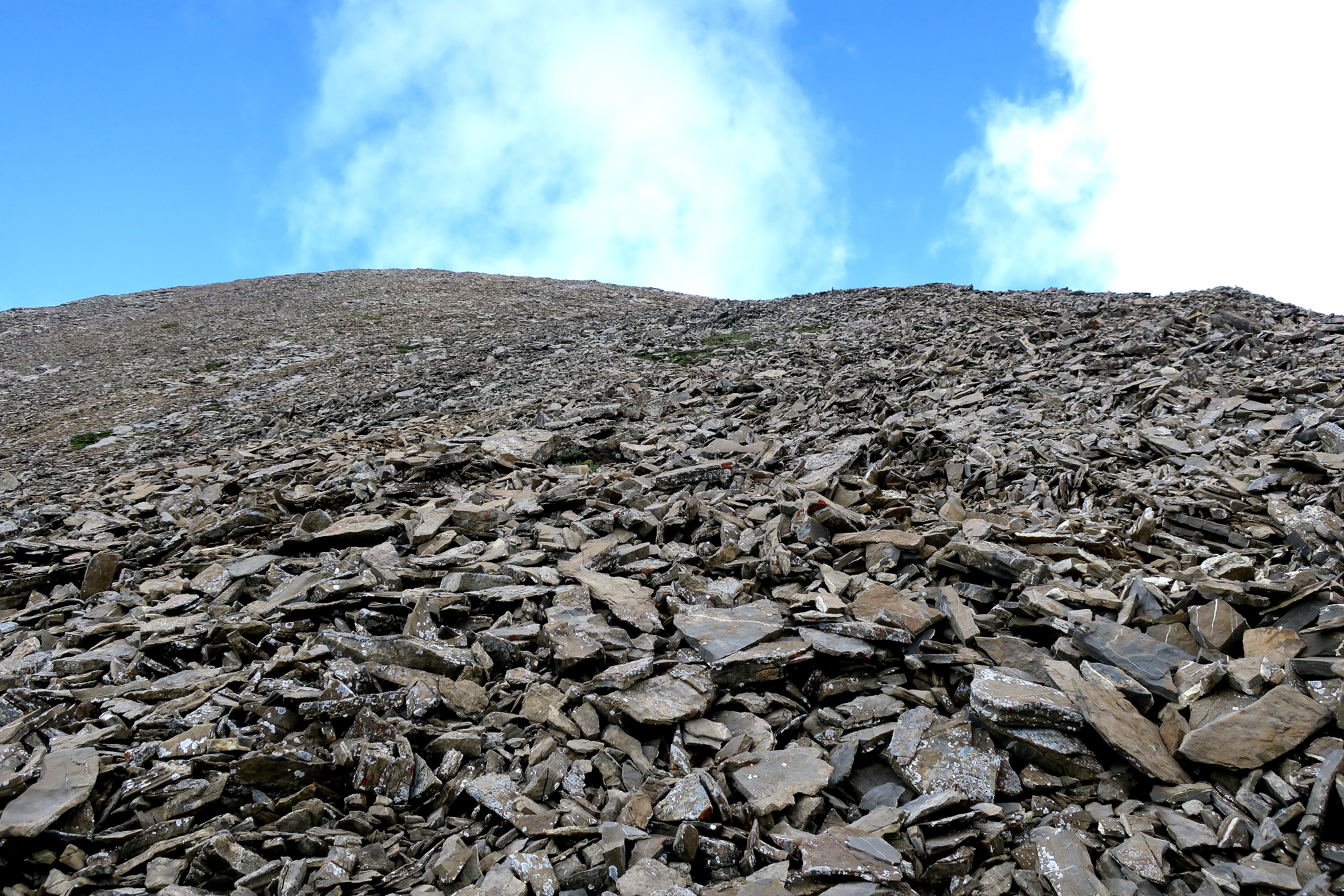
The trail up Wildgärst is not marked. It is a matter of following the path of the most worn rocks. Easier to see on the way up and less easy to find on the way down.
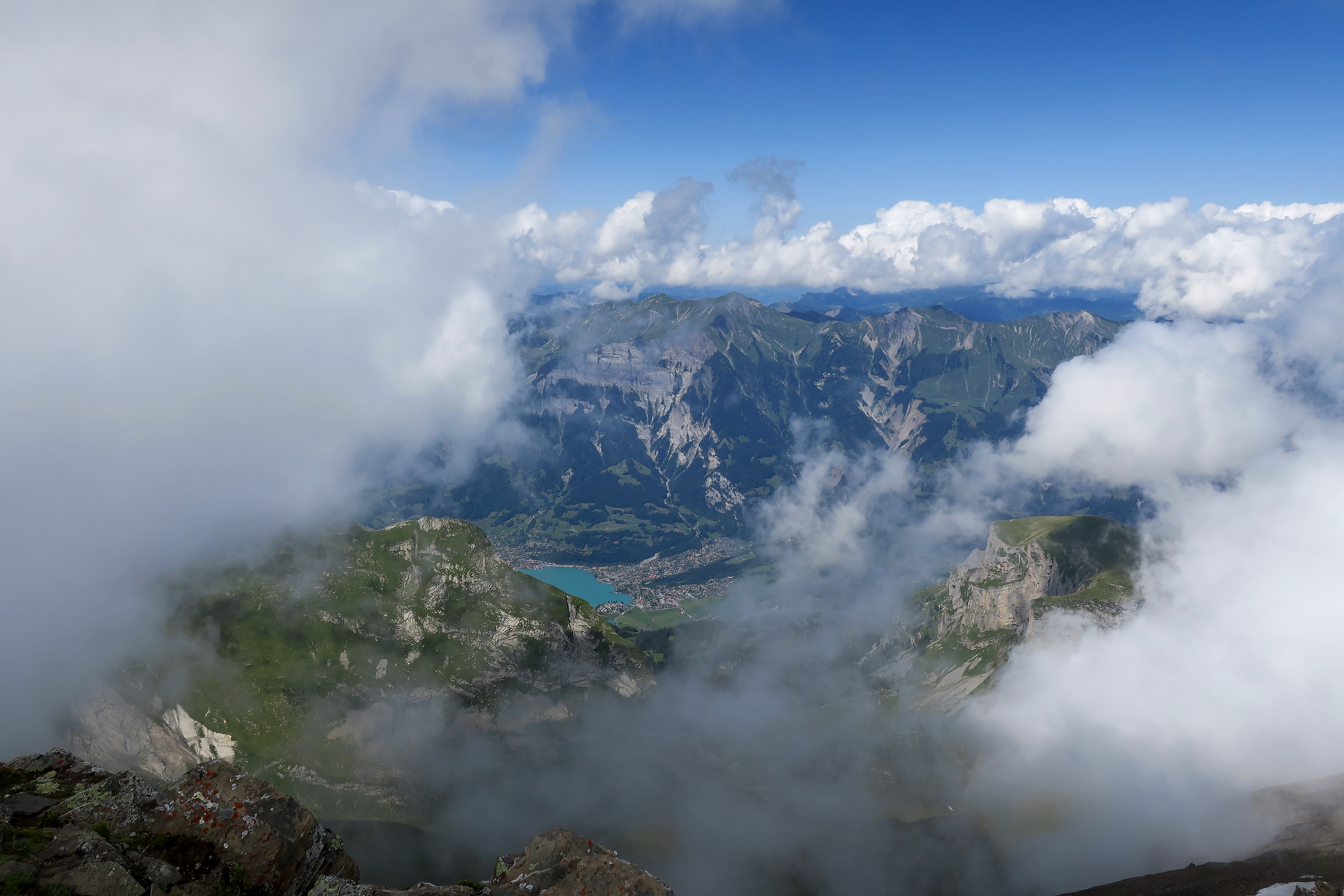
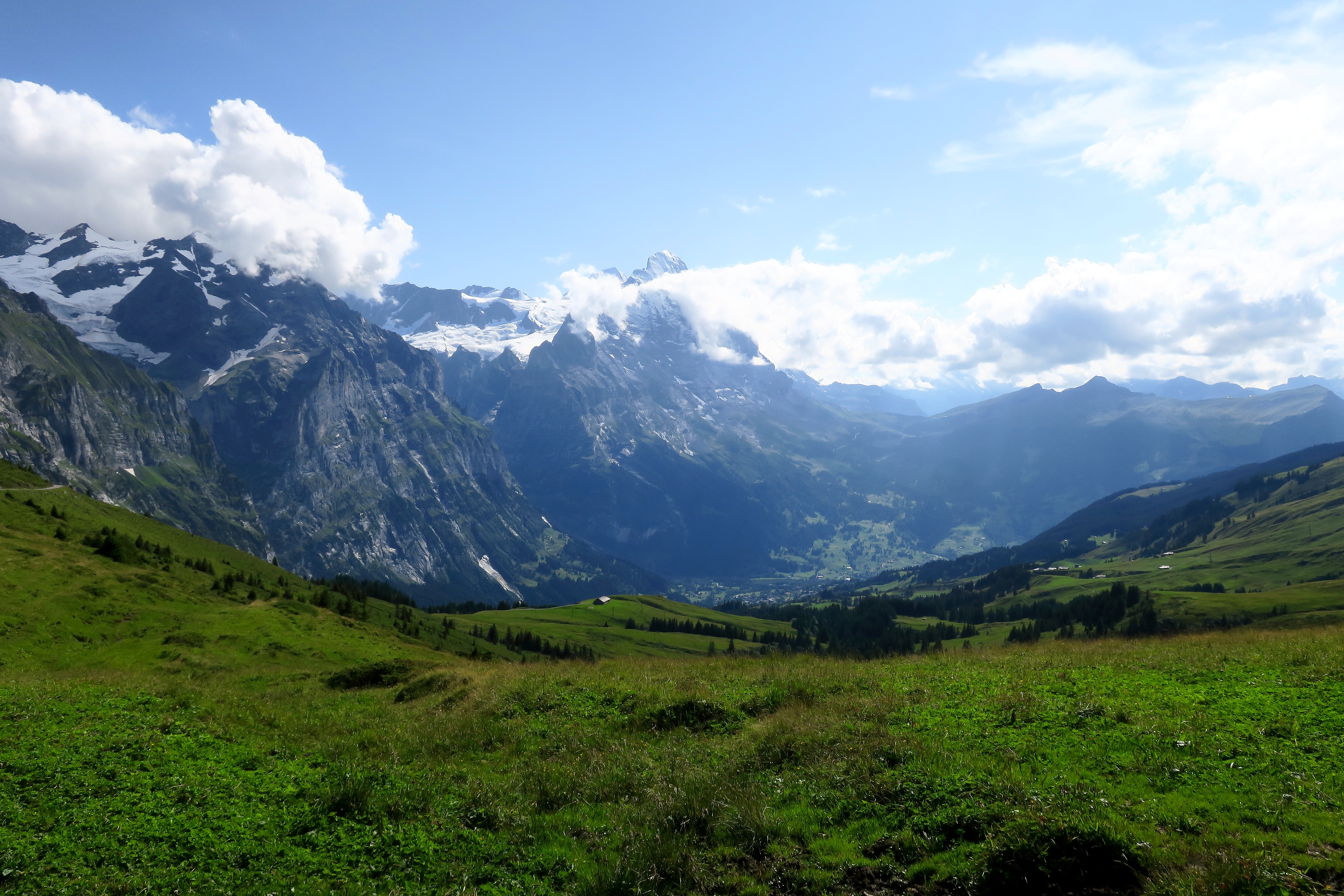
The view at the top gives an amazing look at the Schwarnhorn peak as well as views towards Interlaken. That moment, I knew this hike would be one I would talk about for years. There was nobody. All of the pink pants and fancy hats might as well have been on another planet. This is what hiking is about. One-on-one with nature and beauty.
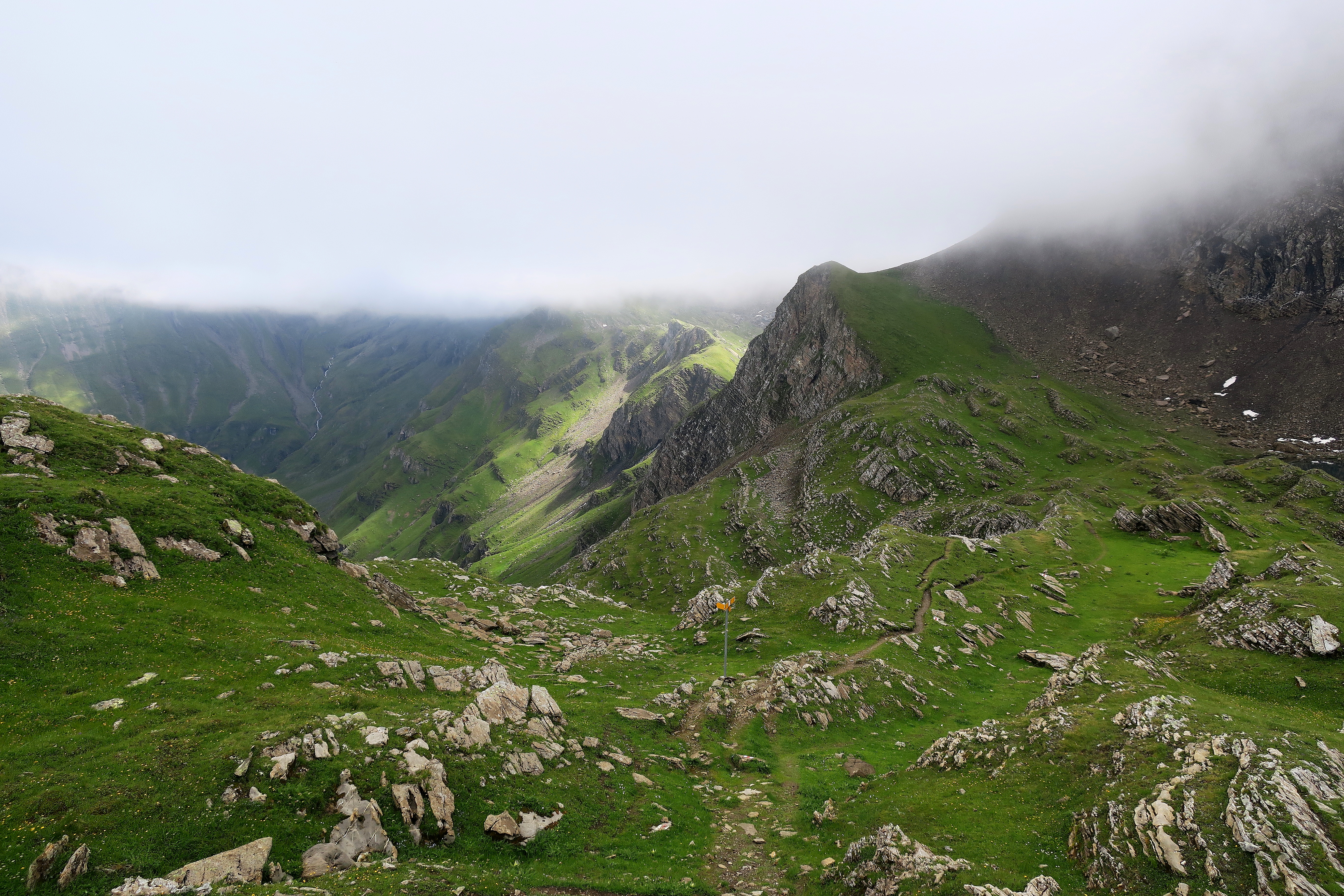
As you descend Wildgärst, the good news or bad news depending on how you look at downhill hiking comes into view.
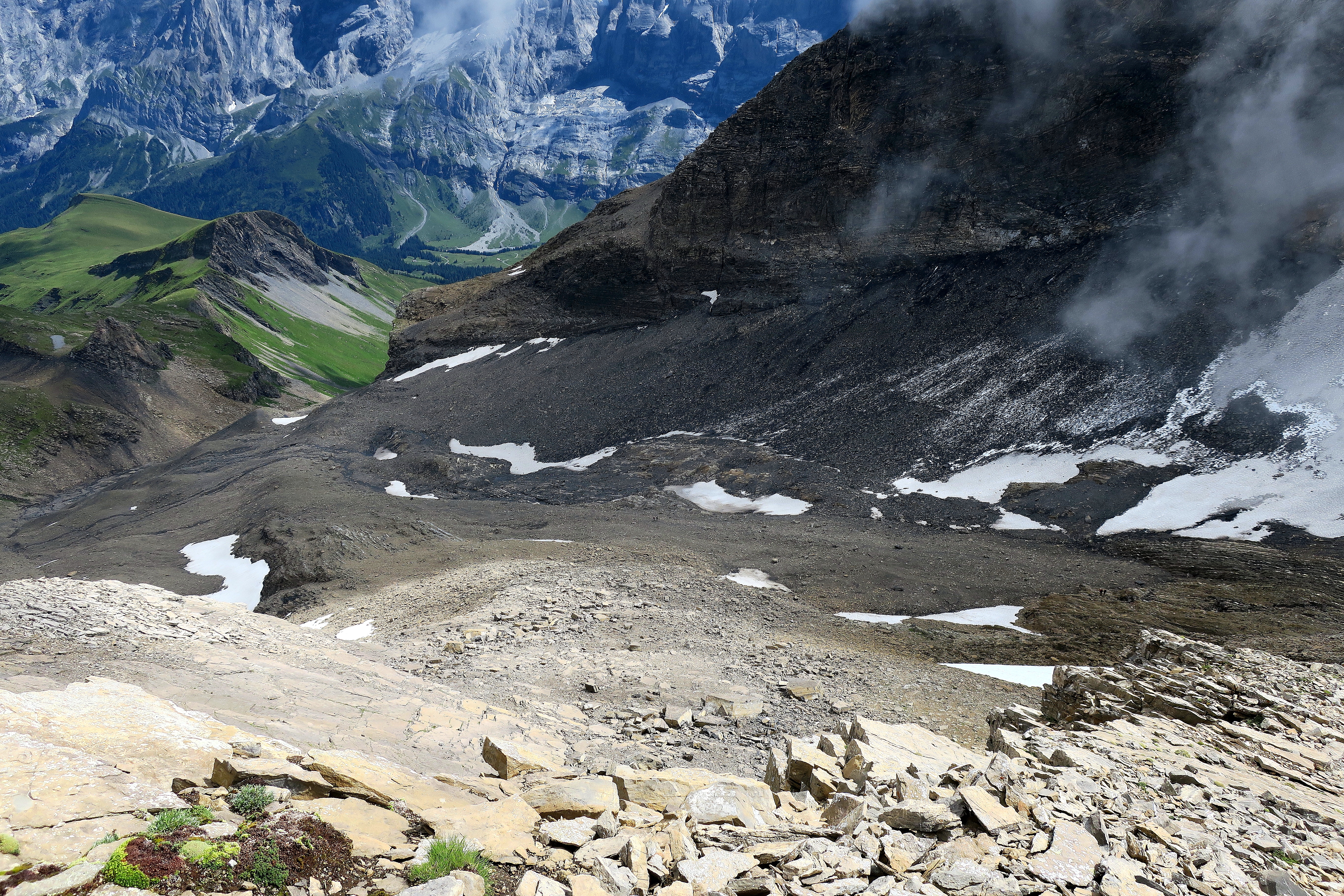
Despite the constant foot and knee pounding, the views more than made up for it.
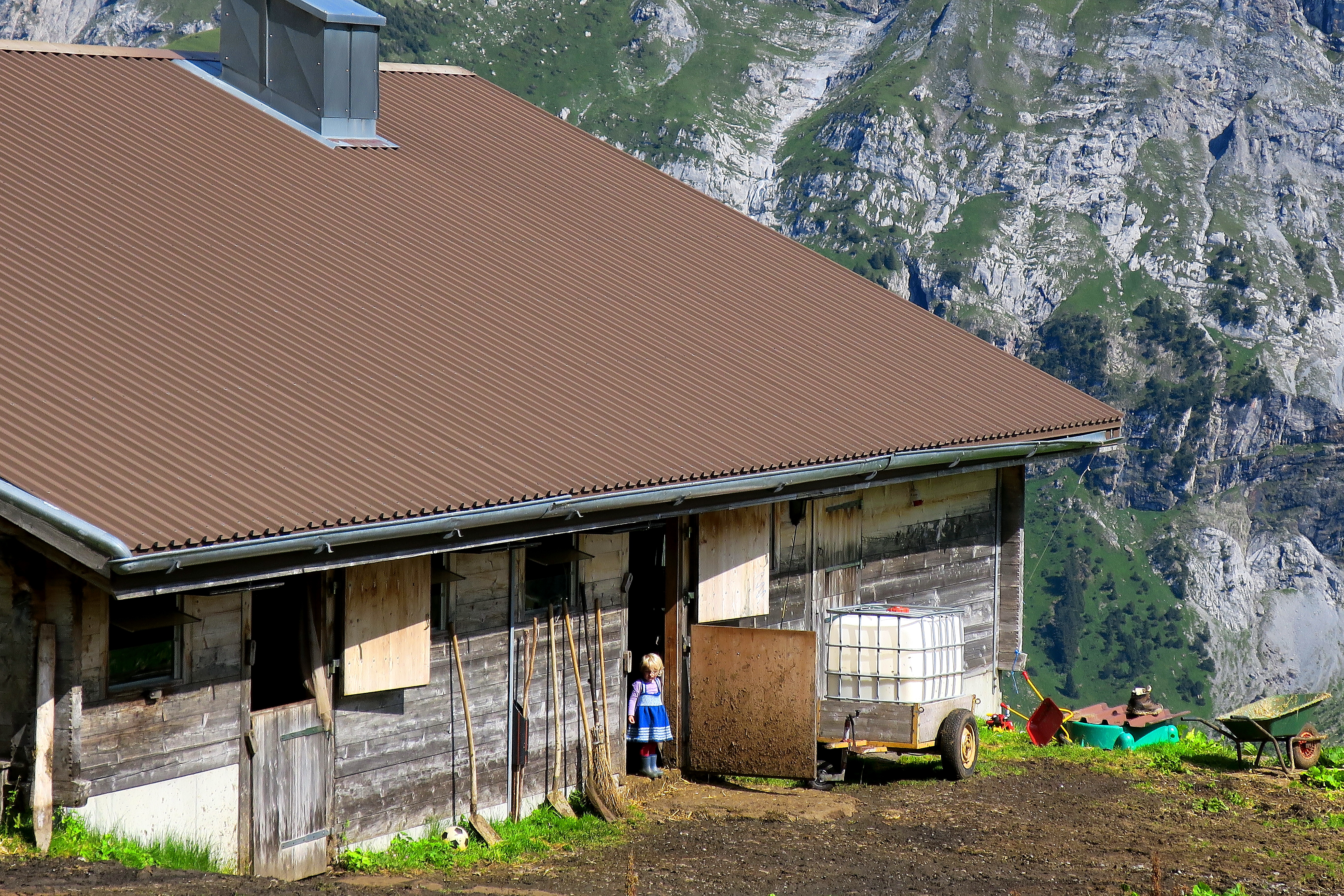
After the worst of the downhill is over, you will pass thru the quaint Oberläger.
Soon after Oberläger, you come back to the Romantikweg which was hiked the day before. But this time, the clouds weren’t completely blocking the view. The “romantik” part finally made sense.
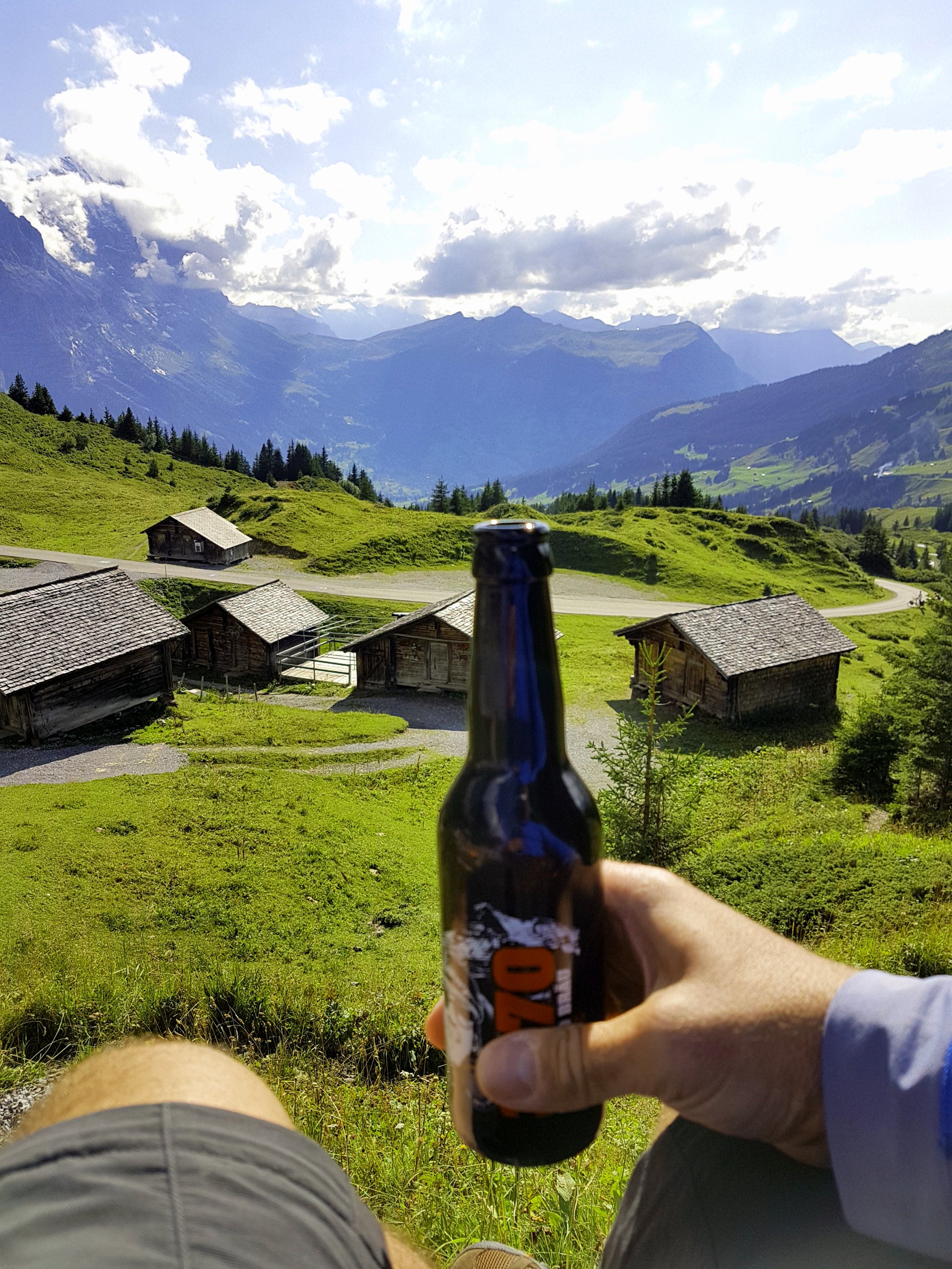
Shortly you are back in Grosse Scheidegg where you can have a rewarding beer while you wait for the bus.
Final Words
In my opinion this should rank right up there with Schynige Platte – Faulhorn – First as a must do hike in this region. In fact, it is a perfect companion to that hike and essentially gives you the entire view of the region from Schynige Platte to Grosse Scheidegg. For the first time this holiday week, I finally felt like I had arrived. And little did I know while I sat there sipping my 3870 Pale Ale from Nordwand Bräu that I had an even more epic hike waiting for me the next day. One I hadn’t even planned yet or knew about.

I’m with you on the downhills – knackers my aging knees!
But a great walk.
LikeLiked by 2 people
Amazing views!!
LikeLiked by 1 person